Former Senior Lecturer at British Open University, research in remote sensing of arid lands, groundwater exploration, Precambrian tectonics and geochemistry
For many years anthropologists were certain that the Americas remained outside the human realm until the great icecap of North America had begun to melt decisively. This view stemmed partly from the only conceived route being across the exposed floor of the Bering Sea when sea-level had fallen to leave it as a landmass known as Beringia. The other literal stumbling block had been the glacial blockage of the only lowland corridor from Alaska to the Great Plains which roughly follows the Alberta – British Columbia border in Canada. There is abundant evidence that the corridor did not become ice-free until about 13 ka, an important fact that for a long while bolstered the Clovis-First hypothesis, from the eponymous and highly distinctive stone tools that date back to just after that time. After a long, sturdy rearguard action by its devotees that view was transcended by finds of earlier tools with dates as old as 15.5 ka that extend close to the southernmost tip of South America. Studies of Y-chromosome DNA from living First Nations men that suggested that all early Americans stemmed from 4 separate colonising populations who may have entered via Beringia by different routes, including along the Pacific coast. A possible common ancestor of all native Americans has turned up from the mitochondrial and Y-chromosome DNA of a fossil skeleton from near Lake Baikal in Siberia who lived about 24 ka ago. But yet another twist has emerged from the Yukon Territory of Northern Canada.
Beringia Land Bridge. Animation of its development from 21.000 BC to modern times.(Photo credit: Wikipedia)
Since 1987 it has been known that animal bones with clear signs of butchery occurred in the Bluefish Cave on the Yukon – Alaska border. Dating of the bones by the 14C method seemed to support human occupation there during the Last Glacial Maximum; highly controversial at the time, in the absence of any other sites of that age in the whole Americas. The material has now been re-examined and dated by a more advanced radiocarbon method (Bourgeon, L. et al. 2017. Earliest human presence in North America dated to the Last Glacial Maximum: new radiocarbon dates from Bluefish Caves, Canada. PLoS ONE, v. 12; doi:10.1371/journal.pone.0169486). This work has confirmed the earlier view since the ages of bones range from 24 to 12 ka. But the discovery of what seems long-term occupation under the most arduous glacial conditions is not the only outcome of the research. One hypothesis for the genetic diversity among living indigenous people of the Americas is that their forebears, the first people of the Americas, may have been from genetically isolated populations stranded on Beringia, yet surviving eventually to migrate southward once climate warmed. The ‘Beringian standstill hypothesis’ suggest that the small population underwent genetic drift for about eight thousand years, their descendants inheriting the genetic diversity produced by this process. Bluefish Cave is probably where some of those pioneers waited-out the Ice Age
The formulation of the theory of plate tectonics provided plausible explanations for the growth of continental crust over time, among many other fundamental Earth processes. Briefly expressed, once basalt capped oceanic lithosphere is forced downwards at plate boundaries where plates move towards one another, beyond a certain penetration cool, moist basalt undergoes a pressure-controlled change of state. Its chemical constituents reassemble into minerals more stable under elevated pressure. In doing so, one outcome involves dehydration reactions the other being that the bulk composition is recast mainly in the form of high-pressure pyroxene and the mineral garnet: the rock eclogite. The density of the basaltic cap increases above that of the mantle. Gravity acts to pull the subducting slab downwards, this slab-pull force being the main driver of plate motions globally. Water vapour and other fluids shed by dehydration reactions rise from the subducted slab into the wedge of overlying mantle to change its conditions of partial melting and the composition of the magma so produced. This is the source of arc magmatism that persists at the destructive plate margin to increase the volcanic pile’s thickness over time. When magma is able to pond at the base of the new crust its fractional crystallisation produces dense cumulates of high-temperature mafic silicates and residual melt that is both lighter and more enriched in silica. Residual magma rises to add to the middle and upper crust while the cumulate-rich lower crust becomes less gravitationally stable, eventually to spall downwards by delamination. Such a process helps to explain the bulk low density of continental crust built up over time together with the freeboard of continents relative to the ocean floor: a unique feature of the Earth compared with all other bodies in the Solar System. It also accounts for the vast bulk of continental crust having remained at the surface since it formed: it rarely gets subducted, if at all.
Tangible signs that such subduction was taking place in the past – eclogites and other high-pressure, low-temperature metamorphosed basalts or blueschists – are only found after 800 Ma ago. Before that time evidence for plate tectonics is circumstantial. Some geologists have argued for a different style of subduction in earlier times, plates under riding others at low angles. Others have argued for a totally different style of tectonics in Earth early history, marked by changes in bulk chemical composition of the continental crust at the Archaean-Proterozoic boundary. A new twist comes from evidence in the Archaean Pilbara Craton of Western Australia (Johnson, T.E. et al. 2017. Earth’s first stable continents did not form by subduction. Nature, v. 543, p. 239-242; doi:10.1038/nature21383). The authors found that basalts dated at about 3.5 Ga have trace-element geochemistry with affinities to the primitive basalts of island arcs. That makes them a plausible source for slightly younger felsic plutonic rocks with a tonalite-trondhjemite-granodiorite (TTG) compositional range (characteristic of Archaean continental crust). If the basalts were partially melted to yield 30% of their mass as new magma the melt composition would match that of the TTG crust. This would be feasible at only 30 km depth given a temperature increase with depth of at least 25° C per kilometre; more than the average continent geothermal gradient today but quite plausible with the then higher heat production by less decayed radioactive isotopes of uranium, thorium and potassium 3.5 Ga ago. This would have required the basalts to have formed a 30 km thick crust. However, the basalts’ geochemistry requires their generation by partial melting of earlier more mafic basalts rather than directly from the mantle. That early Archaean mantle melting probably did generate vast amounts such primary magma is generally acknowledged and confirmed by the common occurrence of komatiitic lavas with much higher magnesium content than common basalts of modern constructive margins. In essence, Johnson et al. favour thermal reworking of primitive Archaean crust, rather than reworking in a plate tectonic cycle.
Teeth are the most likely parts of skeletons to survive for long periods because of their armour by a layer of enamel made of hydroxyapatite (Ca5(PO4)3(OH)). Dental enamel is the hardest material in the bodies of vertebrate animals and lies midway between fluorite and feldspar on Moh’s scale of hardness (value 5). Like the mineral apatite, teeth survive abrasion, comminution and dissolution for long periods in the surface environment. Subdivision of fossil hominin species and even among different groups of living humans relies to a marked extent on the morphology of their teeth’s biting and chewing surface. Although there are intriguing examples in Neolithic jawbones of dental cavities having been filled it is rather lack of attention to teeth that characterises hominin fossils. As well as horrifying signs of mandibular erosion due to massive root abscesses, a great many hominin remains carry large accumulations of dental plaque or calculus made of mineralised biofilm laid down by oral bacteria. Even assiduous brushing only delays the build up. Grisly as this inevitability might seem, plaque is an excellent means of preserving not only the bacteria but traces of what an individual ate. As fossil DNA is a guide to ancestry and relatedness among fossil hominins, so far going back to about 430 ka in the case of a Spanish Homo heidelburgensis, plaque potentially may reveal details of diet and to some extent social behaviour elaborating beyond the possibilities presented by carbon isotopes and dental wear patterns.
Plaque deposits have already shown that Neanderthals had a very varied vegetable diet and that they cooked their food, the sugars thereby released encouraging bacterial biofilms. There have even been hints that they used medicinal herbs, such as yarrow and chamomile. Now a large multinational team of scientists has taken this fascinating line of study a step further using short DNA fragments to identify the actual oral microbes and even plant and animal species that dominated the diets of 8 cave-dwelling Neanderthals found in Spain, Belgium and Italy (Weyrich, L.S. and 30 others 2017. Neanderthal behaviour, diet, and disease inferred from ancient DNA in dental calculus. Nature, v. 543; online doi:10.1038/nature21674). The Spanish individuals found in El Sidrón cave seem to have been mainly vegetarian (mushrooms, pine nuts and edible moss) whereas two from the Spy cave in Belgium feasted on wooly rhinoceros and mouflon sheep. One of the El Sidrón Neanderthals had a dental abscess, and was probably in great pain, and whose calculus contained evidence of ingestion of tissue from poplar trees, known to contain salicylic acid (the active ingredient in aspirin): an example of self-medication. The unfortunate individual was also suffering from acute diarrhoea brought on by a eukaryote parasite (microsporidium). Astonishingly, DNA from several plant fungi, including Penicillium rubens (penicillin) also occurred in this individual’s calculus, from eating mouldy plant material: predating modern antibiotics by more than forty-five thousand years!
More predictable findings from the unfortunate El Sidrón individual was a spectrum of common plaque colonising bacteria. But another surprise was Methanobrevibacter oralis, an archaea common in the human mouth ecosystem, for which a complete genome was reconstructed. It is different from that in the Methanobrevibacter oralis found in living humans and the team were able to use a molecular clock approach to date the divergence between the two sub-species. This seems to have occurred between 112-143 ka ago, long after the divergence of Neanerthals and anatomically modern humans, judged to be around 450 to 750 ka ago. The authors suggest that ‘commensal microbial species were transferred between the two hosts during subsequent interactions, potentially in the Near East’. Two alternative ‘interactions’ occurred to one commentator: kissing or exchange of chewed food (Callaway, E, 2017. Plaque DNA hints at Neanderthal lifestyle. Nature, v. 543, p. 163). Intriguingly the date, albeit imprecise, overlaps with estimates for the timing of Neanderthal – modern human interbreeding as the latter began to leave Africa: not only do living non-Africans share genes with Neanderthals, the may also share saliva and oral bacteria.
For more information on recent human evolution see here.
On the edge of the small town of Lingjing near Xuchang City in Henan Province, China, local people have long practiced intensive vegetable gardening because the local soil is naturally irrigated by the water table beneath the flood plain deposits of the Yinghe River. In the mid 1960s, around a small spring, they began to find dozens of small stone tools together with animal bones. Only in 2005, after the spring had stopped flowing, did systematic excavation begin (Li, Z.-Y. et al. 2017. Late Pleistocene archaic human crania from Xuchang, China. Science, v. 355, p. 969-972; doi: 10.1126/science.aal2482) About 3.5 m below the surface tools and bone fragments, including one with a carved representation of a bird, occurred just above the base of the modern soil profile. Radiocarbon dating of charcoal from the layer clustered around 13 500 years ago, just before the start of the Younger Dryas cooling episode; probably products of modern humans, although no human remains were found in the layer. Continued excavation penetrated sediments free of fossils and tools down to a depth of 8 m, when stone tools and bone fragments began to turn up again through the lowest 2 m of sediment. Optically stimulated luminescence (OSL) dating of mineral grains, which shows the last time that sediments were exposed to sunlight, produced much older dates between 78 to 123 ka. The thousands of stone flakes and cores, and cut marks on the animal bones found through the fossil-rich layer suggests that this was a site long used for tool making and food preparation, that had begun in the last interglacial period. Among the bones were fragments of the crania of as many as five individual humans.
Who were they? Their age range is tens of thousands of years before anatomically modern humans began to migrate into east Asia, so they are likely to have been an earlier human group. Homo erectus is known to have inhabited China since as early as 1.6 Ma ago and may be a possibility. The other possible group are the Denisovans, known only from their DNA in a small finger bone from a cave in eastern Siberia. Fragments of Denisovan DNA are famously present in that of many living indigenous people from eastern Asia, Melanesia and the Americas, but hardly at all in west Asians and Europeans. They also interbred with Neanderthals and may share a common ancestor with us and them, who lived about 700 ka ago.
Map showing the proportion of the genome inferred to be Denisovan in ancestry in non-Africans. The color scale ranges from black – 0, through greens – present to red – highest . (Credit: Sankararaman et al./Current Biology 2016; http://dx.doi.org/10.1016/j.cub.2016.03.037)
Unfortunately the human bones are completely fragmented and lack any teeth, jaw bones or elements of the face. However, the Chinese-US team used sophisticated computer refitting of CT-scanned fragments to reconstruct two of the crania, revealing one individual with prominent brow ridges and a flat-topped skull extended towards the back, similar to that of Neanderthals but with a much larger brain than H. erectus. The semi-circular canals associated with the ears, but used in balancing, are well preserved and also resemble those of Neanderthals. Yet east Asia has yielded not a single Neanderthal fossil. Could these be the elusive Denisovans? Even if more diagnostic bones turn up, especially teeth, such is the state of late hominin taxonomy that only DNA will provide definitive results: the Denisovans are defined entirely by DNA. The authors, perhaps wisely, do not speculate, but others may not be able to resist the temptation.
For more information on recent human evolution see here.
Related articles
Gibbons, A. 2017. Close relative of Neandertals unearthed in China. Science, v. 355, p. 899; doi: 10.1126/science.355.6328.899
That seawater circulates through the axial regions of rifts associated with sea-floor spreading has been known since well before the acceptance of plate tectonics. The idea stems from the discovery in 1949 of brines with a temperature of 60°C on the central floor of the Red Sea, which in the early 60s turned out to be anomalously metal-rich as well. Advanced submersibles that can withstand the high pressures at great depth a decade later produced images of swirling clouds of sediment from large sea-floor springs, first on the Galapagos rift and subsequently on many others. The first shots were of dark, turbulent clouds, prompting the term ‘black smoker’ for such hydrothermal vents and it turns out that others produce light-coloured clouds – ‘white smokers’. Sampling revealed that the sediments in black smokers were in fact fine-grained precipitates of metallic sulfides, whereas those forming white smokers were sulfates, carbonates and oxides of barium calcium and silicon also precipitated from solute-rich brines produced by partial dissolution of ocean floor through which they had passes.
A black smoker with associated organism. (credit: Wikipedia)
Excitement grew when hydrothermal vents were shown to have complex animal ecosystems completely new to science. A variety of chemical evidence, most importantly the common presence of proteins and other cell chemicals built around metal sulfide groups in most living organisms, prompted the idea that hydrothermal vents may have hosted the origins of life on Earth. Many fossil vent systems also contain fossils; macrofossils in the Phanerozoic and microbial ones from the Precambrian. But tangible signs of life, in the form of mats ascribed to bacteria or archaea holding together fine-grained sediments, go back no further than 3830 Ma in the Isua area of SW Greenland. Purely geochemical evidence that carbonaceous compounds may have formed in living systems are ambiguous since quite complex hydrocarbons can be synthesised abiogenically by Fischer-Tropsch reactions between carbon monoxide and hydrogen. Signs of deep sea hydrothermal activity are common in any geological terrain containing basalt lavas with the characteristic pillows indicating extrusion beneath water. So to trace life’s origins all that is needed to trigger the interest of palaeobiologists are the oldest known pillow lavas. Until quite recently, that meant the Isua volcano-sedimentary association, but heating, high pressures and very strong deformation affected those rocks when they were metamorphosed half a billion years after they were formed; a cause for skepticism by some geoscientists.
The primacy of Isua metavolcanic rocks has been challenged by more extensive metamorphosed basalts in the Nuvvuagittuk area in Quebec on the east side of Hudson Bay, Canada. They contain hydrothermal ironstones associated with pillowed basalts that are cut by more silica-rich intrusive igneous rocks dated between 3750 and 3775 Ma. That might place the age of basalt volcanism and the hydrothermal systems in the same ball park as those of Isua, but intriguingly the basalts’ 146Sm-142Nd systematics suggest a possible age of magma separation from the mantle of 4280 Ma (this age is currently disputed as it clashes with U-Pb dates for zircon grains extracted from the metabasalts around the same as the age at Isua). Nonetheless, some parts of the Nuvvuagittuk sequence are barely deformed and show only low-grade metamorphism, and they contain iron- and silicon-rich hot spring deposits (Dodd, M.S. et al. 2017. Evidence for early life in Earth’s oldest hydrothermal vent precipitates. Nature, v. 543, p. 60-64; doi:10.1038/nature21377). As at Isua, the ironstones contain graphite whose carbon isotope proportions have an ambiguous sign of having formed by living or abiotic processes. It is the light deformation and low metamorphism of the rocks that gives them an edge as regards being hosts to tangible signs of life. Extremely delicate rosettes and blades of calcium carbonate and phosphate, likely formed during deposition, remain intact. These signs of stasis are in direct contact with features that are almost identical to minute tubes and filaments formed in modern vents by iron-oxidising bacteria. All that is missing are clear signs of bacterial cells. Ambiguities in the dating of the basalt host rocks do not allow the authors claims that their signs of life are significantly older than those at Isua, but their biotic origins are less open to question. Neither offer definitive proof of life, despite widespread claims by media science correspondents, some of whom tend metaphorically to ‘run amok ‘ when the phrase ‘ancient life’ appears; in this case attempting to link the paper with life on Mars …
It is some 40 years since the last explosive development in understanding the way the world works. In 1976 verification of Milutin Milanković’s astronomical theory to explain cyclical climate change as expressed by surface processes has had a similar impact as the underpinning of internal processes by the emergence of plate tectonics in the preceding decade. Signals that match the regularity of changes in the Earth’s orbital eccentricity and the tilt and precession of its axis of rotation, with periods of roughly 96 and 413 ka, 41 ka, 21 and 26 ka respectively, were found in climate change proxies in deep-sea sediment cores (oxygen isotope sequences from benthonic foraminifera) spanning the last 2.6 Ma. The findings seemed as close to proof as one might wish, albeit with anomalies. The most notable of these was that although Milanković’s prediction of a dominant 41 ka effect of changing axial tilt, the strongest astronomical forcing, had characterised cooling and warming cycles in the early Pleistocene, since about a million years ago a ~100 ka periodicity took over – that of the weakest forcing from changing orbital obliquity. Analysis of sedimentary cycles from different episodes in earlier geological history, as during Carboniferous to Permian global frigidity, seemed to confirm that gravitational fluctuations stemming from the orbits of other planets, Jupiter and Saturn especially, had been a continual background to climate change.
All manner of explanations have been offered to explain why tiny, regular and predictable changes in Earth’s astronomical behaviour produce profound changes in the highly energetic and chaotic climate system. Much attention has centred on the mathematically based concept of stochastic resonance. That is a phenomenon where weak signals may be induced to show themselves if they are mixed with a random signal – ‘white noise’ spanning a great range of frequencies. The two resonate at the hidden frequencies thereby strengthening the weak, non-random signal. Noise is already present in the climate system because of the random and highly complex nature of the components of climate itself and the surface processes that it induces.
The latest development along these lines suggests that something quite simple may be at the root of inner complexities in the climatic history of the Pleistocene Epoch: the larger an ice sheet becomes and the longer it lasts the easier it is to cause it to melt away (Tzedakis, P.C. et al. 2017. A simple rule to determine which insolation cycles lead to interglacials. Nature, v. 542, p. 427-432; doi:10.1038/nature21364). The gist of the approach taken in the investigation lies in analysing the degree to which the onsets of major ice-cap melting match astronomically predicted peaks in summer insolation north of 65° N. It also subdivides O-isotope signals of periods of sea level rise into full interglacials, interstadials during periods of climate decline and a few cases of extended interglacials. Through time it is clear that there has been an increase in the number of interstadials that interrupt cooling between interglacials. Plotting the time of peaks in predicted summer warming closest to major glacial melting events against their insolation energy is revealing.
Before 1.5 Ma the peak energy of summer insolation in the Northern Hemisphere exceeded a threshold leading to full interglacials rather than interstadials more often than it did during the period following 1 Ma. Although Milanković’s 41 ka periodicity remained recognisable throughout, from about 1.5 Ma ago more and more of the energy peaks resulted in only the partial ice melting of interstadial events. The energy threshold for the full deglaciation of interglacials seems to have increased between 1.5 to 1.0 Ma and then settled to a ‘steady state’. The balance between glacial growth and melting increasingly ‘skipped’ 41 ka peaks in insolation so that ice caps grew bigger with time. Deglaciation then required additional forcing. But considering the far larger extent of ice sheets, the tiny additional insolation due to shifts in orbital eccentricity every ~100 ka surprisingly tipped truly savage ice ages into warm interglacials.
Resolving this paradox may lie with three simple, purely terrestrial factors associated with great ice caps: thicker and more extensive ice becomes warmer at its base and more prone to flow; climate above and around large ice caps becomes progressively colder and drier, so reducing their growth rate; the more sea level falls as land ice builds up, the more the vertical structure and flow of ocean water change. The first of these factors leads to periodic destabilisation when ice sheets surge outwards and increase the rate of iceberg calving into the surrounding oceans. Such ‘iceberg armadas’ characterised the last Ice Age to result in sudden irregularly spaced changes in ocean dynamics and global climate to return to metastable ice coverage, as did earlier ones of similar magnitude. The second factor results in dust lingering at the surface of ice caps that reduced the ability of ice to reflect solar radiation back to space, which enhances summer melting. The third and perhaps most profound factor reduces the formation of ocean bottom water into which dissolved carbon dioxide has accumulated from thermohaline sinking of surface water. This leads to more CO2 in the atmosphere and a growing greenhouse effect. Comforting as finding simplicity within huge complexity might seem, that orbital eccentricity’s weak effect on climatic warming – an order of magnitude less than any other astronomical forcing – can tip climate from one extreme to the other should be a grave warning: climate is chaotic and responds unpredictably to small changes …
Until only a few decades ago artistic portrayals of dinosaurs had them as leathery and scaled like lizards or crocodiles, as indeed rare examples of their fossilized skin seemed to suggest. The animatronic and CGI dinosaurs of the first Jurassic Park film were scary, but brownish grey. Later films in the franchise had them mottled and sometimes in colour, but still as mainly scaled leathery monsters. Reality soon overtook imagination as more and more exquisitely preserved fossils of small species were turned up, mainly in China, that were distinctly furry, fuzzy or feathered as shown below in a Microraptor gui fossil. It is now well-established that birds arose in the Jurassic from saurischian dinosaurs, the order that also included all of the large carnivorous dinosaurs as well as the many more nimble and diminutive ones whose feathers sometimes conferred an ability to glide or fly. Even the other main order, the ornithischia noted for hugeness and herbivory, has yielded fossil skin that suggest furry or feathered pelts. Once fur and feathers had been found, the next big issue became whether or not dinosaurs may have been as gaudy as many modern birds.
Fossil of a feathered dinosaur Microraptor gui from the early Cretaceous Jiufotang Formation in China (source: Wikipedia)
One of the first palaeobiologists to become immersed in the search for colourful dinosaurs was Jakob Vinther, now of Britain’s Bristol University. In The March 2017 issue of Scientific American he summarises the progress that he and his colleagues have made (Vinther, J. 2017. The true colors of dinosaurs. Scientific American, v. 316(3), p. 42-49). On his account, the major breakthrough was Vinther’s discovery of tiny spherules in fossilised octopus ink that were identical to the granules of the pigment melanin that give the famous cephalopod ‘smoke screen’ its brownie-black colour. Melanin, or more precisely the melanosomes in which it is enclosed, is a key to coloration throughout much of the animal kingdom, especially in fur and feathers. There are two basic kinds, one conferring blackness and the other that imparts a rusty red hue, which combined with paleness due to lack of melanin together produce a gamut of greys, reds, browns oranges and yellows. Elongated melanosomes when lined up produce the phenomenon of interference fringes that yield iridescence, responsible for the bright colours of starlings, hummingbirds and some ducks when in bright light. There are other pigments, such as carotenoids (bright reds and yellows) and porphyrins (green, red and blue) that add to the gamut possible in animals, but it was melanosomes that captured Vinther’s attention because of their importance in living feather colours.
Melanosomes occur in distinctively grouped assemblages, according to actual colour, and very similar microscopic structures turned up in the first fossil bird feathers that he studied. Others had assumed that they were bacterial colonies, which had grown during decay. The breakthrough was finding a fossil bird feather in which different structures were arranged in stripes; clear signs of patterning. Vinther’s concept bears fruit in a range of furry and feathered dinosaurs. One (Anchiornis) with a black and white body and limb speckles had a bright red crest and another (Sinosauropterix) was ginger over its back with a tiger striped tail and a white underside; an example of countershaded camouflage. His team has even been able to assign different kinds of patterning to a variety of possible habitats. Given superbly preserved specimens it seems likely that dinosaur and bird coloration may be traceable back more than 200 Ma.
Artist’s impression of the small theropod dinosaur Microraptor showing colours predicted by analysis of melanosomes on its feathers.(credit: Wikipedia)
Another aspect of the filmic licence of Jurassic Park was its hinging on preservation of genetic material from the Mesozoic, specifically in a parasite preserved in amber, so that the creatures could be resurrected by bio-engineering. The only relevant find is a 46 Ma old mosquito whose abdomen was blood-engorged when it was fossilised. But all that remains are high iron concentrations the organic molecule porphyrin; break-down products of haemoglobin. Given that fossil DNA can only be reassembled from millions of fragmentary strands found in fossils in digital form that corresponds to the order of AGCT nucleobases that is barely likely to be possible – the oldest full genome yet analysed is that of a 700 ka horse. However, another biological material that varies hugely among living animals, protein, has proved to be tractable, albeit in a very limited way. Frozen mammoth meat, somewhat bloody, is sometimes unearthed from Siberian permafrost, but according to one Russian mammoth expert even the best preserved is inedible.
Beyond the Pleistocene the search for fossilised proteins has been hesitant and deeply controversial, particularly in the case of that from dinosaurs, for the obvious reason of publicity suspicions. But again, it is a story of persistence and patience. Mary Schweitzer of North Carolina State University claimed in 2007 that she had found some, but was howled down by other palaeontologists on the issues of its unlikely survivability and contamination. But other researchers had pushed back the age limits. By repeating their earlier analyses with the greatest possible care Schweitzer’s team confirmed their earlier results with several strands of the protein collagen about 15 amino acids in length from an 80 Ma old duck-billed dinosaur. Moreover they were able to show a closer affinity of the partial proteins to those of modern birds than to other reptiles, tallying with tangible fossil evidence (Schroeter, E.R and 8 others 2017. Expansion for the Brachylophosaurus canadensis Collagen I Sequence and Additional Evidence of the Preservation of Cretaceous Protein. Journal of Proteome Research, v. 16, p. 920-932). The work continues for other dinosaurs and early fossil birds, with better reason for confidence and a chance of tying-down genetic relatedness. Another approach shows that collagen may still be preserved in a Jurassic (195 Ma) sauropod dinosaur’s rib (Lee, Y-C. and 9 others 2017. Evidence of preserved collagen in an Early Jurassic sauropodomorph dinosaur revealed by synchrotron FTIR microspectroscopy. Nature Communications, v. 8 doi:10.1038/ncomms14220).
Studies of DNA among living animals suggest that our own group, the vertebrates of the phylum Chordata, originated from a common ancestor that we share with echinoderms (sea urchins, star fish, sea cucumbers etc) and one of many worm-like phyla. This superphylum comprises the deuterostomes, but it is just one of several that encompass all animals and happens to be one of the smallest in terms of the number of living species that belong to it. We deuterostomes are vastly outnumbered by arthropods, nematodes, other worm-like creatures, molluscs, the rest of the animal kingdom and, of course, single-celled organisms, plants and fungi. Yet the DNA-based Circle of Life reveals that the deuterostome ancestral spoke originated early on in animal evolution.
The ‘Circle of Life’ as compiled by Cody Hinchliffe of the University of Michigan and 21 collaborators from the USA, and partly based on Fischetti, M. 2016. The circle of life. Scientific American, v. 314 (March 2016).
The majority of animals of all kinds are blessed with a mouth separate from means of expelling waste products and can be divided into two similar halves, hence their name bilaterians. The earliest fossils judged to be of this kind date to about 580 to 600 Ma ago, in the Doushantuo Formation of southern China, all of them visible only using microscopes. A DNA-based molecular clock hints at around 900-1000 Ma for the emergence of all animal body plans known today. Now another important time marker has turned up, again in sediments showing exquisite fossil preservation from China (Han, J. et al. 2017. Meiofaunal deuterostomes from the basal Cambrian of Shaanxi (China). Nature, v. 542, (online); doi: 10.1038/nature21072). The Chinese-British team of palaeontologists has found tiny, bag-like fossils preserved in phosphate, which have a mouth surrounded by folds and conical openings on either side of the body. They lived in limy muds on the sea bed now preserved as limestones at the base of the Cambrian System (541 Ma) and probably had a habit akin to worms in the most general sense. The authors sifted through 3 tonnes of rock to recover the fossils, rather than relying on a lucky hammer stroke.
Reconstruction of Saccorhytus coronarius (diameter about 1 mm) from the lowest Cambrian of Shaanxi, China. (credit: Han et al 1917)
Not especially prepossessing, the fossils are said to show more affinity to deuterostomes than anything else and to be the earliest known fossil examples. Yet the world’s media pounced on them as the ‘earliest known human ancestors’, which is a bit rich as they could equally be the earliest sea urchins or may have led to several odd-looking fossils known only from the later Cambrian. It isn’t possible to say with any certainty that they lie on the path that led to chordates and thus ourselves. Of course, that would not raise headlines in newspapers of record, such as Britain’ Daily Telegraph, on the BBC News website or Fox News. The authors are much more honest, claiming only that the Saccorhytus coronarius fossils are probably deuterostomes whose affinities and later descendants are obscure. Their most important conclusion is that the cradle of our branch of animals lay in deep water muds laid down around the Precambrian-Cambrian boundary, ideal for subtly varied small, flabby creatures behaving like worms. Many more varieties are likely remain to be found in similar rocks of the late Precambrian and slightly younger Cambrian when they are studied painstakingly in microscopic detail. A start has been made, that’s all.
The Earth continues to collect meteorites, the vast majority of which are about as old as our planet; indeed many are slightly older. So it has long been thought that Earth originally formed by gravitational accretion when the parental bodies of meteorites were much more abundant and evenly distributed. Meteorites fall in several classes, metallic (irons) and several kinds that contain silicate minerals, some with a metallic component (stony irons) others without, some with blebs or chondrules of once molten material (chondrites) and others that do not (achondrites), and more subtle divisions among these general groups. In the latter half of the 20th century geochemists and cosmochemists became able to compare the chemical characteristics of different meteorite classes with that of the Sun –from its radiation spectrum – and those of different terrestrial rocks – from direct analysis. The relative proportions of elements in chondrites turned out to match those in the Sun – inherited from the gas nebula from which it formed – better than did other classes. The best match with this primitive composition turned out to be the chemistry of carbonaceous chondrites that contain volatile organic molecules and water as well as silicates and sulfides. The average chemistry of one sub-class of carbonaceous chondrites (C1) has been chosen as a ‘standard of standards’ against which the composition of terrestrial rocks are compared in order that they can be assessed in terms of their formative processes relative to one another. For a while carbonaceous chondrites were reckoned to have formed the bulk of the Earth through homogeneous accretion: that is until analyses became more precise at increasingly lower concentrations. This view has shifted …
Geochemistry is a complex business(!), bearing in mind that rocks that can be analysed today predominantly come from the tiny proportion of Earth that constitutes the crust. The igneous rocks at the centre of wrangling how the whole Earth has evolved formed through a host of processes in the mantle and deep crust, which have operated since the Earth formed as a chemical system. To work out the composition of the primary source of crustal igneous rocks, the mantle, involves complex back calculations and modelling. It turns out that there may be several different kinds of mantle. To make matters worse, those mantle processes have probably changed considerably from time to time. To work back to the original formative processes for the planet itself faces the more recent discovery that different meteorite classes formed in different ways, different distances from the Sun and at different times in the early evolution of the pre-Solar nebula. Thankfully, some generalities about chemical evolution and the origin of the Earth can be traced using different isotopes of a growing suite of elements. For instance, lead isotopes have revealed when the Moon formed from Earth by a giant impact, and tungsten isotopes narrow-down the period when the Earth first accreted. Incidentally, the latest ideas on accretion involve a series of ‘embryo’ planets between the Moon and Mars in size.
An example of an enstatite chondrite (from the Abee fall) in the Gallery of Minerals at the Royal Ontario Museum. (Photo credit: Wikipedia)
Calculating from a compendium of isotopic data from various types of meteorite and terrestrial materials, Nicolas Dauphas of the University of Chicago has convincingly returned attention to a model of heterogeneous accretion of protoplanetary materials from different regions of the pre-Solar nebula (Dauphas, N. 2017. The isotopic nature of the Earth’s accreting material through time. Nature, v. 541, p. 521-524; doi:10.1038/nature20830). His work suggests that the first 60% of Earth’s accretion involved materials that were a mixture of meteorite types, half being a type known as enstatite chondrites. These meteorites are dry and contain grains of metallic iron-nickel alloy and iron sulfides set in predominant MgSiO3 the pyroxene enstatite. The Earth’s remaining bulk accumulated almost purely from enstatite-chondrite material. A second paper in the same issue of Nature (Fischer-Gödde, M. & Kleine, T. 2017. Ruthenium isotopic evidence for an inner Solar System origin of the late veneer. Nature, v. 541, p. 525-527; doi:10.1038/nature21045) reinforces the notion that the final addition was purely enstatite chondrite.
This is likely to cause quite a stir: surface rocks are nothing like enstatite chondrite and nor are rocks brought up from the upper mantle by volcanic activity or whose composition has been back-calculated from that of surface lavas; and where did the Earth’s water at the surface and in the mantle come from? It is difficult to escape the implication of a mantle dominated by enstatite chondrite From Dauphas’s analysis, for lots of other evidence from Earth materials seem to rule it out. One ‘escape route’ is that the enstatite chondrites that survived planetary accretion, which only make up 2% of museum collections, have somehow been changed during later times. The dryness of enstatite chondrites and the lack of evidence for a late veneer of ‘moist’ carbonaceous chondrite in these analyses cuts down the options for delivery of water, the most vital component of the bulk Earth and its surface. Could moister meteorites have contributed to the first 60% of accretion, or was post-accretion cometary delivery to the surface able to be mixed in to the deep mantle? Nature’s News & Views reviewer, Richard Carlson of the Carnegie Institution for Science in Washington DC, offers what may be a grim outlook for professional meteoriticists: that perhaps “the meteorites in our collection are not particularly good examples of Earth’s building blocks” (Carlson, R.W. 2017. Earth’s building blocks. Nature, v. 541, p. 468-470; doi:10.1038/541468a).
Concerns about impending, indeed actual, anthropogenic climate change brought on by rapidly rising levels of the greenhouse gas carbon dioxide have spurred efforts to quantify climates of the distant past. Beyond the CO2 record of the last 800 ka established from air bubbles trapped in glacial ice palaeoclimate researchers have had to depend on a range of proxies for the greenhouse effect. Those based on models linking plate tectonic and volcanic CO2 emissions with geological records of the burial of organic matter, weathering and limestone accumulation are imprecise in the extreme, although they hint at considerable variation during the Phanerozoic. Other proxies give a better idea of the past abundance of the main greenhouse gas, one using the curious openings or stomata in leaves that allow gases to pass to and fro between plant cells and the atmosphere. Well preserved fossil leaves show stomata nicely back to about 400 Ma ago when plants first colonised the land.
Stomata draw in CO2 so that it can be combined with water during photosynthesis to form carbohydrate. So the number of stomata per unit area of a leaf surface is expected to increase with lowering of atmospheric CO2 and vice versa. This has been observed in plants grown in different air compositions. By comparing stomatal density in fossilised leaves of modern plants back to 800 ka allows the change to be calibrated against the ice-core record. Extending this method through the Cenozoic, the Mesozoic and into the Upper Palaeozoic faces the problems of using fossils of long-extinct plant leaves. This is compounded by plants’ exhalation of gases to the atmosphere – some CO2 together with other products of photosynthesis, oxygen and water vapour. Increasing stomatal density when carbon dioxide is at low concentration risks dehydration. How extinct plant groups coped with this problem is, unsurprisingly, unknown. So past estimates of the composition of the air become increasingly reliant on informed guesswork rather than proper calibration. The outcome is that results from the distant past tend to show very large ranges of CO2 values at any particular time.
An improvement was suggested some years back by Peter Franks of the University of Sydney with Australian, US and British co-workers (Franks, P.J. et al. 2014. New constraints on atmospheric CO2 concentration for the Phanerozoic. Geophysical Research Letters, v. 41, p. 4685-4694; doi:10.1002/2014GL060457). Their method included a means of assessing the back and forth exchange of leaf gases with the atmosphere from measurements of the carbon isotopes in preserved organic carbon in the fossil leaves, and combined this with stomatal density and the actual shape of stomata. Not only did this narrow the range of variation in atmospheric CO2 results for times past, but the mean values were dramatically lessened. Rather than values ranging up to 2000 to 3000 parts per million (~ 10 times the pre-industrial value) in the Devonian and the late-Triassic and early-Jurassic, the gas-exchange method does not rise above 1000 ppm in the Phanerozoic.
The upshot of these findings strongly suggests that the Earth’s climate sensitivity to atmospheric CO2 (the amount of global climatic warming for a doubling of pre-industrial CO2 concentration) may be greater than previously thought; around 4° rather than the currently accepted 3°C. If this proves to be correct it forebodes a much higher global temperature than present estimates by the Intergovernmental Panel on Climate Change (IPCC) for various emission scenarios through the 21st century.
See also: Hand, E. 2017. Fossil leaves bear witness to ancient carbon dioxide levels. Science, v. 355, p. 14-15; DOI: 10.1126/science.355.6320.14.
Note: Earth-Pages will be closing as of early July, but will continue in another form at Earth-logs
Accelerated evolution may occur when a small population of a species – whose genetic variability is therefore limited – becomes isolated from all other members. This is one explanation for the rise of new species, as in the Galapagos archipelago. Creation of such genetic bottlenecks encourages rapid genetic drift away from the main population. It has been suggested to explain sudden behavioural shifts in anatomically modern humans over the last hundred thousand years or so, partly through rapid and long-distance migrations and partly through a variety of environmental catastrophes, such as the huge Toba eruption around 74 ka. Another example has been proposed for the teemingly diverse flora and fauna of the Amazon Basin, particularly among its ~7500 species of butterflies, which has been ascribed to shrinkage of the Amazonian rain forest to isolated patches that became refuges from dry conditions during the last glacial maximum.
Potential forest cover inferred from global climate models for the last glacial maximum (top) the Holocene thermal maximum and at present.. (credit: Wikipedia)
A great deal of evidence suggests that during glacial maxima global climate became considerably drier than that in interglacials, low-latitude deserts and savannah grasslands expanding at the expense of humid forest. Yet the emerging complexity of how climate change proceeds from place to place suggests that evidence such continental drying from one well-documented region, such as tropical Africa, cannot be applied to another without confirming data. Amazonia has been the subject of long-standing controversy about such ecological changes and formation of isolated forest ‘islands’ in the absence of definitive palaeoclimate data from the region itself. A multinational team has now published data on climatic humidity changes over the last 45 ka in what is now an area of dense forest but also receives lower rainfall than most of Amazonia; i.e. where rolling back forest to savannah would have been most likely to occur during the last glacial maximum (Wang, X. et al. 2017. Hydroclimate changes across the Amazon lowlands over the past 45,000 years. Nature, v. 541, p. 204-207; doi:10.1038/nature20787).
Their study area is tropical karst, stalagmites from one of whose caves have yielded detailed oxygen-isotope time series. Using the U/Th dating technique has given the data a time resolution of decades covering the global climatic decline into the last glacial maximum and its recovery to modern times. The relative abundance of oxygen isotopes (expressed by δ18O) in the calcium carbonate layers that make up the stalagmites is proportional to that of the rainwater that carried calcium and carbonate ions dissolved from the limestones. The rainwater δ18O itself depended on the balance between rainfall and evaporation, higher values indicating reduced precipitation. Relative proportions of carbon isotopes in the stalagmites, expressed by δ13C, record the balance of trees and grasses, which have different carbon-isotope signatures. Rainfall in the area did indeed fall during the run-up to the last glacial maximum, to about 60% of that at present, then to rise to ~142% in the mid-Holocene (6 ka). Yet δ13C in the stalagmites remained throughout comparable with those in the Holocene layers, its low values being incompatible with any marked expansion of grasses.
Amazonian rain forest north of Manaus, Brazil. (credit: Wikipedia)
One important factor in converting rain forest to grass-dominated savannah is fire induced by climatic drying. Tree mortality and loss of cover accelerates drying out of the forest floor in a vicious circle towards grassland, expressed today by human influences in much of Amazonia. Fires in Amazonia must therefore have been rare during the last ice age; indeed sediment cores from the Amazon delta do not reveal any significant charcoal ‘spike’.
See also: Bush, M.B 2017. The resilience of Amazonian forests. Nature, v. 541, p. 167-168; doi:10.1038/541167a
For most scientists research brings many pleasures: exercising curiosity and ingenuity; the moment of discovery, sometimes an esprit de corps; showing that you were right, and so on. Anthropologists might say that it is a form of playfulness, the ‘scientific method’ being the rules of the game. Telling people about your results at conferences also has its bright moments: showing off; making new acquaintances and renewing old ones; a wider esprit de corps; globetrotting, all expenses paid. Communicating data and discussing results formally before that part of the academic world that you inhabit is a pain by comparison, even for the most gifted writer. Have all avenues of enquiry and interpretation been exhausted? Is your paper a model of clarity, and will/can anyone read it? Is what you have to recount actually new and/or important? Have you missed something that has already been published? Have you committed plagiarism unconsciously. Are your references bang up to date? The anonymous peer-review system can be merciless, and so can journal editors. Writing up and awaiting reviews are among the most stressful periods in the professional lives of most researchers, because so many boxes have to be ticked to glide effortlessly into print.
The greatest of all literary bugbears is tailoring the style of your list of references to that of the target journal. Very, very occasionally the publisher will employ kindly sub-editors who make sure that all is well in this the most arcane of all academic rituals. The problem is that every academic publishing house and even different journals that each produces have subtly different rules for references cited, in the text and in the list at the end. There are so many permutations and combinations: a comma before the year; v. before volume number, including the issue or not, bold or plain font; journal name in full or one of several kinds of abbreviation; each author’s initials separated by a space or not (the former for the Journal of Geology if you have been wondering – ‘Their given names in full are separated by a space, so it is only polite’!). And there is much, much more in each journal’s ‘Information for Authors’. Quanmin Guo of the University of Birmingham (Correspondence, Nature, v. 540 22/29 December 2016, p. 525) makes the obvious point that every journal should conform to a uniform style – within vividly distinctive bindings what is the need for arcane house rules?
But there is another, more serious grouse about the vast majority of journals. If your institution or you as an individual cannot afford to subscribe to a journal you will inevitably come up against the ‘paywall’ when you try to read an article on line ($10 – 50 per article) even at a time when well-heeled academics are paying for their papers to be open-access (in most cases still behind the paywall for 6 months following publication). The irony is that less well-off researchers also cannot afford to make their work available to all. Alexandra Elbakyan of Alamaty, Kazakhstan, set out to circumvent the paywall barrier to scholarly exchange, and succeeded in the foundation of Sci-Hub (Van Noorden, R. 2016. Paper pirate. Nature, v. 540, p. 512-513), which hosts about 60 million papers and encompassed about 3% of all PDF downloads in the last year (simply by pasting in a paper’s DOI. Alexandra has been widely praised and thanked, served with a writ for breach of copyright (by Elsevier), had Sci-Hub shut down by order of a US judge (there are proxies), and is currently incommunicado (except for encrypted e-mail) for fear of a demand for multi-million dollar damages. Chances are that she has opened a floodgate to future universal open access. In the meantime, unless I am hopelessly mistaken, there is a perfectly legal work around for you to get must-read papers shortly after they appear at no cost. Email the corresponding author (usually in the free online Abstract in a journals latest issue list of contents) and ask for an offprint in the form of a PDF ‘for the purpose of scholarly exchange’.
The baculum or penis bone is arguably the most variable of mammalian bones, present in some species but not others. Among those in which it does occur the baculum varies enormously in shape, length and breadth relative to body size. This makes it likely to have been subject to the most divergent evolution among mammals. Yet its evolution has remained somewhat puzzling until recently. Observation has shown that the width of the baculum in male house mice is positively correlated with reproductive success. So one factor in the bone’s evolution may be postcopulatory sexual selection: female mice seem to favour males well endowed in this department once they have mated with them, a notion supported by careful laboratory experimentation. The physical role of the penis bone is to support and protect the penis during sexual intercourse. Sturdy dimensions are increasingly efficacious the longer the duration and the greater the frequency of copulation, particularly among polygamous and seasonally breeding species. They also tend to delay or inhibit a female mating with another male after copulation.
Walrus baculum, approximately 0.6 metres long (credit: Wikipedia)
Matilda Brindle and Christopher Opie of University College London have applied advanced phylogenetic statistical analysis to data on the dimensions of penis bones among 2000 mammal species (Brindle, M. & Opie, C. 2016. Postcopulatory sexual selection influences baculum evolution in primates and carnivores. Proceedings of the Royal Society, B, v. 283, doi: 10.1098/rspb.2016.1736) and suggest that the baculum first evolved in mammals between 145 to 95 Ma ago, earlier mammals likely having no penis bone. Ancestral primates and carnivorous mammals, however, were so endowed. Yet some mammalian species have lost the baculum. Among the primates human males do not have one whereas male chimpanzees and bonobos, with which we share a last common ancestor, do: both are boisterously promiscuous whereas humans are pair-bonded to a large degree.
The issue of polygamy versus monogamy among human ancestors, and when the latter emerged, continues to exercise palaeoanthropologists. The former in other living primates is often associated with a marked contrast in size between males and females – sexual dimorphism. The earliest hominins, such as species of Australopithecus, did exhibit such dimorphism whereas species of Homo show significantly less size contrast, which some have taken to mark the emergence of pair-bonding amongst members of the earliest human species to be passed on to their successors. Another indicator of competitiveness among primate males for females, and their dominance over the latter, is the near universal possession of large canine teeth among males of polygamous primates; an odd feature for species whose diet is dominantly and often exclusively vegetarian. Not only do living humans not have prominent canines, neither do any known fossil hominins. Despite the views of a small minority of anthropologists who demand that modern human females won social parity with males only in the last 100 thousand years, only to lose it following the Neolithic ‘revolution’, the physical evidence suggests that a trend towards that emerged with other distinct characteristics of hominins and concretised in early Homo. An assiduous search for fossil hominin penis bones may yet reveal the moment of monogamy.
While she was US Secretary of State from 2009 to 2013, Hilary Clinton the 2016 Democrat candidate for presidential office habitually used her private email server to send and receive messages, both personal and concerning affairs of state. She did not activate a state.gov email account for the official stuff, saying that it was ‘for convenience’ as her Blackberry smartphone could only access on account. More than 30 thousand undeleted e-mails were hacked by ‘persons unknown’ and appeared on Wikileaks in early 2016, with more in late October 2016, to become one of several issues central to the 2016 US presidential campaign. This practice was twice exonerated by the FBI, despite her account proving to be insecure and the risk to state secrets.
Hans Thybo, President of the European Geophysical Union and a widely esteemed professor of seismology at the University of Copenhagen, was not so lucky. He was fired by the University authorities, allegedly for using his private email account for work-related issues and advising a postdoctoral fellow that criticising the University’s management was ‘legitimate’. More than 1000 academic colleagues have petitioned the University of Copenhagen to reverse its decision and reinstate Thybo, and his case was central to the lead editorial A creeping corporate culture in Nature of 15 December 2016.
Anyone connected for more than a few years with academic life in probably every university on the planet will be conscious of the spread of a culture of bureaucratic control, corporatism and commodification in what formerly were largely self-governing institutions of higher education and research. The trend is in line with increasing, omnidirectional economic pressures stemming from the aftermath of the 2007-8 global financial crisis. But it is not entirely new. My own experience suggests it is partly a logical outcome of leading academics becoming increasingly prone to saying ‘Yes’; at best simply disengaging from dispute with a growing managerial caste within education and research, at worst by opportunistically joining it. A serious disjuncture has developed between teachers and researchers and the managers and business administrators in institutions of higher education. Symptomatic of this kind of schism was the recent passing of a motion of no confidence in the Vice Chancellors Executive of Britain’s Open University by its unionised academic and academic-related staff, following disastrous bungling of a new means of tuition of its entirely non-residential undergraduates in the current academic year. Those who were to implement the measures were inadequately consulted by the leading managers, most of whom had little experience of how the OU had functioned successfully since it received its Charter in 1969.
In Britain, checks and balances on the requirements of management and faculty historically centred on their Senate, once the primary academic authority of universities, in which all members of both academic and non-academic sectors freely debated and passed judgement on new directions and the abandonment of practices that had been found wanting. In most institutions, the Senate has been reduced since the mid 1980s to a mere fraction of staff, who, after nomination, are elected by the various components of the institution, together with unelected, ex officio, members of senior management. In practice, Senates now generally act as a ‘rubber stamp’ for decisions of the top echelons, much in the manner of business corporations.
Part of the new culture attempts to regulate electronic communications. An example of such an IT regulation states that the institution ‘… may monitor all data, systems and network traffic at any time …’, i.e. it claims ownership of work-related communication. No wonder Hans Thybo fell foul of his university. Should outside pressure persuade the authorities of the University of Copenhagen to reinstate him, that would be a significant blow against what has become an unwholesome aspect of learning and scholarship.
Two petabytes (2×10¹⁵) is a colossal number which happens to approximate how much data has been collected in geocoded form by the LandsatThematic Mapper and its successors since it was first launched in 1984. In tangible form these would occupy about half a million DVDs, weighing in at about 8 metric tonnes; ‘daunting’ comes nowhere near describing the effort needed to visually interpret this unique set of multi-date imagery. Using the Google Earth Engine, the free cloud-computing platform for big sets of image data which hosts all Landsat data and much else (but not yet the equally daunting ASTER data – roughly a million 136 Mb scenes) the 32 years-worth has been analysed for its content of hydrological information by the European Commission’s Joint Research Centre in Italy, with assistance from Google Switzerland. Using the various spectral characteristics of water in the visible and infrared region, the team has been able to assess the position on the continents of surface water bodies larger than 900 m2, both permanent and ephemeral, and how the various categories have changed in the last 32 years (Pekel, J.-F. et al. 2016. High-resolution mapping of global surface water and its long-term changes. Nature, v. 540, p. 418-422; doi:10.1038/nature20584). The results are conveniently and freely available in their entirety at the Global Surface Water Explorer, an unparalleled and easy-to-use opportunity for water resource managers, wetland ecologists and geographers in general.
Among the revelations are sites and areas that have been subject to gains and losses in water availability, the extents of new and vanished permanent and seasonal water bodies and the conversion of one to the other. A global summary gives a net disappearance of 90 thousand km2 of permanent water bodies, about the area of Lake Superior, but exceeded by new permanent bodies totalling 184 thousand km2. There has been a net increase in permanent water on all continents except Oceania with a loss one percent (note that Antarctica and land north of the Arctic Circle were not analysed). More than 70 % of the losses are in the semi-arid Middle East and Central Asia (Iran, Iraq, Uzbekistan, Kazakhstan and Afghanistan), due mainly to overuse of irrigation, dam construction and long-term drought. Much of the increase in water occurrence stems from reservoir construction, but climate change may have played a part through increased precipitation and melting of high-altitude snow and ice, as in Tibet.
The Aral Sea in Uzbekistan and Kazakhstan has suffered dramatic loss of standing and seasonal water cover due to overuse of water for irrigation from the two main rivers, the Amu (Oxus) and Syr, that flow into it. Note the key to the colours that represent different categories of changes in surface water. (Credit: Global Surface Water Explorer)Many of the lakes in the northern Tibetan Plateau have grown in size during the last 32 years, mainly due to increased precipitation and snow melt. (Credit: Global Surface Water Explorer)
There are limitation to the accuracy of the various categories of change, one being the persistence of cloud cover in humid climates, another being the sometimes haphazard scheduling of Landsat Data capture (in some case that has depended on US Government interest in different areas of the world).
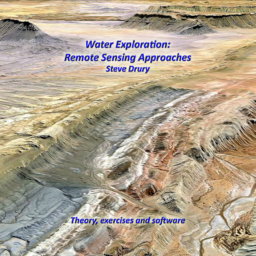
More detail on using remote sensing in exploration for and evaluation of water resources can be found here.
The record preserved in cores through the thickest part of the Greenland ice cap goes back only to a little more than 120 thousand years ago, unlike in Antarctica where data are available for 800 ka and potentially further back still. One possible reason for this difference is that a great deal more snow falls on Greenland so the ice builds up more quickly than in Antarctica. Because ice flows under pressure this might imply that older ice on Greenland long flowed to the margins and either melted or calved off as icebergs. So, although it is certain that the Antarctic ice cap has not melted away, at least in the last million years or so, we cannot tell if Greenlandic glaciers did so over the same period of time. Knowing whether or not Greenland might have shed its carapace of ice is important, because if ever does in future the meltwater will add about 7 metres to global sea level: a nightmare scenario for coastal cities, low-lying islands and insurance companies.
Edge of the Greenland ice sheet with a large glacier flowing into a fjiord at the East Greenland coas (Photo credit: Wikipedia)
One means of judging when Greenland was last free of ice, or at least substantially so, is based on more than a ice few metres thick being opaque to cosmic ‘rays’. Minerals, such as quartz, in rocks bared at the surface to ultra-high energy, cosmogenic neutrons accumulate short-lived isotopes of beryllium and aluminium – 10Be and 26Al with half-lives of 1.4 and 0.7 Ma. Once rocks are buried beneath ice or sediment, the two isotopes decay away and it is possible to estimate the duration of burial from the proportions of the remaining isotopes. After about 5 Ma the cosmogenic isotopes will have decreased to amounts that cannot be measured. Conversely, if the ice had melted away at any time in the past 5 Ma and then returned it should be possible to estimate the timing and duration of exposure of the surface to cosmic ‘rays’. Two groups of researchers have applied cosmogenic-isotope analysis to Greenland. One group (Schaefer, J.G. et al. 2016. Greenland was nearly ice-free for extended periods during the Pleistocene. Nature, v. 540, p. 252-255) focused on bedrock, currently buried beneath 3 km of ice, that drilling for the ice core finally penetrated. The other systematically analysed the cosmogenic isotope content of mineral grains at different depths in North Atlantic seafloor sediment cores, largely supplied from East Greenland since 7.5 Ma ago (Bierman, P.R. et al. 2016. A persistent and dynamic East Greenland Ice Sheet over the past 7.5 million years Nature, v. 540, p. 256-260). As their titles suggest, the two studies had conflicting results.
The glacigenic sediment grains contained no more than 1 atom of 10Be per gram compared with the 5000 to 6000 in grains deposited and exposed to cosmic rays along the shores of Greenland since the end of the last ice age. These results challenge the possibility of any significant deglaciation and exposure of bedrock in the source of seafloor sediment since the Pliocene. The bedrock from the base of Greenland’s existing ice cap, however, contains up to 25 times more cosmogenic isotopes. The conclusion in that case is that there must have been a protracted, >280 ka, exposure of the rock surface in what is now the deepest ice cover at 1.1 Ma ago at most. Allowing for the likelihood of some persistent glacial cover in what would have been mountainous areas in an otherwise substantially deglaciated Greenland, the results are consistent with about 90% melting suggested by glaciological modelling.
Clearly, some head scratching is going to be needed to reconcile the two approaches. Ironically, the ocean-floor cores were cut directly offshore of the most likely places where patches of residual ice cap may have remained. Glaciers there would have transported rock debris that had remained masked from cosmic rays until shortly before calved icebergs or the glacial fronts melted and supplied sediment to the North Atlantic floor. If indeed the bulk of Greenland became ice free around a million years ago, under purely natural climatic fluctuations, the 2° C estimate for global warming by 2100 could well result in a 75% glacial melt and about 5-6 m rise in global sea level.
We know that Lucy, the famous Australopithecus afarensis, could climb trees because her many bone fractures show that she fell out of a tree to her death. But that does not mean her species was an habitual tree-climber: plenty of modern humans fall to their deaths from trees, cliffs and the like. But the issue seems to have been resolved by using X-ray tomography of Lucy’s limb bones (Ruff, C.B. et al. 2016. Limb bone structural proportions and locomotor behaviour in A.L. 288-1 (“Lucy”). PLOS ONE v. 11, e0166095. doi:10.1371/journal.pone.0166095) during the skeleton’s triumphal series of exhibits in the US.
The authors, including two of those who showed that Lucy died after a fall using similar data, compared the digital 3-D models of her surviving arm- and leg bones with those of other hominins and living primates, estimating their relative strengths at different positions. Lucy was probably stronger in the arm than in the leg, but not to the same degree as chimpanzees. This is a feature that would significantlyassist climbing , but her bipedal locomotion on the ground would have been only slightly different from that of later Homo species. If anything, her strength relative to size would have been greater than ours, perhaps reflecting less reliance on tools for getting food and defending herself. But almost certainly Australopithecus afarensis habitually spend more time in trees, perhaps foraging and as a defence against predation, especially at night.
The new data for Lucy allows palaeoanthropologists to better judge the capabilities of other hominins. Interestingly Homo habilis, the earliest of our genus, may have had similar habits. But later species, beginning with H. erectus/ergaster, were as Earth-bound as we are. This suggests a shift in hominin ecology from an early and probably long history of semi-arboreal behavior until humans became masters of their terrain about 1.9 Ma ago, probably through their invention of better tools and the controlled use of fire.
Comparison of DNA from ancient hominin fossils with that obtained from a broad spectrum of living people showed that on the road out of Africa in the last 130 thousand years some anatomically modern humans successfully interbred with Neanderthals and Denisovans to produce fertile offspring. All non-African people contain a trace of those liaisons and include fertile hybrids in their ancestry, whereas Africans do not. Using quick, low-cost and sensitive genomic analyses these discoveries made similar searches for hybridisation among other supposedly distinct species a popular and fruitful line of research (Pennisi, E. 2016. Shaking up the tree of life. Science, v. 354, p. 817-820; doi: 10.1126/science.354.6314.817). They also challenge the long-held view that individual species are incapable of fertile interbreeding with others. Yet fertile hybrids have long been known among plants and butterflies without recourse to genomics. Now that it is a basic tool, it has been shown that up to 10% of known plant species have arisen from hybrids and examples are quickly being found among birds, insects, fish and mammals, including the famous Galapagos finches. Hybridisation introduces genetic variation more quickly than does mutation, potentially a major advantage in adaptive radiation.
Page from Darwin’s notebooks around July 1837 showing his first sketch of an evolutionary tree. (credit: Wikipedia)
Of course, the concept of ‘species’ is arbitrarily based on biological ‘form and function’, and in the same fashion as discoveries about epigenetics have shown genetic determinism to have an air of dogma, so hybridisation suggests that a ‘web’ is more apt as shorthand for the progress of evolution than is Darwin’s ‘tree’ or even a tangled ‘bush’. Another welcome outcome spurred by the pioneers of hominin comparative genetics is a powerful challenge to the dominant philosophies of reductionism and dualism among scientists; legacies of René Descartes bound up with the ‘scientific method’ – especially among physical scientists – and ideas such as ‘nature versus nurture’. A major revolution is in progress, from which the seekers for a Theory of Everything, from quantum mechanists through particle physicists to cosmologists need to draw some sharp and perhaps embarrassing lessons.
It is appropriate that the driving agency lies within anthropology, and thrilling too, for everyone can quickly learn a new way of approaching the world by contemplating their own origins. They would be hard-pressed to do that by pondering on the early nanoseconds of the cosmos …
One of the most eagerly followed ocean-floor drilling projects has just released some results. Its target is 46 km radially away from the centre of the geophysical anomaly associated with the Chixculub impact structure just to the north of Mexico’s Yucatan Peninsula. In the case of large lunar impact craters the centre is often surrounded by a ring of peaks. Modelling suggests such features are produced by the deep penetration of immense seismic shock waves. In the first minute these excavate and fling out debris to leave a cavity penetrating deep into the crust. Within three minutes the cavity walls collapse inwards creating a rebound superficially similar to the drop flung upwards after an object is dropped in liquid. This, in turn, collapses outwards to emplace smashed and partially melted deep crustal material on top of what were once surface materials, creating a crustal inversion beneath a mountainous ring of Himalayan dimensions that surrounds a by-now shallow crater. That is the story modelled from what is known about well-studied, big craters on the Moon and Mercury. Chixculub is different because the impact was into the sea and involved debris-charged tsunamis that finally plastered the actual impact scar with sediments. The drilling was funded for several reasons, some palaeontological others relating to the testing of theories of impact processes and their products. Chixculub is probably the only intact impact crater on Earth, and the first reports of findings are in the second category (Morgan, J.V. and 37 others 2016. The formation of peak rings in large impact craters. Science, v. 354, p. 878-882; doi: 10.1126/science.aah6561).
Artist’s depiction of the Chicxulub impact 65 million years ago that many scientists say is the most direct cause of the dinosaurs’ disappearance (credit: Wikipedia)
The drill core, reaching down to about 1.3 km below the sea floor penetrates post-impact Cenozoic sediments into a 100 m thick zone of breccias containing fragments of impact melt rock, probably the infill of the central crater immediately following the first few minutes of impact. Beneath that are coarse grained granites representing the middle continental crust from original depths around 10 km. The granite is intensely fractured and riven by dykes and pods of impact melt, and contains intensely shocked grains that typify impacts that produce a transient pressure of ~60 GPa – around six hundred thousand times atmospheric pressure. From seismic reflection surveys this crustal material overlies as yet un-drilled Mesozoic sedimentary rocks. Its density is significantly less than that of unshocked granite – averaging 2.4 compared with 2.6 g cm3. So it is probably filled with microfractures and sufficiently permeable for water to have penetrated once the impact site had cooled. This poses the question, yet to be addressed in print, of whether or not this near-surface layer became colonised by microorganisms in the aftermath (Barton, P. 2016. Revealing the dynamics of a large impact. Science, v. 354, p. 836-837). That is, was the surrounding ocean sterilised at the time of the K-T (K-Pg) mass extinction?; an issue whose resolution is awaited with bated breath by the palaeobiology audience. OK; so theory about the physical process of cratering has been validated to some extent, but will later results be more interesting, outside the planetary sciences community?
Read more about impacts here and mass extinctions here .
Mapping the Earth’s gravitational field once involved painstaking use of highly sensitive gravimeters at points on the surface, then interpolating values in the spaces between. How revealing maps produced in this way are depends on the spacing of the field sites, and that is still highly variable because of accessibility and how much money is available to carry out such a task in different areas. Space-borne methods have been around for decades. One uses radar measurement of sea-surface height, which depends on the underlying gravitational field. The other deploys two satellites in tandem orbits (the US-German Aerospace Centre Gravity Recovery and Climate Experiment – GRACE), the distance between them – measureable using radar – varying along each orbit according to variations in the Earth’s gravity. Respectively, these methods have produced gravity maps of the ocean floor and estimates melting rates of ice caps and the amount of groundwater extraction from sedimentary basins. The problem with GRACE is that satellites need to avoid the Earth’s atmosphere by using orbits hundreds of kilometres above the surface, otherwise drag soon brings them down. So the resolution of the gravity maps that it produces is too coarse (about 270 km) for most useful applications. If a world has no atmosphere, however, there is no such limit on orbital altitude, other than surface topography. A similar tandem-system to GRACE has been orbiting the Moon at 55 km since 2011. The Gravity Recovery and Interior Laboratory (GRAIL) mission has produced full coverage of lunar gravity at a resolution of 20 km. In a later phase of operation, GRAIL has been skimming the tops of the highest mountains on the Moon at an average altitude of 6 km; close enough to give a resolution of between 3 and 5 km.
The Mare Orientale basin on the Moon. (credit: Wikipedia)
This capacity has given a completely new take on lunar near-surface structure, about as good as that provided by conventional gravity mapping for parts of the Earth. The first pay-off has been for the best preserved major impact feature on the lunar surface: the Orientale basin that formed at the end of the Late Heavy Bombardment of the Solar System, around 3.8 billion years ago. The ~400 km diameter Orientale basin is at the western border of the moon’s disk visible from Earth, and looks like a gigantic bullseye. Its central crater, floored by dark-coloured basalt melted from the mantle by the power of the impact, is surrounded by three concentric rings extending to 900 km across; a feature seen partially preserved around even larger lunar maria. The structure of such giant ringed basins – also seen on other bodies in the Solar System – has been something of a puzzle since their first recognition on the Moon. A popular view has been that they are akin to the rippling produced dropping a pebble in water, albeit preserved in now solid rock.
The Orientale basin superimposed by the strength of the moon’s gravity field. Areas shaded in red have higher gravity, while areas in blue have the least gravity. (Credit: Ernest Wright, NASA/GSFC Scientific Visualization Studio)
GRAIL has allowed planetary scientists to model a detailed cross section through the lunar crust (Zuber, M.T. and 27 others, 2016. Gravity field of the Orientale basin from the Gravity Recovery and Interior Laboratory Mission. Science, v. 354, p. 438-441). The 40 km thick anorthositic (feldspar-rich) lunar crust has vanished from beneath the central crater, which is above a great upwards bulge of the lunar mantle mantled by about 2 km of mare basalts. The shape of the crust-mantle boundary beneath the rings shows that it has been thickened by anorthositic debris flung out by the impact. But the rings seem to be controlled by huge faults that penetrate to the mantle: signs of 2-stage gravitational collapse of the edifice produced initially by the impact.
Mary Anning, now something of a feminist icon, combed the foreshores and undercliffs of the Jurassic Coast of southern England for fossils, including those of marine reptiles. Self-taught, she unearthed, prepared and described the first ichthyosaurs and plesiosaurs known to science. Being a working class woman – and she did work in the early 19th century – she was not allowed to publish. Instead, she provided fossils to notables like Owen, Buckland and Cuvier who published and got the credit, only rarely acknowledging her as the collector. In 1964, during my induction as a fresher in the Lapworth Library of the Geology Department at Birmingham University, the ‘Prof’ Fred Shotton declared to the 14 young men sitting meekly before him, ‘There will be no women students in this department while I am its Head’. By my final year, Fred had relented and the first ever female undergraduate enrolled. When I left with a PhD in 1970, there were more and now my guess is the proportion is around 40%.. But professional geoscience is still largely a man’s world. In the US, where geoscience is still a major science – it has declined in Britain as a result of ‘rationalisation’ of UK Earth science departments that followed the 1987 Oxburgh Report – a mere 16% of faculty are women; female PhDs are paid 12% less than males; fellowship of learned societies is below 20%, and there is a host of other issues in which women are ‘less favoured’. It’s much the same, although perhaps a little less blatant, in most sciences. Being in a discipline that is still largely focussed on field work by individuals, female ‘lone workers’ in often remote places sometimes face worse problems.
Three of the presenters in The Bearded Lady Project pose on the foreshore at Lyme Regis – note the weathered Cretaceous Upper Greensand forming Golden Cap in the background. (Credit: Kelsey Vance)
Asking themselves a few rhetorical questions, such as, ‘What comes to mind when you hear the word “palaeontologist”?’ or ‘List as many female scientists as you can’, three women professionals – a palaeontologist, a performance art director and a photographer – decided to challenge a few stereotypes. Their project is a feature length, live-action documentary plus a series of photographic exhibitions to inspire young women to become geoscientists. It centres on what most ‘geos’ really enjoy; field work conducted exclusively by women. It is as realistic as the common perception of field geology might suggest, yet at some point each of the presenters has a beard or moustache. Hence, The Bearded Lady Project! Part of the film is to include footage shot at Lyme Regis, as a tribute to Mary Anning, the whole project covering many different aspects of practical geoscience.
For British readers: The Bearded Lady Project’s portrait exhibition is planned to be in Exeter.
The Palaeocene–Eocene (P-E) boundary at 55.8 Ma marks the most dramatic biological changes since the mass extinction at the Cretaceous-Palaeogene boundary 10 million years earlier. They included the rapid expansions of mammals and land plants and major extinction of deep-water foraminifera. It was a time of sudden global warming (5-10°C in 10-20 ka) superimposed on the general Cenozoic cooling from the ‘hothouse’ of the Cretaceous Period. It coincided with a decrease in the proportion of 13C in marine carbonates. Because photosynthesis, the source of organic carbon, favours light 12C, such a negative δ13C “spike” is generally ascribed to an unusually high release of organic carbon to the atmosphere. The end-Palaeocene warming may have resulted from a massive release of methane from gas-hydrate buried in shallow seafloor sediments. But another process may yield such a signature; massive burning of organic material at the land surface. Since its discovery, the P-E thermal maximum has been likened to the situation that we may face should CO2 emissions from fossil-fuel burning continue to rise without control. Unsurprisingly, funds are more easily available for research on this topic than, say, ‘Snowball Earth’ events.
Climate change during the last 65 million years. The Paleocene–Eocene Thermal Maximum is labelled PETM. (Photo credit: Wikipedia)
Three seafloor sediment cores off the east coast of the US that include the P-E boundary have been found to contain evidence for an impact that occurred at the time of the δ13C “spike” (Schaller, M.F. et al. 2016. Impact ejecta at the Paleocene-Eocene boundary. Science, v. 354, p. 225-229). The evidence is dominated by tiny spherules and tear-shaped blobs of glass, some of which contain tiny crystals of shocked and high-temperature forms of silica (SiO2). These form part of the suite of features that have been used to prove the influence of asteroid impacts. Two other onshore sites have yielded iridium anomalies at the boundary, so it does look like there was an impact at the time. The question is, was it large enough either to cause vast amounts of methane to blurt out from shall-water gas hydrates or set the biosphere in fire? Two craters whose age approximates that of the P-E boundary are known, one in Texas the other in Jordan, with diameters of 12 and 5 km respectively; far too small to have had any global effect. So either a suitably substantial crater of the right age is hidden somewhere by younger sediments or the association is coincidental – the impact that created the Texan crater could conceivably have flung glassy ejecta to the area of the three seafloor drilling sites.
Almost coinciding with the spherule-based paper’s publication another stole its potential thunder. Researchers at Southampton University used a mathematical model to investigate how a methane release event might have unfolded (Minshull, T.A. et al. 2016. Mechanistic insights into a hydrate contribution to the Paleocene-Eocene carbon cycle perturbation from coupled thermohydraulic simulations. Geophysical Research Letters, v. 43, p. 8637-8644, DOI: 10.1002/2016GL069676). Their findings challenge the hypothesized role of methane hydrates in causing the sudden warming at the P-E boundary. But that leaves out the biosphere burning, which probably would have neded a truly spectacular impact.
Channeled Scablands at the time of a glacial lake outburst flood (credit: Wikipedia)
The eastern side of Washington State in the US includes a vast, barren area that has been scoured virtually free of superficial sediment, including soils. Its landscape is among the most odd in North America, consisting of a network of unusually wide canyons or couleés that incise a regional plateau formed by the Columbia River flood basalts. The now largely dry canyon floors contain immense potholes, megaripples and erratic boulders, together with strangely streamlined hillocks made of residual, windblown loess deposits, which collectively resemble features of normal river beds but at a gargantuan scale. The canyon network emerges from the Rocky Mountains near the city of Spokane, then criss-crosses what had previously been a wide basalt plain to merge with the Columbia River in southern Washington. The couleés are up to 100 km long and reach 100 m in depth.
Dry Falls in Grand Colee, Washington state, US, showing typical features of the Channelle Scablands. (credit: Wikipedia)
In the 1920s J. Harlen Bretz suggested that the Channelled Scablands had been formed by a massive flood, a view that met disbelief until his colleague Joseph Pardee discovered that a huge lake of glacial meltwater (Lake Missouala) had formed in the intricate valleys of the Montana Rockies when their outflow into Washington had been blocked by a southward-surging finger of the Cordilleran ice sheet. Lake Missouala is estimated to have been about half the size of modern Lake Michigan (~7700 km2) and up to 610 m deep, reaching a maximum volume of 2100 km3 between 15 to 13 ka ago. Bretz’s idea was vindicated; melting of the ice dam was widely thought to have produced a single vast outburst flood and the removal of approximately 320 km3 of basalt and loess. The later discovery of strandlines, similar to those on a smaller scale in Glen Roy, western Scotland, on the flanks of former lake modified the theory to a series of individual, but still huge outburst flood events. Their magnitudes, estimated by assuming that each filled the coulees to their brim, were thought to be up to 60 km3 per hour, i.e. 100 times greater than the largest recorded historically, that of the Amazon. A recent study tempers the awe long-associated with the Scablands.
Isaac Larsen and Michael Lamb of the University of Massachusetts and the California Institute of Technology examined Moses Couleé, one of the largest, in detail (Larsen, I.J. & Lamb, M.P. 2016. Progressive incision of the Channelled Scablands by outburst floods. Nature, v. 538, p. 229-232; doi;10.1038/nature19817). Terraces in Moses Couleé allow successive topographic profiles of the canyon to be reconstructed, and the flow features on its floor allow water depth during some of the flows to be estimated. Far from being brim-full at any time, except during the first incision, individual discharges of meltwater were probably 5 to 10 times less than those previously suggested. Moreover, the pattern of the Scablands reflects major fracture zones n the Columbia River flood basalts, which suggests that floods followed lines of least resistance and greatest ease of erosion by removal of joint-bound blocks of basalt. Yet the floods still reached a magnitude never recorded for modern ones, and Larsen and Lambs modelling may well apply to the even vaster outburst canyons on Mars, such as Valles Marineris.
See also: Perron, J.T. & Venditti, J.G. 2016, Megafloods downsized. Nature, v. 538, p. 174-175; nature.com/newsandviews
The Châtelperronian material culture represents the earliest sign of the Upper Palaeolithic in Europe and its products span a period from about 45 to 40 ka. It includes stone tools, such as points and long, thin blades with a single cutting edge and a blunt back, reminiscent of a modern knife, and others with notched, or denticulate edges that resemble saw blades. A great many of the tools, including ivory and bone ones, are probably designed for working and stitching skins. But the most revealing worked objects are animal teeth, shells and fossils that are either bored or grooved to be strung together. The best have been found in the Grotte du Renne in eastern France. The most controversial aspect of the Châtelperronian is that its artefacts are sometimes found with the fossil remains of Neanderthals who had previously produced less sophisticated, Mousterian tools since around 160 ka. The controversy centres on whether or not Neanderthals created the Châtelperronian culture, and if so, did they develop them independently or through cultural exchange with or copying from the newly arrived anatomically modern humans (AMH).
The Grotte du Renne material is especially rich in ornaments, but insufficient fossil material is present to tell from anatomical characteristics whether or not they were made by AMH or Neanderthals. It has now become possible using traces of bone proteins to detect hominin bone fragments and DNA to assess which group is implicated (Welker, F. and 127 others, 2016. Palaeoproteomic evidence identifies archaic hominins associated with the Châtelperronian at the Grotte du Renne. Proceedings of the National Academy of Science, www.pnas.org/cgi/doi/10.1073/pnas.1605834113). Analyses of mtDNA and radiometric dating of the bones that yielded it show that the Grotte du Renne tools and ornaments link with Neanderthals who lived there about 37 ka ago. Interestingly, the stratigraphic horizon beneath the definite Neanderthal occupation level contains their earlier, Mousterian artefacts. So it seems that they developed new manufacturing techniques and material culture. Yet, the findings do not resolve the issue of independent invention or copying AMH methodology.
Importantly, Grotte du Renne shows that Neanderthals, even if they copied AMH techniques, were capable of appreciating, producing and using personal ornamentation: they could learn and transmit ideas. In that respect, here is support for the notion that, apart from significant anatomical differences from AMH they were not that different intellectually.
250 million people who live in the drylands of Africa and Asia face a shortage of water for their entire lives. Hundreds of millions more in less drought-prone regions of the ‘Third World’ have to cope repeatedly with reduced supplies. A rapid and effective assessment of how to alleviate the shortfall of safe water is therefore vital. In arid and semi-arid areas surface water storage is subject to a greater rate of evaporation than precipitation, so groundwater, hidden beneath the land surface, provides a better alternative. Rainwater is also lost by flowing away far more quickly than in areas with substantial vegetation. Harvesting that otherwise lost resource and diverting it to storage secure from evaporation – ideally by using it to recharge groundwater – is an equally important but less-used strategy. Securing a sustainable water supply for all peoples is the most important objective that geoscientists can address.
In practice, to assure good quality water supplies to a community in the form of productive wells, surface water harvesting schemes or planning the recharge of exploited aquifers requires skill, a great deal of work and considerable financial resources. Yet in many parts of sub-Saharan Africa and arid areas of Asia knowing where to focus effort and increase the chances of it being fruitful is one the biggest hurdles to overcome. Such reconnaissance – highlighting the most probable localities on geological and hydrological grounds, and screening out those least likely to yield water for drinking and hygiene – depends on details of the geology and topography of the terrain in which needy communities are situated. For most of the Afro-Asian dryland belt adequate geological and topographic maps are in as short supply as potable water itself. Remote sensing combined with an understanding of groundwater storage and surface-water harvesting is a powerful tool for bridging that knowledge gap, and is routinely used successfully in areas blessed with abundances of experienced geoscientists, money and engineering infrastructure. Again, most of the Afro-Asian dryland belt is poorly endowed in these respects.
Having long ago written a textbook on general remote sensing for geoscientists, now out of print (Image Interpretation in Geology (3rd edition): 2001. Nelson Thorne/Blackwell Science), I decided to re-issue revised parts of it framed in the specific context of water exploration in arid and semi-arid terrains, and to add practical case studies and exercises based on a free version of professional image processing and desktop mapping software. Some of the most geologically revealing remotely sensed image data – those from the Landsat series of satellites and the joint US-Japan ASTER system carried by Terra, one of NASA’a Earth Observing System satellites – are now easily and freely available for the whole of the Earth’s land surface. Given basic familiarity with theory and practicalities, a computer and appropriate software together with a moderately fast internet connection there is nothing to stop any geoscientist, university geology student or engineer working in the water, sanitation and hygiene (WASH) sector from becoming a proficient, self-contained practitioner in water reconnaissance. Water Exploration: Remote Sensing Approacheshas that aim. Online access to the theoretical parts is free, and a DVD that combines theory, software, exemplary data and several exercises that teach the use of image processing/desktop mapping software is available at cost of reproduction and postage.
If you visit the website, find what you see potentially useful and wish to know more, contact me through the Comments form at the H2Oexplore homepage.