Can a supernova affect the Earth System?

The easy answer is yes, simply because chemical elements with a greater relative atomic mass than that of iron are thought to be created in supernovae when dying giant stars collapse under their own gravity and then explode. Interstellar dust and gas clouds accumulate their debris. If the clouds are sufficiently dense gravity forms clumps that may become new stars and the planets that surround them. Matter from every once-nearby supernova enters these clouds and thus contributes to the formation of a planet. This was partly proven when pre-solar grains were found in the Murchison meteorite, some of which are as old as 7.5 billion years (Ga) – 3 Ga older than the Solar System (see: Mineral grains far older than the Solar System; January 15, 2020). Murchison is a carbonaceous chondrite, a class of meteorite which likely contributed lots of carbon-based compounds to the early Earth, setting the stage for the emergence of life. It has been estimated that a near-Earth supernova (closer than 1000 light years) would have noticeable effects on the biosphere, mainly because of the effects on atmospheric composition of the associated high-energy gamma-ray burst. That would create sufficient nitrogen oxides to destroy the ozone layer that shields the surface from harmful radiation. There are reckoned to have been 20 nearby supernovae during the last 10 Ma or so from the presence of anomalously high levels of the isotope 60Fe in marine sediment layers on the Pacific floor. Yet there is no convincing evidence that they coincided with detectable extinctions in the fossil record. But supernovae have been suggested as a possible cause of more ancient mass extinctions, such as that at the end of the Ordovician Period (but see: The late-Ordovician mass extinction: volcanic connections; July 2017).

Diorama of an Early Devonian reef with tabulate and rugose corals and trilobites (Credit: Richard Bizley)

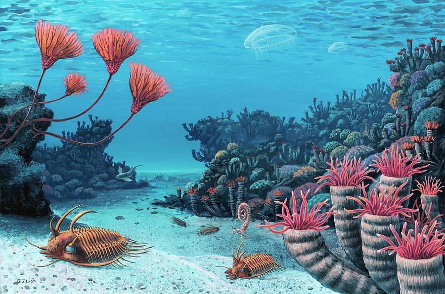
The Late Devonian is generally accepted to be one of the ‘Big Five’ mass extinction events. However, unlike the others, the event was a protracted decline in biodiversity, with several extinction peaks). In particular it marked the end of Palaeozoic reef-building corals. Some have put down the episodic faunal decline to the effects of species moving from one marine basin to another as global sea levels fluctuated: much like the effects of the ‘invasion’ of the coral-eating Crown of Thorns sea urchin that has helped devastate parts of the Great Barrier Reef during present-day global warming (see: Late Devonian: mass extinction or mass invasion? January 2012). Recently, attention has switched to evidence for ultra-violet damage to the morphology of spores found in the strata that display faunal extinction; i.e. to the possibility of the ozone layer having been lost or severely depleted. One suggestion has been sudden peaks in volcanic activity, hinted at by spikes in the abundance of mercury of marine sediments. Brian Fields of the University of Illinois, with colleagues from the USA, UK, Estonia and Switzerland, have closely examined the possibility and the testability of a supernova’s influence (Fields. B.D. et al. 2020.  Supernova triggers for end-Devonian extinctions. Proceedings of the National Academy of Sciences, v. 117, article 202013774; DOI: 10.1073/pnas.2013774117).

They propose the deployment of mass-spectrometric analysis for anomalous stable-isotope abundances in the sediments that contain faunal evidence for accelerated extinction, particularly those of 146Sm, 235U and the long-lived plutonium isotope 244Pu (80 Ma hal-life). They suggest that the separation of the extinction into several events, may be a clue to a supernova culprit. A gamma-ray burst would arrive at light speed, but dust – containing the detectable isotopes –  although likely to be travelling very quickly would arrive hundred to thousands of years later, depending on the distance to the supernova. Cosmic rays generated by the supernova, also a possible kill mechanism, given a severely depleted ozone layer, travel about half the speed of light. Three separate arrivals for the products of a single stellar explosion are indeed handy as an explanation for the Late Devonian extinctions. But someone needs to do the analyses. The long-lived  plutonium isotope is the best candidate: even detection of a few atoms in a sample would be sufficient proof. But that would require a means of ruling out contamination by anthropogenic plutonium, such as analysing the interior of fossils. But would even such an exotic discovery prove the sole influence of a galactic even?

Finding Archaean atmospheric composition using micrometeorites

Modern micrometeorites (about 20 μm in diameter) from deep-sea sediments, with shiny magnetite-rich veneers (Credit: D. E. Brownlee)

The gases making up the Earth’s atmosphere and their relative proportions before 2.5 billion years (Ga) ago are known with very little certainty. Carbonate rocks are rare, indicating that the oceans were more acidic, which implies that they had dissolved more CO2 from the atmosphere, which, in turn implies that there was much more of that gas than in present air. There are few signs of widespread glaciogenic sediments of Archaean age, at a time when the Sun’s energy output is estimated to have been at 70 to 75% of its present level. Without an enhanced greenhouse effect oceans would have been frozen over; so that supports high CO2 concentrations too. The fact that water worn grains of minerals such as uraninite (UO2) and pyrite (FeS2), which are stable only in reducing conditions, occur in Archaean conglomerates is a good indicator that there were only vanishingly small amounts of oxygen in the air. That was not to change until marine photosynthesisers produced enough to overcome the general reducing conditions at the Earth’s surface, marked by the Great Oxidation Event at around 2.4 Ga (see: Massive event in the Precambrian carbon cycle; Earth-logs, January 2012. Search for more articles in sidebar at Earth-logs home page). It was then that ancient soils (palaeosols) became the now familiar red colour because of their content of ferric iron oxides and hydroxides The problem is that reliable numbers cannot be attached to these kinds of observation. A common means of estimating CO2 levels comes from the way in which the gas reacts with silicates as soils form at the land surface, estimated from carbon isotopes in soil carbonate nodules. Since the rise of land plants around 400 Ma ago the distribution of pores (stomata) in fossil leaves provides a more precise estimate: the more CO2 in air the less densely packed are leaf stomata. For the Precambrian we are stuck with estimates based on chemical reactions of minerals with the atmosphere. Until recently, one reaction that must always have been extremely common was overlooked.

When meteorite pass through the atmosphere at very high speed friction heats them to incandescence. Their surfaces not only melt but the minerals from which they are composed react very strongly with air. The reaction products should therefore provide chemical clues to the relative proportions of atmospheric gases. Both oxygen and carbon dioxide are reactive at such temperatures, although nitrogen is virtually inert, yet it tends to buffer oxidation reactions. The rest of the atmosphere comprises noble gases – mainly argon – and by definition they are completely unreactive. Pure-iron micrometeorites collected from 2.7 Ga old sediments in the Pilbara Province of Western Australia are veneered with magnetite (Fe3O4) and wüstite (FeO), thus preserving a record of their passage through the Neoarchaean atmosphere. If the oxidant had been oxygen, for these minerals to form from elemental iron suggests oxygen levels around those prevailing today: clearly defying the abundant evidence for its near-absence during the Archaean. Carbon dioxide is the only candidate. Two studies have produced similar results (Lehmer, O. R. et al. 2020. Atmospheric CO2 levels from 2.7 billion years ago inferred from micrometeorite oxidationScience Advances, v. 6, article aay4644;  DOI: 10.1126/sciadv.aay4644 and Payne, R.C. et al. 2020. Oxidized micrometeorites suggest either high pCO2 or low pN2 during the Neoarchean. Proceedings of the National Academy of Sciences, v. 117 1360 DOI:10.1073/pnas.1910698117). Both use complex modelling of the chemical effects of meteorite entry. Lehmer and colleagues estimated that the Neoarchaean atmosphere contained about 64% CO2, with a surface atmospheric pressure about half that at present. This would be sufficient for a surface temperature of about 30°C achieved by the greenhouse effect, taking into account lower solar heating. The team led by Payne concluded a lower concentration (25 to 50%) and a somewhat cooler planet at that time. Both results suggest ocean water considerably more acid than are today’s. The combined warmth and acidity would have had a fundamental bearing on both the origin, survival and evolution of early life.

See also: Carroll, M. 2020. Meteorites reveal high carbon dioxide levels on early Earth; Yirka, R. Computer model shows ancient Earth with an atmosphere 70 percent carbon dioxide. (both from Phys.org)

Subglacial impact structure: trigger for Younger Dryas?

Radar microwaves are able to penetrate easily through several kilometres of ice. Using the arrival times of radar pulses reflected by the bedrock at glacial floor allows ice depth to be computed. When deployed along a network of flight lines during aerial surveys the radar returns of large areas can be converted to a grid of cells thereby producing an image of depth: the inverse of a digital elevation model. This is the only means of precisely mapping the thickness variations of an icecap, such as those that blanket Antarctica and Greenland. The topography of the subglacial surface gives an idea of how ice moves, the paths taken by liquid water at its base, and whether or not global warming may result in ice surges in parts of the icecap. The data can also reveal topographic and geological features hidden by the ice (see The Grand Greenland Canyon September 2013).

Untitled-2
Colour-coded subglacial topography from radar sounding over the Hiawatha Glacier of NW Greenland (Credit: Kjaer et al. 2018; Fig. 1D)

Such a survey over the Hiawatha Glacier of NW Greenland has showed up something most peculiar (Kjaer, K.H. and 21 others 2018. A large impact crater beneath Hiawatha Glacier in northwest Greenland. Science Advances, v. 4, eaar8173; DOI: 10.1126/sciadv.aar8173). Part of the ice margin is an arc, which suggests the local bed topography takes the form of a 31km wide, circular depression. The exposed geology shows no sign of a structural control for such a basin, and is complex metamorphic basement of Palaeoproterozoic age. Measurements of ice-flow speeds are also anomalous, with an array of higher speeds suggesting accelerated flow across the depression. The radar image data confirm the presence of a subglacial basin, but one with an elevated rim and a central series of small peaks. These are characteristic of an impact structure that has only been eroded slightly; i.e. a fairly recent one and one of the twenty-five largest impact craters on Earth.. Detailed analysis of raw radar data in the form of profiles through the ice reveals  that the upper part is finely layered and undisturbed. The layering continues into the ice surrounding the basin and is probably of Holocene age (<11.7 ka), based on dating of ice in cores through the surrounding icecap. The lower third is structurally complex and shows evidence for rocky debris. Sediment deposited by subglacial streams where they emerge along the arcuate rim contain grains of shocked quartz and glass, as well as expected minerals from the crystalline basement rocks. Some of the shocked material contains unusually high concentrations of transition-group metals, platinum-group elements and gold; further evidence for impact of extraterrestrial material – probably an iron asteroid that was originally more than 1 km in diameter. The famous Cape York iron meteorite, which weighs 31 t – worked by local Innuit to forge harpoon blades – fell in NW Greenland about 200 km away.

The central issue is not that Hiawatha Glacier conceals a large impact crater, but its age. It certainly predates the start of the Holocene and is no older than the start of Greenland glaciation about 2.6 Ma ago. That only Holocene ice layers are preserved above the disrupted ice that rests immediately on top of the crater raises once again the much-disputed possibility of an asteroid impact having triggered the Younger Dryas cooling event and associated extinctions of large mammals in North America at about 12.9 ka (see Impact cause for Younger Dryas draws flak May 2008). Only radiometric dating of the glassy material found in the glaciofluvial sediments will be able to resolve that particular controversy.

A hint of life on Mars

We can be certain that life was around on Planet Earth around 3.5 billion years ago, if not before, because unmetamorphosed sedimentary rocks of that age from Western Australia in which stromatolites occur contain a black to brownish, structureless material known as kerogen. The material is a hodgepodge of organic compounds that form during the breakdown of proteins and carbohydrates in living matter. It is the source material for petroleum compounds when kerogen-rich rocks are heated during burial. The vast bulk of organic compounds preserved on Earth are in the form of ancient kerogen, whose mass exceeds that of the living biosphere by about 10 thousand times. A good sign that it does represent ancient life lies in sedimentary kerogen’s depletion in ‘heavy’ 13C compared with 12C (negative values of δ13C), because in metabolising carbon dioxide living cells preferentially use the lighter of these two isotopes. Conceivably, 13C can be removed from inorganic carbon by metamorphic processes, so low values of δ13C in metasediments from West Greenland might be organically derived or, equally, they might not.

At the time of writing, geoscientists specialising in Martian matters had become excited by some results from the geochemical system aboard the surviving functional NASA rover. Curiosity has slowly been making its way up Mount Sharp at the centre of Gale Crater near to Mars’s equator. Analysis of high-resolution images taken from orbit suggest that the rocks forming the mountain are sediments. the lowest and oldest strata are suspected to have been deposited in a crater lake when conditions were warmer and wetter on Mars, about 3 billion years ago. Curiosity was equipped with a drill to penetrate and sample sediment unaffected by ultraviolet radiation that long ago would have destroyed any hydrocarbons exposed at the surface. In late 2016, before the rover had reached the lake sediments, the drill’s controller broke down. Since then, Curiosity had moved on to younger, less promising sediments. More than a year later mission engineers fixed the problem and the rover backtracked to try again. Heating the resulting samples to almost 900°C yields any volatile components as a gas to a mass spectrometer, results from which give clues to the molecules released.

‘Selfie’ of Curiosity rover en route to Mount Sharp. (Credit: NASA)

The Sample Analysis at Mars (SAM) team report a range of thiophenic, aromatic and aliphatic molecules of compounds of carbon, hydrogen and sulfur (Eigenbrode, J.L and 21 others 2018. Organic matter preserved in 3-billion-year-old mudtsones at Gale crater, Mars. Science, v. 360, p. 1096-1101; doi:10.1126/science.aas9185). The blend of pyrolysis products closely resembles those which form from heated terrestrial kerogens and coals, but also from pyrolysis of carbonaceous chondrite meteorites. So, the presence of Martian kerogen is not proven. But the results are so promisingly rich in hydrocarbons that another weapon in SAM’s armoury will be deployed, dissolving organic compounds directly from the drill cuttings. This may provide more convincing evidence of collagen. Yet only when samples are returned to labs on Earth will there be a chance to say one way or the other that there was once life on Mars. The results reported in Science’s 8 June issue will surely add weight to the clamour for the Mars 2020 sample-return mission to be funded. Whether or not there is life on Mars demands a great deal more investment still…

A fully revised edition of Steve Drury’s book Stepping Stones: The Making of Our Home World can now be downloaded as a free eBook

Impact debris in Britain

These days reports of geological evidence for asteroid impacts are not regarded with a mixture of disbelief, wonder and foreboding: well, not by geologists anyway. But for such a small area as Britain now to have three of widely different ages and in easily accessible places is pretty good for its brand as the place to visit for practically every aspect of Earth history. The first to be discovered lies at the base of Triassic mudstones near Bristol (see Britain’s own impact) and would need some serious grubbing around at a former construction site. The next to emerge was located in one of the best geological districts in the country at several easily accessed coastal exposures in Northwest Scotland. A glass-rich ejecta layer occurs in the basal Torridonian Stoer Group on Stac Fada, Stoer, Sutherland (UK National Grid Reference 203300, 928400). The most recently found (Drake, S.N. and 8 others 2018. Discovery of a meteoritic ejecta layer containing unmelted impactor fragments at the base of Paleocene lavas, Isle of Skye, Scotland. Geology, v. 46, p. 171-174; doi:10.1130/G39452.1) is on the Inner Hebridean island of Skye at the base of its famous Palaeocene flood basalt sequence (UK National Grid Reference 155371,821112).

View to the northwest across Loch Slapin to the Cuillin Hills of Skye (Central Igneous Complex). The flood basalts beneath which the ejecta layer occurs are just above the trees. (Credit: Wikipedia)

The last is perhaps the most spectacular of the three, as it contains the full gamut of provenance, matched only by material from the drill core into the 66 million year-old Chicxulub crater. The 0.9 m thick debris layer rests directly on mid-Jurassic sandstones beneath Palaeocene basalts of the North Atlantic Igneous Province (NAIP). The layer contains a basalt clast dated at 61.54 Ma, but is dominantly reminiscent of a pyroclastic ignimbrite flow as it contains glass shards. But there the resemblance ends for the bulk of small clasts are of quartz and K-feldspar, sandstone and gneiss. Zircons extracted from the debris show shock lamellae and give Archaean and Proterozoic ages commensurate with the local basement, but also with the bulk of the Scandinavian and Canadian Shields. So the impact could have been anywhere in such widespread terrains, although the enclosed basalt narrows this down to areas where basement is overlain by lavas of the NAIP. The Skye impactite contains unmelted meteorite fragments in the form of titanium nitrides alloyed with vanadium and niobium, metallic iron-silicon alloy containing exsolved carbon, and manganese sulfide.

Although it may be coincidental, the situation of the ejecta layer immediately beneath the Skye lavas, its containing a clast of basalt whose age corresponds to the oldest flows anywhere in the NAIP is fascinating. But the actual impact site is, as yet, unknown. Even so, the layer provokes thoughts about whether an impact may have been more than spatially related to the large NAIP flood basalt pile, preserved on either side of the North Atlantic. If the event was large, then surely the ejecta should be preserved near the base of the flood basalts elsewhere in NW Britain and further afield

Hadean potentially fertile for life

The earliest incontrovertible signs of life on Earth are in the 3.48 billion-year-old Dresser Formation in the Pilbara craton of Western Australia, which take the form of carbon-coated, bubble-like structures in fine-grained silica sediments ascribed to a terrestrial hot-spring environment. In the same Formation are stromatolites that are knobbly, finely banded structures made of carbonates. By analogy with similar structures being produced today by bacterial mats in a variety of chemically stressed environments that are inhospitable for multicelled organisms that might know them away, stromatolites are taken to signify thriving, carbonate secreting bacteria. There are also streaks of carbon associated with wave ripples that may have been other types of biofilm. A less certain record of the presence of life are stromatolite-like features in metasediments from the Isua supracrustal belt of West Greenland, dated at around 3.8 Ga, which also contain graphite with carbon-isotopic signs that it formed from biogenic carbon. Purely geochemical evidence that carbonaceous compounds may have formed in living systems are ambiguous since quite complex hydrocarbons can be synthesised abiogenically by Fischer-Tropsch reactions between carbon monoxide and hydrogen.

At present there is little chance of extending life’s record further back in time than four billion years because the Hadean is mainly represented by pre 4 Ga ages of zircon grains found in much younger sedimentary rocks – resistant relics of Hadean crustal erosion. The eastern shore of Hudson Bay does preserve a tiny (20 km2) patch of metamorphosed basaltic igneous rocks, known as the Nuvvuagittuq Greenstone Belt. Dated at 3.77 Ga by one method but 4.28 Ga by another, this could be Hadean. Like the Isua sequence that in Quebec also contains metasediments, including banded ironstones with associated iron-rich hydrothermal deposits. Silica from the vent system shows dramatically lifelike tubules. Yet the ambiguity in dating upsets any claims to genuine Hadean life. There has also been a physical stumbling block to the notion that life may have originated and thrived during the Hadean: the bombardment record.

English: An outcrop of metamorphosed volcanose...
Metamorphosed volcanosedimentary rocks from the Nuvvuagittuq supracrustal belt, Canada. Some of these rocks contain quite convincing examples of fossil cells. (credit: Wikipedia)

While oxygen-isotope data from 4.4 Ga zircons hints strongly at subsurface and perhaps surface water on Earth at that time, continued accretion of large planetesimals would have created the hellish conditions associated with the name of the first Eon in Earth’s history. Liquid water is essential for life to have formed, on top of a supply of the essential biological elements C, H, O, N, P and S. The sheer amount of interstellar dust that accompanied the Hadean impact record would have ensured fertile chemical conditions, but would the surface and near-surface of the early Earth have remained continually wet? Judging by the lunar surface and that of other bodies in the solar system, after the cataclysmic events that formed the Moon, many Hadean impacts on Earth were in the range of 100 to 1000 km across, with a Late Heavy Bombardment (LHB)that not only increased the intensity of projectile delivery but witnessed the most energetic single events such as those that created the lunar maria and probably far larger structures on Earth. The thermal energy, accompanied, by incandescent silicate vapour ejected from craters, may have evaporated oceans and even subsurface water with calamitous consequences for early life or prebiotic chemistry. Until 2017 no researchers had been able to model the energetic of the Hadean convincingly.

After assessing the projectile flux up to and through the LHB, and the consequent impact heating Bob Grimm and Simone Marchi of the Southwest Research Institute in Boulder, Colorado modelled the likely thermal evolution of the outer Earth through the Hadean. This allowed them to calculate the likely thermal gradients in the near-surface, the volumes of rock each event would have affected and the times taken for cooling after impacts (Grimm, R.E. & Marchi, S. 2018. Direct thermal effects of the Hadean bombardment did not limit early subsurface habitability. Earth and Planetary Science Letters, v. 485, p. 1-9; doi:10.1016/j.epsl.2017.12.043). They found that subsurface ‘habitability’ would have grown continuously throughout the Hadean, even during the worst events of the LHB. Sterilizing Earth and thus destroying and interrupting any life processes could only have been achieved by ten times more projectiles arriving ten times more frequently over the 600 Ma history of the Hadean and LHB. Although surface water may have been evaporated by impact-flash heating and vaporized silicate ejecta, the subsurface would have been wet at least somewhere on the early Earth. Provided it either originated in or colonised surface sedimentary cover it would have been feasible for life to have survived the Hadean. However, nobody knows how long it would have taken for the necessary accumulation of prebiotic chemicals and to achieve the complex sequence of processes that lead to nucleic acids encapsulated in cells and thus self-replication and life itself.

Ice cliffs on Mars

An illustration of what Mars might have looked...
An illustration of what Mars might have looked like during an ice age between 2.1 million and 400,000 years ago, when Mars’s axial tilt is believed to have been much larger than today.  (credit: Wikipedia)

For Mars to support life and for life to have emerged there demand water that is readily accessible from the surface. There is evidence that in the distant past liquid water may have flowed across the Martian surface to erode river-like features, some associated with the vast canyon system of Valles Marineris. That feature is thought to have been initiated by tectonic forces and perhaps flowing magma, but it shows definite signs of water erosion. Water in great volume was released during the Noachian phase of Mars’s evolution possibly by major impacts 4100 to 3700 million years ago, during the interval known as the Late Heavy Bombardment). Large tracts of the Martian surface that are more muted than Valles Marineris show topographic features reminiscent of huge braided stream systems. Water may have covered vast, low-lying areas in the planet’s Northern Hemisphere to form an early ocean. Yet today the Red Planet seems extremely dry and its thin atmosphere shows only minute traces of water vapour – it is dominated by carbon dioxide. Results from various rovers deployed across its surface and from Mars orbiting satellites have, however, revealed signs of waterlain sediments and minerals that can only have formed by the breakdown of igneous rocks by water. Signs that liquid water continues to flow occasionally down steep slopes, such as rill-like features and ephemeral darkened patches, have been much disputed.

Mars does have an ice cap at its North Pole that waxes and wanes with its seasons, but rather than melting during Martian ‘summers’ the ice sublimates directly to water vapour. Conversely, the polar ices probably form from frost. Yet, astonishingly, there appear to be active glaciers complete with flow lines and moraines, but chances are that some of them are sediment flows ‘lubricated’ by frost binding together mineral particles and boulders that undergoes pressure-induced regelation. Data from orbiting neutron and gamma-ray spectrometers reveal that between 60°N and 60°S the top metre of Martian soil contains between 2 to 18% of ice, making it akin to terrestrial permafrost. So, contrary to its appearance Mars is rich in water, but almost exclusively in solid form. Until very recently, the bulk was thought to be as a matrix binding together sediments, accessible to future crewed mission in useful volumes only by surface mining. That somewhat pessimistic view has now changed dramatically.

Monochrome HiRISE image of a cliff on Mars (the pinkish swath is a simulated natural colour image – see below). beneath the cliff is a zone of jumbled ground formed by cliff collapses. (credit: NASA)

Careful study of fine resolution imagery from the HiRISE instrument on the Mars Reconnaissance Orbiter at latitudes a little less than 60° has centred on cliffs formed by recent erosion (Dundas, C.M and 11 others 2018. Exposed subsurface ice sheets in the Martian mid-latitudes. Science, v. 359, p. 199-201; doi: 10.1126/science.aao1619). Colin Dundas of the US Geological Survey, Flagstaff, Arizona, and US colleagues used the multispectral capacities of HiRISE data to study the composition of sedimentary layers exposed in the cliffs. In eight cases, the cliffs contained layered, almost pure blue ice tens of metres thick and only a few metres below the surface. The cliffs seem to have formed as ice has sublimated where exposed, thereby undermining to sedimentary cover. Below the cliffs are jumbled zones of collapsed material. Being so close to the surface and underlain by apparently ice-free sediments, the layered ice sheets must be geologically quite young.

Simulated natural-colour HiRISE image of a Martian cliff showing nearly pure water ice in blues. Note the layered structure that may represent seasonal variations during the period of ice formation (credit: NASA)

Unlike the Earth, whose axial tilt is stabilised to a large degree by the Moon’s gravity, Mars’s two tiny moons have little effect of this kind. So Mars’s axis wobbles between its current 25° tilt to as much as 45°. This results in large climatic shifts, of which there have been an estimated forty over the last 5 million years. At high tilts solar energy heats up the poles and releases water vapour by accelerated sublimation to be laid down at lower latitudes as frost or snow. Mars’s present tilt suggests that it is experiencing a cold episode so that wind blown dust has covered and preserved mid-latitude ice sheets over tens of thousand years. Nearly pure ice is easier to exploit than permafrost layers. Yet optimism among enthusiasts for a crewed Mars mission and eventual colonisation is tempered by the latitudes of the discoveries. While ready supplies of water from ice and CO2 from the Martian atmosphere give the ingredients for oxygen, methane through catalysis of CO2 and hydrogen, agricultural photosynthesis and all kinds of other useful chemistry, low latitudes offer the most assured solar energy supplies. Latitudes around 55° are frigid and dark during Martian winters; perhaps totally inhospitable. So the remote-sensing search is likely to continue in cliffs closer to the ‘tropics’ of Mars.

Lid tectonics on Earth

Geoscientists have become used to thinking of the Earth as being dominated by plate tectonics in which large, rigid plates of lithosphere move across the surface. They are driven mainly by the sinking of cold, densified lithosphere in slabs at subduction zones. The volume of recycled slabs is replaced by continual supply of mafic magma to form oceanic crust at constructive margins. Such a process has long been considered to have reached far back into the Precambrian past and there are lively debates concerning when this modus operandi first arose and what preceded it. Now that we know more about other rocky planets and moons it appears that Earth is the only one on which plate tectonics has occurred. The other, more common, behaviour is dominated by stagnancy, although some worlds evidence volcanism and resurfacing as a result of giant impacts. Their subdued activity has come to be known as ‘lid tectonics’, in which their highly viscous innards slowly convect beneath a rigid, stagnant lid through which thermal energy is lost by convection: they are ‘one-plate’ systems. Although Earth loses internal heat by conduction through plate interiors, a large amount dissipates by convection associated with constructive margins: the oceanic parts of its plates lose heat laterally, as they grow older. Six papers in an advance, online issue of the free-access journal Geoscience Frontiers are concerned with the issue of terrestrial lid-tectonics and whether or not it dominated the Earth repeatedly in its Precambrian history.

A model is emerging for a hot, early Earth that was dominated by a form of lid tectonics (Bédard, J.H. 2018 Stagnant lids and mantle overturns: implications for Archaean tectonics, magmagenesis, crustal growth, mantle evolution, and the start of plate tectonics. Geoscience Frontiers, v. 9, 19-49; https://doi.org/10.1016/j.gsf.2017.01.005). Bedard’s model centres on lithosphere that was so weak because of its temperature that its subduction was impossible. Density of the lithosphere rarely increased above that of the mantle because the necessary mineralogical changes were not achieved – those involved in plate tectonics require low-temperature, high-pressure metamorphism as oceanic lithosphere is driven down at modern subduction zones. Even if such reactions did happen, the lithosphere would have been too weak to sustain slab-pull force and dense lithosphere would have simply ‘dripped’ back to the mantle. Mantle convection in a hotter Earth would have been in the form of large, long-lived upwelling zones rather than the relatively ephemeral and narrow plumes known today. Low density materials resulting from magma fractionation, the precursors of continental crust, would have been shifted willy-nilly across the face of the planet to collide. accrete and undergo repeated partial melting. In Bedard’s view, plate tectonics arose as Earth’s heat production waned below a threshold that permitted rigid lithosphere, probably in the late Archaean, to dominate after 2.5 Ga.

Bédard’s impression of an early Archaean lid-tectonic scenario. (credit: Jean H Bédard 2018, Figure 3B)

A radically different view is that stagnant-lid episodes alternated with periods of limited subduction and plate tectonics in the Archaean. Some Archaean cratons – the so-called ‘granite-greenstone terrains – seems to provide geological evidence for lid tectonics (Wyman, D. 2018. Do cratons preserve evidence of stagnant lid tectonics? Geoscience Frontiers, v. 9, 19-49; https://dx.doi.org/10.1016/j.gsf.2017.02.001). Others, such as the famous Isua supracrustal belt in West Greenland hint at plate tectonics. John Piper, of Liverpool University in Britain, argues from a series of Archaean palaeomagnetic polar wander curves that in three periods – ~2650 to 2200 Ma, 1550 to 1250 Ma, and 800 to 600 Ma – the poles shifted comparatively slowly with respect to the cratons providing the magnetic data; a feature that Piper ascribes to dominant lid tectonics (Piper, J.D.A., 2018. Dominant Lid Tectonics behaviour of continental lithosphere in Precambrian Times: palaeomagnetism confirms prolonged quasi-integrity and absence of Supercontinent Cycles. Geoscience Frontiers, v. 9, p. 61-89; https://doi.org/10.1016/j.gsf.2017.07.009). Similarly, there is some evidence based on the geochemical variation of basaltic rocks derived from the mantle. Through the Archaean, geochemical changes roughly follow cycles in the abundance of zircon radiometric ages and other geological changes that may reflect plate- and lid-tectonic episodes (Condie, K.C. 2018. A planet in transition: the onset of plate tectonics on Earth between 3 and 2 Ga? Geoscience Frontiers, v. 9, p. 51-60; https://doi.org/10.1016/j.gsf.2016.09.001). Interestingly, the age-frequency plot of almost three thousand Archaean and Hadean zircons recovered from the famous 1.6 Ga old sandstones of the Jack Hills Formation in Western Australia reveals similar cycles that may reflect such tectonic fluctuations in the Hadean (Wang, Q. & Wilde, S.A. 2017. New constraints on the Hadean to Proterozoic history of the Jack Hills belt,Western Australia. Gondwana Research, v. 55, p. 74-91; https://doi.org/10.1016/j.gr.2017.11.008). Since zircons are most likely to crystallize from intermediate and felsic magmas – i.e. precursors of continental material – their abundance in the Jack Hills rocks suggests that their source must have been in the 3.7 to 3.3 Ga gneisses on which the younger sediments rest. That is, part of those Archaean gneisses may well be made up of Hadean continental material that was repeatedly reworked and maybe remelted since such crust first appeared (in the form of surviving zircons) around 4.4 to 4.5 Ga, perhaps during vigorous lid-tectonic regimes.

Possible evolution of magmatic and tectonic styles for large silicate planets. (Credit: Stern et al. 2018, Figure 3)

Based on their reassessment of tectonic activity revealed by 8 rocky planets and moons Robert Stern of the University of Texas (Dallas) and colleagues from ETH-Zurich suggest a possible evolutionary sequence of tectonics and magmatism that Earth-like bodies might go through (Stern, R.J. et al. 2018. Stagnant lid tectonics: Perspectives from silicate planets, dwarf planets, large moons, and large asteroids. Geoscience Frontiers, v. 9, p. 103-119 ; https://doi.org/10.1016/j.gsf.2017.06.004). In their scheme plate tectonics requires certain conditions of lithospheric density and strength to evolve and suggest that, depending on planetary characteristics, slab-pull driven tectonics is likely to be preceded and followed by stagnant lid tectonics, to give perhaps a cyclical geotectonic history.

A fully revised edition of Steve Drury’s book Stepping Stones: The Making of Our Home World can now be downloaded as a free eBook

Banded iron formations (BIFs) reviewed

During most of the last hundred years every car body, rebar rod in concrete, ship, bridge and skyscraper frame had its origins in vividly striped red rocks from vast open-pit mines. Comprising mainly iron oxides with some silica, these banded iron formations, or BIFs for short, occur in profitable tonnages on every continent.

This image shows a 2.1 billion years old rock ...
2.1 billion years old boulder of banded ironstone. (credit: Wikipedia)

This article can now be read in full at Earth-logs in the Sedimentology and stratigraphy archive for 2017

Mega-impacts and tectonics

Because they are fast as well as weighty, destination-Earth asteroids and comets pack quite a punch. That is because their kinetic energy is proportional to the square of their speed (at least 13 km s-1) as well as half their mass. So, even all one half a kilometre across carries an energy a hundred times the solar energy received by Earth in a year, and a great deal more when compared with geothermal heat production. Much of the focus on the effects of impact events has dwelled on the upper crust, the oceans and atmosphere. Yet they also have huge seismic effects, with a proportion of their shock effect being dissipated throughout the entire planet. One obvious consequence would be a thermal anomaly directly beneath the crater as well as some thinning of the lithosphere and body waves affecting the rest of the solid Earth.

Thermal and mechanical processes lie at the core of tectonics, so a big question has been ‘Could impacts create mantle plumes or set new tectonic processes in motion?’ There has been speculation of diverse kinds since impacts became popular following the link between the Chicxulub crater and the end-Cretaceous mass extinction, discovered in 1980. But ‘educated guesses’ have generated more hot air than clear conclusions. Much as most of us are modelling-averse, a mathematical approach is the only option in the welcome absence of any severe extraterrestrial battering to which scientists have borne witness. With refined algorithms that cover most of the nuances of projectiles and targets – conservation of mass, energy and momentum in the context of the solid Earth behaving as a viscous medium –  Craig O’Neill and colleagues at Macquairie University, Australia, and the Southwest Research Centre in Boulder, CO USA, have simulated possible tectonic outcomes during plausible bombardment scenarios during the Hadean (O’Neil, C. et al. 2017. Impact-driven subduction on the Hadean Earth. Nature Geoscience, v. 10, p. 793-797; DOI: 10.1038/NGEO3029).

It appears that truly gargantuan objects – radius >500 km – are required to stimulate sufficient thermal anomalies that would lead to mantle upwellings whose evolution might lead to subduction at their margins. One at the limit posed by lunar cratering history (~1700 km radius) could have resulted in wholesale subduction of the entire lithosphere present at the time about 4 Ma after the impact. In the Hadean, it is likely that the lithosphere would have had a roughly mantle composition, so that the density excess needed for slab descent would have been merely temperature dependent. Note: after the onset of a basalt-capped lithosphere heat flow would have needed to be below the limit at which basalt converts to eclogite at high pressures, and thus to a density greater than that of the mantle, for continuing subduction. The authors’ Hadean scenario is one of episodic subduction dependent on the projectile flux and magnitude; i.e. with an early Hadean with stop-start subduction waning to tectonic stagnation and then a restart during the Late Heavy Bombardment after 4.1 Ga. Evidence for this is clearly scanty, except for Hadean zircons, whose presence indicates differentiation of early magmas with a peak between 4.0 to 4.2 Ga, in which magnetic intensities are preserved that are roughly as predicted by the scenario.

No impacts preserved in Precambrian to Recent times suggest extraterrestrial objects with the power to induce significant changes to global tectonics.