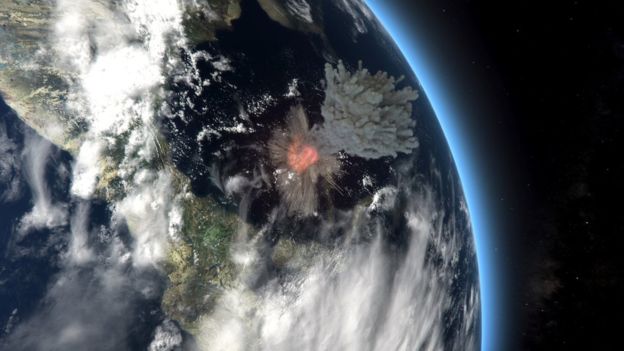
A study of boron isotopes in the tests of foraminifera that lived deep in the oceans and near their surface just after the K-Pg boundary event has revealed that ocean water suddenly became more acidic (Henehan, M.J. and 13 others 2019. Rapid ocean acidification and protracted Earth system recovery followed the end-Cretaceous Chicxulub impact. Proceedings of the National Academy of Sciences. Online; DOI: 10.1073/pnas.1905989116). Because the data came from marine sediment sequences exposed in Europe and North America and from ocean-floor cores beneath the Atlantic and Pacific Oceans, the acidification was global in scope. The sharp fall in pH, almost certainly due to massive release of sulphuric and carbonic acids from thick anhydrite and limestone beds beneath the Chicxulub impact site was instrumental in the collapse of marine ecosystems. A rebound to higher, more alkaline pH values (overshooting those of the preceding Late Cretaceous) was equally rapid. That is ascribed to the post-extinction dearth of marine organisms that take up calcium in their shells so that dissolved Ca became more abundant. Within less than 100 ka of the Chicxulub impact ocean pH had returned to its pre-impact levels. Since Deccan flood-basalt volcanism was active until long after, Henehan et al. consider that its influence on ocean acidification was minimal and that The Chicxulub impact ‘was key in driving end-Cretaceous mass extinction’.
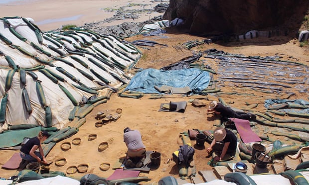
Records of marine fossils are both more abundant and continuous than are those of land-based organisms. That animal extinctions on the continents were dramatic has been clear for over a century. Entire classes, notably the dinosaurs (except for birds), as well as orders, families, genera and species disappear from the fossil record. The event more than decimated plant taxa too. How and at what pace the vacated ecological niches were reoccupied during the evolutionary radiation among what became modern fauna and flora remain poorly understood. For the first million years of post-impact time fossils of terrestrial and freshwater organisms are very rare. Well-dated sedimentary sequences are patchily distributed, and fossils preserved in them as rare as proverbial hen’s teeth, apart from a few, better endowed strata separated by thick, unproductive sediments. A Lower Palaeocene site near Denver in Colorado, USA extends for 27 km. At first sight it does not impress palaeontologists, but it carries concretions that yield rich hauls of tiny vertebrate fossils. Dating using U-Pb dating of interleaved volcanic ash layers, stratigraphy based on normal and reversed polarity of remanent magnetism, and plant pollen variations. The 250 m thick sedimentary unit can be divided into 150 levels that represent the first million years flowing the Chicxulub impact (Lyson, T.R. and 15 others 2019. Paleogene mass extinction -Exceptional continental record of biotic recovery after the Cretaceous. Science, online first release; DOI: 10.1126/science.aay2268.

The levels contain abundant remains of early Cenozoic mammals, particularly skulls that are vitally important in taxonomy and size estimation. During the last few hundred thousand years of the Cretaceous, mammals about the size of a modern racoon (~8 kg) were abundant. The oldest Palaeocene holds nothing bigger than a 600 g rat, and few of them. Then, remarkably, the numbers, diversity and mean body mass of mammals grow; raccoon-size back within 100 ka then, in a series of steps, beasts around 25, 35 and 45 kg emerged successively during the next 600 ka. Clearly, the local food chain had to support this growth in size as well as numbers. Pollen records reveal a terrain first dominated by ferns – not especially nutritious – then after 200 ka by palms and finally legumes (pulses) appear. The diversification of animals and plants changed in lockstep. Studies of fossil-leaf shapes (toothed = cooler; smooth = warmer) indicated a similarly triple-stepwise amelioration in climate from cool, post-impact to hot by 65 Ma ago. This climatic warming may have been connected to successive pulses of Deccan volcanism that drove up atmospheric CO2 levels. Geologically, that is pretty quick. In the context of a possible, equally rapid mass extinction as a result of anthropogenic factors, such a pace of recovery is hardly reassuring…