Ancient deep groundwater

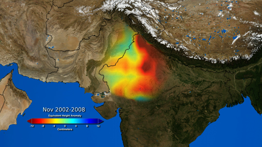
Worldwide, billions of people depend on groundwater for their water needs from wells, deep boreholes and natural springs. Even surface water in rivers and lakes is directly connected to that moving sluggishly below the surface. In fact the surface water level marks where the water table coincides with the land surface. From season to season the water table rises and falls and so too do river and lake levels, depending on fluctuations in rainfall, snow melt, evaporation and extraction. Where it is present, vegetation plays a role in the hydrological cycle, through transpiration from roots through stems and leaves, from which it is exhaled by minute pores or stomata; effectively plants are able to pump water through their tissues to a height of up to a hundred metres.  Groundwater, like that at the surface, moves under gravity roughly parallel to the slope of the land surface from the place where precipitation infiltrates soil and rock. But the deeper it is the slower the flow and the less it is in direct contact with surface processes to be replenished by infiltration. Wells and boreholes rarely penetrate deeper than a few hundred metres, so that the vast bulk of groundwater is never used. Indeed most deep groundwater would not be drinkable or suitable for irrigation since over millennia or longer it dissolves material from the rock that contains it to become saline. In some deep sedimentary aquifers it may actually be composed of seawater trapped at the time of sedimentation.

Damp conditions in the Mponeng gold mine near Johannesburg, South Africa, the world’s deepest at 3.8 km below the surface with planned expansion to 4.3 km (Credit: AngloGold Ashanti)

The pore spaces in sandstones and fractures in limestones, the most common aquifers, are not the only conduits for groundwater. Crystalline igneous and metamorphic rocks are generally full of minute fractures resulting from their tectonic history. The deepest mines in crystalline basement, such as the gold mines of the Johannesburg area in South Africa, penetrate almost 4 km below the surface, yet are by no means dry and have to be pumped to stave off flooding. The water is a brine containing sodium and calcium chloride with high concentrations of dissolved, reduced gases such as hydrogen, methane and ethane (C2H6). Studies of the proportions of oxygen isotopes in the water reveal that the water in the fractures is very different from that in modern rainwater: this fluid is completely isolated from the modern hydrological cycle and is very old indeed. Just how old has now been determined (Warr, O. et al. 2022. 86Kr excess and other noble gases identify a billion-year-old radiogenically-enriched groundwater system. Nature Communications v. 13, Article number 3768; DOI: 10.1038/s41467-022-31412-2).

Brine extracted from a borehole in the floor of the Moab Khotsong gold/uranium mine also contains the noble gases helium, neon, argon, krypton and xenon. Noble gases are present in today’s atmosphere, so conceivably they may have originally entered the brine in rain water that seeped along fractures. However, when their isotopes are measured their proportions are very different from those in air. There are excesses of 4He, 21Ne, 22Ne, 40Ar, 86Kr and several isotopes of Xe. These isotopes are emitted during the radioactive decay of uranium, thorium and 40K, the main heat producing isotopes in the crust and mantle. Oliver Warr of the University of Toronto Canada and geochemists from Oxford University UK, Princeton University and the New Mexico Institute of Mining and Technology US, and the Sorbonne France show that originally atmospheric noble gases have been enriched in these radiogenic isotopes. Their present isotopic proportions therefore give clues to the time when air dissolved in groundwater was trapped in the host rock more than a billion years ago. A complicating factor is that the host rocks themselves are dated at about three times that age. They suggest that the fractures systems were initiated by the Vredfort asteroid impact at 2.0 Ga to form aquifers, but they became isolated from hydrological circulation around 1.2 Ga and now now contain the world’s oldest groundwater.

One of the implications of the study is that such trapped water may be present at depth in the crust of Mars, despite its current aridity. Another is that, because the fluid contains hydrogen, sulfate ions and hydrocarbon gases, it can potentially support organisms that use them to power their metabolism and reproduce. In 2008 microbes were found living in similar ancient groundwater 2.4 km below the surface in the Kidd Creek Mine, Canada, at a level of around 5 thousand cells per millilitre (50 times less than in surface water). They are powered by reduction of sulfate ions to sulfide. In 2008 another peculiar discovery in the deep biosphere emerged from the Mponeng gold mine near Johannesburg, South African (the world’s deepest) in the form of a living sulfate reducing bacterium Desulforudis audaxviator. DNA  analysis of the ancient water revealed that it was the sole inhabitant, a biological mystery confirmed by later deep-biosphere studies in Death Valley, USA, and Siberia.

See also: Researchers uncover life’s power generators in the Earth’s oldest groundwaters, EurekaAlert, 5 July 2022; Mantle link with biosphere, July 2009

Indian groundwater shortage threatens food production

Farmers in India have been engaged in mass protests since September 2020. Their anger is directed at a series of laws introduced by the central government of Narendra Modi’s  Bharatiya Janata Party (BJP) that change farmers’ terms of trade. Agriculture in India also faces a future of reduced availability of groundwater on which farmers have become increasingly dependent, especially in the vast alluvial plains of the Ganges river system. The twin satellites of the Gravity Recovery  and Climate Experiment (GRACE), which chart changes in mass beneath the Earth’s surface, detected a major change in gravity over 3 million km2 of India’s largest area of agriculture in the northwestern Gangetic plains (Rodell, M. et al. 2009. Satellite-based estimates of groundwater depletion in India. Nature, v. 460, p.999-1002; DOI: 10.1038/nature08238). The data suggested a loss between 2002 and 2008 of around 109 cubic kilometres of water from the aquifers that support regional irrigation and the livelihoods of about 114 million people (see NASA summary). The loss of water and decline in well-water levels have continued since then.

Colour-coded GRACE data  from 2002 to 2008 showing the estimated drawdown in water levels in wells in NW India and NE Pakistan during this period. Green to dark-red colours indicate from 0 to 12 metres of decline (credit: Trent Schindler and Matt Rodell, NASA)

A recent comprehensive survey (Jain, M. and 8 others 2021. Groundwater depletion will reduce cropping intensity in India. Science Advances, v. 9, article eabd2849; DOI: 10.1126/sciadv.abd2849) uses satellite image and census data to document the actual changes in winter crops (those most dependent on irrigation) over the period 2001 to 2012. It roughly measures the realities of the unsustainable extraction of groundwater indicated by GRACE from 2002 to 2008. The study projects an average reduction of 20% in winter cropping across the whole of India, with some of the worst-hit areas being likely to experience a 68% loss. The dominant supplies of irrigation water are from countless tube wells and systems of canals supplied by dams or rivers. India has witnessed impressive gains in food production in the last half century, thanks to rapid and continuing growth in the number of tube wells driven by individual farmers. The livelihoods of about 600 million people depend on agriculture. There is no prospect of substituting either form of irrigation to maintain current levels of production. If increased canal supply was used to replace well water and reduce groundwater depletion, cropping intensity would still decline, albeit at about half the projected rate; however, that doesn’t take into account unpredictable droughts in surface water accumulation and movement.

Faced with this situation, it is hardly surprising that farmers fear for their families future and react massively to state intervention in their marketing and crop storage strategies.

For a wider context to the Indian agricultural crisis see also: The ecological roots of India’s farming crisis (Deutche Welle, 1 February, 2021)

Water-borne arsenic back in the news

In the 1980s grim news began to emerge from the Indian State of West Bengal and a decade later from neighbouring Bangladesh. Villagers from the low-lying delta plains of the Ganges and Brahmaputra river systems at the head of the Bay of Bengal began to present at clinics with disfiguring skin lesions or keratoses on hands and feet, loss of feeling in fingers and toes and dark skin patches on their torsos. The latter were colloquially known as ‘black rain’. The victims were often stigmatised, as their neighbours believed they were suffering from leprosy. These symptoms were followed a few years later by increased incidences of lung, liver, kidney and bladder cancers. The first medical practitioner to recognise these typical signs of chronic arsenic poisoning in 1983, Dr Depankar Chakraborti of Kolkata, was branded as a ‘panic monger’ by local authorities. His warnings, backed by evidence published by the World Health Organisation (WHO) in 1988 that there was a connection with high arsenic levels in West Bengal drinking water supplies from new tubewells, went largely unheeded for a decade. Tragically, as it turned out, thousands of tubewells had been sunk in the Bengali delta plains from the 1970s onwards, aimed at reducing the risk of disease from pathogens in the previously used surface water from ponds and streams. After a conference on the perceived problem, organized in Kolkata by Dr Chakraborti in 1995, the WHO declared the situation in Bangladesh to be a ‘Major Public Health Issue’, and the world’s press took up the story. Clearly, millions of Bengali villagers were at risk or were already suffering from chronic arsenic poisoning. By the late 1990s thousands of samples of tubewell waters from the delta plains had been analysed, many of which revealed arsenic levels far above the 10 μg l-1 safe threshold. In 2002, 400 Bangladeshi victims sued the British Geological Survey (BGS) for negligence. The BGS had analysed 150 water samples from the Bangladesh delta plains in 1992 and had not reported any risks, but arsenic was not among the elements being analysed. The civil action eventually failed.

Skin lesions or keratoses that are symptomatic of chronic arsenic poisoning

Almost two decades after the arsenic scandal on the eastern side of the subcontinent well-water analyses showing high arsenic values have been published from the Indus plains of Pakistan (Podorski, J.E. et al. 2017. Extensive arsenic contamination in high-pH unconfined aquifers in the Indus Valley. Science Advances, v. 3,; doi:10.1126/wsciadv.1700935). The Indus catchment having a similar Himalayan source and being at a similar latitude it has long been considered to be at potential risk from arsenic derived from its thick alluvial sediments. The Swiss-Pakistani-Chinese team have produced geochemical data from 1200 tubewells throughout the catchment within Pakistan. A swath from Lahore to Karachi, with the country’s greatest population density, is at high risk of water with arsenic concentrations above the WHO guideline safe concentration, suggesting some 50 to 60 million people being subject to its hazard.

Although the geological setting is similar to that in the Bengal plains, a different natural chemical process causes the high concentrations ultimately from the iron hydroxide veneer on sediment grains which selectively absorbs several trace elements, including arsenic, from river water. In Bangladesh arsenic is released from sediments as a result of highly reducing conditions due to organic matter buried in some layers of alluvium, by a process known as reductive dissolution – when insoluble ferric iron (Fe3+) hydroxide (goethite) is exposed to a ready supply of electrons the iron is reduced to the soluble ferrous (Fe2+) form and the mineral breaks down to release its absorbed trace elements. Most of the alluvium in the Indus plain contains little organic carbon, so another mechanism is implicated. The high arsenic levels correlate with high pH in the groundwater and therefore seem most likely to be released from goethite grain coatings by alkaline water. That, in turn, is often a product of high evaporation and salinisation from the massive irrigation using groundwater in semi-arid southern Pakistan. The alkaline water then returns to the underlying groundwater in the highly permeable Indus alluvium; i.e. it is a consequence of irrigated agriculture rather than of a natural geochemical process as in more humid Bengal.

Whereas a remedy in Bangladesh and West Bengal has been to sink new tubewells into oxidising alluvial strata (red coloured rather than the reducing grey sediments)  that yield water with safe arsenic levels, the risky areas in Pakistan may need expensive use of absorbent filters on a large scale to remove the hazard. Because irrigation using groundwater is on such a large scale on the Indus plain there is also a definite risk of ingesting arsenic from crops produced there, principally rice but also unwashed leaf vegetables

See also:

http://www.bbc.co.uk/news/science-environment-41002005

http://www.sciencemag.org/news/2017/08/arsenic-drinking-water-threatens-60-million-pakistan

http://www.dawn.com/news/1353482/50-million-at-risk-of-arsenic-poisoning-in-pakistan?preview

https://www.dawn.com/news/1354023

Fresh offshore groundwater resources

There are paradoxes with groundwater: while over-use of coastal aquifers may draw in seawater to become undrinkable, on reef islands with no surface water adequate supplies may be had from fresh groundwater ‘floating’ on deeper, denser salt water. Seemingly even more odd, there are places several kilometres off some coastlines where freshwater rises in large volumes to the surface from springs on the sea floor.

Despite this and the fact that onshore aquifers extend far out to sea on continental shelves, hydrogeologists have paid scant attention to the potential water supplies that they might offer. Indeed, around the Persian Gulf where many submarine fresh springs are known petrodollars have poured into desalination rather than cheaper drilling and pipelines to the aquifers feeding the springs.

Reviewing the known potential of offshore groundwater, which occurs seawards of most continental shores, Vincent Post of Flinders University, Australia and colleagues from Holland, the US and Britain, consider that the global potential might be as high as half a million cubic kilometres (Post, V.E.A. et al. 2013. Offshore fresh groundwater reserves as a global phenomenon. Nature , v. 504, p. 71-78), around one tenth that of shallow (<750 m deep) groundwater onshore . It should be noted that the maximum safe level of salts dissolved in drinking water is about 1 gram per litre, and double that for irrigation water. The best prospects are where aquifers are trapped beneath impermeable sedimentary layers that prevent downward contamination by salt water.

The key to explaining such huge reserves is dating the water. In those places where that has been done the water is older than the Holocene (i.e. > 11 ka), which suggests infiltration when sea level was as much as 130 m lower than in interglacial periods, due to storage of evaporated seawater in major ice sheets. That would have exposed vast areas of what is now the sea floor to recharge. Modelling downward diffusion of seawater as sea level rose suggests that interglacials have too short to fully flush fresh water from the now submarine aquifers. Nevertheless, recharge is not continual, so that exploiting the resource is akin to ‘mining’ water. Yet the potential may prove essential in some coastal regions, and the authors caution against contamination by human activities offshore, such as exploration drilling for petroleum and carbon dioxide sequestration.

The review points out that submarine hydrogeology is one of the last great challenges in analysis of sedimentary basins.

Estimating arsenic risks in China

Two weeks after Earth pages featured arsenic in groundwater below the Mekong Delta another important paper has emerged about modelling risk of arsenic contamination throughout the People’s Republic of China (Rodriguez-Lado, L. et al. 2013. Groundwater arsenic contamination throughout China. Science, v. 341, p. 866-868). Scientists based in the Swiss Federal Institute of Aquatic Science and technology and the China Medical University follow up the results of geochemical testing of groundwater from almost 450 thousand wells in 12% of China’s counties; part of a nationwide aim to test millions of wells. That is a programme likely to last for decades, and their work seeks to develop a predictive model that might better focus such an enormous effort and help in other large regions where well sampling is not so advanced.

As well as the well-known release of arsenic-containing ions through the dissolution of iron oxy-hydroxides in aquifers that exhibit reducing conditions, aridity that causes surface evaporation can create alkaline conditions in groundwater that also desorbs arsenic from similar minerals. The early results from China suggested 16 environmental  factors available in digital map form, mainly geological, topographic and hydrogeochemical, that possibly encourage contamination; a clear indication of the sheer complexity of the problem.  Using GIS techniques these possible proxies were narrowed down to 8 that show significant correlation with arsenic levels above the WHO suggested maximum tolerable concentration of 10 micrograms per litre (10 parts per billion by volume). Geology (Holocene sediments are most likely sources), the texture of soils and their salinity, the potential wetness of soils predicted from topography and the density of surface streams carrying arsenic correlate positively with high well-water contamination, whereas slope, distance from streams and gravity (a measure of depth of sedimentary basins) show a negative correlation. These parameters form the basis for the predictive model and more than 2500 new arsenic measurements were used to validate the results of the analysis.

Estimated probability of arsenic in Chinese groundwater above the WHO acceptable maximum concentration (Credit:Rodriguez-Lado, et al. 2013)

The results graphically highlight possible high risk areas, mainly in the northern Chinese provinces that are partly confirmed by the validation. Using estimated variations in population density across the country the team discovered that as many as 19.6 million people may be affected by consumption of arsenic contaminated water. In fact if groundwater is used for irrigation, arsenic may also be ingested with locally grown food. It seems that the vast majority of Chinese people live outside the areas of risk, so that mitigating risk is likely to be more manageable that it is in Bangladesh and West Bengal.

As well as being an important input to environmental health management in the PRC the approach is appropriate for other large areas where direct water monitoring is less organised, such as Mongolia, Kazakhstan and Kyrgyzstan in central Asia, and in the arid regions of South America.

Global groundwater depth

The single most vital resource for human survival is clean, fresh drinking water. For a large proportion of the world’s population that right is not guaranteed, with harrowing consequences especially for children under 5-years old. Without careful processing surface water can only rarely be assumed fit to drink, especially in areas with dense populations of people, livestock or wildlife. Groundwater, on the other hand, has generally passed through aerated upper soil layers before it ended up below the water table in an aquifer. In that passage it is filtered and subject to various oxidising processes, both chemical and organic, that renders it a great deal more free of pathogens than standing or running surface water. Remarkably, a common mineral in any oxidised soil horizon is goethite, an iron hydroxide, which is capable of adsorbing a variety of potentially damaging ions.  So, of all fresh water that stored beneath the surface is the safest for people to drink.

By its very nature groundwater is hidden and requires both geological exploration and the drilling or digging of wells before it can become a resource. Areas underlain by simple stratiform sediments or lava flows present far less of a challenge than do geological settings with complex structures or that are dominated by ancient crystalline basement rocks. Time and again, however, crises in water supply arise from drought or sudden displacements of  populations a great deal faster than the pace of groundwater exploration or development needed to cope with shortages. Were the potential for subsurface supplies known beforehand relief would be both quicker and more effective than it is at present.

Image of simulated depth to water table for Africa (Courtesy of Y. Fan, Rutgers University, USA)

Thanks to three geoscientists from Rutgers University, USA and the University of Santiago de Compostela, Spain, (Fan, Y et al. 2013. Global patterns of groundwater table depth. Science, v. 339, p. 940-943) a start has been made in quantifying the availability of groundwater worldwide. They have modelled how the likely depth of the water table may vary beneath the inhabited continents. As a first input they digitised over 1.5 million published records of water table depths. Of course, that left huge gaps, even in economically highly developed areas. There is also bias in hydrogeological data towards shallow depths as most human settlements are above easily accessible groundwater.

To fill in the gaps and assess the deeper reaches of groundwater Fan et al. adapted an existing model that assumes groundwater depth to be forced by climate, topography and ultimately by sea-level. It is based on algorithms that predict groundwater flow after its infiltration from the surface. Such an approach leaves out drawdown by human interference and is at a spatial resolution that removes local complexities. The influence of terrain relies on the near-global elevation data acquired by NASA’s Shuttle Radar Topography Mission (SRTM) in February 2000, resampled to approximately 1 km spatial resolution, supplemented by the less accurate Japan/US ASTER GDEM produced photogrammetrically from stereo- image pairs. Other input data are assumptions about variation in hydraulic conductivity, which is reduced to a steady decrease with depth, models of infiltration from the surface based on global rainfall and evapotranspiration patterns and those of surface drainage and slopes. No attempt was made to input geological information

The results have been adjusted using actual water-table depths as a means of calibration across climate zones on all inhabited continents. The article itself is not accessible without a Science subscription, but the supplementary materials that detail how the work was done are available to the public, and include remarkably detailed maps of simulated water table depths for all continents except Antarctica.  The detail is much influenced by terrain to create textures that override climate, which might suggests that the results flatter to deceive. Yet the modelling does result in valleys and broad basins of unconsolidated sediment showing shallower depths that tallies with the tendency for less infiltration where slopes are steep and run-off faster. The fact that the degree of fit between model and known hydrogeology is high does suggest that at the regional scale the maps are very useful points of departure for more detailed work that brings in lithological and structural information.

Groundwater in Africa

English: Mwamanongu Village water source, Tanz...
Drinking water for many rural Africans often comes from open holes dug in the sand of dry riverbeds, and it is invariably contaminated. (Bob Metcalf on Wikipedia)

Sub-surface water supplies have rarely, if ever, figured in Earth Pages except in passing or in relation to the on-going crisis of arsenic pollution in drinking-water supplies. That is largely because of the paucity of groundwater publications that have a general interest. So it was welcome news to learn that hydrogeologists of the British Geological Survey and University College London have produced a continent-wide review of groundwater prospects for Africa, probably in most need of good news about water supplies (MacDonald, A.M. et al. 2012. Quantitative maps of groundwater in Africa. Environmental Research Letters, v. 7 doi:10.1088/1748-9326/7/2/024009. They used existing hydrogeological maps, publications and other publically available data to estimate total groundwater storage in a variety of aquifer types and the yield potentials of boreholes. Details can be seen at http://www.bgs.ac.uk/research/groundwater/international/africanGroundwater/maps.html

Dominated by the vast sedimentary aquifers of Libya, Algeria, Egypt and Sudan, such as the Nubian Sandstone, around 0.66 million km3 may lie below the continental surface: more than 100 times the annually renewable freshwater resources, including the flows in  three of the world’s largest rivers, the Nile, Congo and Niger. Though only a fraction of this subsurface potential may be available for extraction through wells, the arithmetic, or rather the statistics, suggest that small diameter boreholes and simple handpumps, as well as traditional wells, can sustainably satisfy the drinking water needs of the bulk of Africa’s rural populations with yields of individual wells between 0.1 to 1 l s-1. However, groundwater use in irrigation and for large urban supplies demands well productivities an order of magnitude higher from thick sedimentary sequences, which rarely coincide in Africa with areas suitable for large-scale agriculture or existing cities and large towns. Both the humid tropical lowlands with thick unconsolidated sediments and the deep sedimentary rock aquifers beneath the Sahara and other arid areas match great groundwater potential with either little need for groundwater or virtually no potential for agricultural development and very few people. Moreover, the truly vast reserves of North Africa that are an order of magnitude or more greater than in any other countries are at such depths and so remote that development needs commensurately huge investment, in the manner of oil-rich Libya’s Great Man Made River Project projected at more than US$25 billion investment. To say that reserves, convenience and yields are inequitably distributed in Africa would understate the hydrogeological difficulties of the continent.

Average well productivity predicted by MacDonald et al from Africa’s regional geology

Much of Africa has crystalline basement at the surface that has useful yields (>0.1  l s-1) only when deeply weathered, and even then rarely yields better than 1 l s1. An exception to this general rule is where basement has been shattered by large faults and fractures. Sedimentary cover is generally thin across the continent and with highly variable yield potential. The other issue is that of sustainability, for if extraction rates exceed those of recharge then groundwater effectively becomes a non-renewable resource. About half of the African surface, mainly in its western equatorial region, has sufficient rainfall and infiltration potential to outpace universally high evapotranspiration to give recharge rates of more than 2.5 cm of annual rainfall. For all the areas repeatedly hit by drought and famine, average recharge through the surface that escapes being literally blown away on the wind is less than half a centimetre.

To have synopses of all the important issues surrounding African groundwater – the best choice for safe domestic supplies in hot, poor areas – would seem to be very useful to those engaged in development and relief strategies; i.e. to governments, the UN ‘family’ and World Bank. But there are important caveats. An obvious one is the antiquity of many of the surveys drawn on by MacDonald et al. Some 23 out of 33 were published more than 20 years ago using data that may be a great deal older: such has been the snail-like pace of publication by all geological surveys, including BGS. That is compounded by the small scale of the maps (mainly smaller than 1:1 million) and the extremely sparse geophysical data concerning subsurface geology across most of Africa. ‘Quantitative’ is not the adjective to use here, for unlike in most of the developed world, groundwater reserves and locations in Africa have not been measured, but estimated from pretty meagre data. In fact to be brutally realistic, most of the source maps are based on educated guesswork by a few hard-pressed geoscientists once personally responsible for areas that would cripple most of their colleagues working in say Europe or North America.

If there is a truism about water exploration in Africa, outside the well-watered parts, it is this: sink a well at random, and it will probably be dry. The stats may well be encouraging, as MacDonald et al. clearly believe, but finding useful groundwater supplies relies on a great deal more. Outside cities, people survive as regards groundwater often as a result of traditional means of water exploration and well digging: they or at least some locals are experts at locating shallow sources. Yet to improve their access to decent water in the face of both rising populations and climate change demands sophisticated exploration techniques based on geological knowledge. Most important is to ensure supplies to existing communities, whose locations do not necessarily match deeper groundwater availability, bearing in mind that a universal problem for most African villagers is the sheer distance to wells with safe water. Rigs used to drill tube wells are expensive to hire, so the likelihood of success needs to be maximised. In the absence of large-scale (1:50 000) geological maps – rarities throughout Africa – only skilled hydrogeological interpretation of aerial or satellite images followed-up by geophysical ground traverses offer that vital confidence.

Geologically useful ASTER image of the Danakil Block in Eritrea/Ethiopia, showing Mesozoic and Recent sedimentary aquifers and crystalline basement (Steve Drury)

In fact, thanks to the joint US-Japan ASTER system carried in sun-synchronous orbit, geologically-oriented image data are available for the whole continent. Interpretation requires some skills but few if any beyond learning in a practical, field setting. Indeed, the African surface in its arid to semi-arid parts, most at risk of drought and famine, lends itself to rapid hydrogeological reconnaissance mapping using ASTER data. Given on-line training in image interpretation, a ‘crowd-source’ approach coordinating many interpreters could complete a truly life-giving and easily available map base for local people to focus their own well-construction programmes.

South Asian arsenic update

Skin lesions from arsenic poisoning in Bangladesh
The first signs of chronic arsenic poisoning: skin keratoses. Image by waterdotorg via Flickr

That groundwater in West Bengal, India was polluted with arsenic to such levels that symptoms of poisoning had become endemic was reported by Depankar Chakraborti in 1983, leading to his being branded a ‘panic monger’ by the Indian authorities. The news broke internationally in 1993 as the now infamous tragedy in neighbouring Bangladesh emerged. Means of mitigating the effects – lesions or keratoses and skin discoloration, and later increases in incidence of several forms of cancer – and ideas of how the pollution had occurred had to await proper geochemical analyses of well waters and logging of the mainly alluvial sediments from which water was being withdrawn; another 8 years went by. Reports of arsenicosis began to emerge from other areas of alluvial sediments in SE Asia, revealing by far the worst mass poisoning in history and the likelihood that the lives of millions would be blighted by what Bangladeshis dubbed ‘the Black  Rain’ from the resemblance of the characteristic skin lesions to drops of black water.

Thanks principally to the work of water engineer Peter Ravenscroft with other geochemists, the source of arsenic in groundwater was narrowed down to the effect of reducing conditions in grey, carbonaceous sandstones and peats on the mineral goethite, an iron oxy-hydroxide that forms the main colorant in oxidised sediments and whose loose structure normally encourages the mopping-up by surface adsorption of a wide spectrum of dissolved ions, including those of arsenic. Goethite readily breaks down under reducing conditions, and when that happens all the adsorbed material is released into solution. The upper parts of the alluvial and deltaic sediments in the lower reaches of the Ganges and Brahmaputra rivers contain abundant organic remains picked up when vegetation burgeoned during the Holocene, which mixed with goethite-coated sand grains derived from erosion in the Himalayan stretches of the rivers. Purely natural sedimentary and hydrogeological processes created the dreadful plight of villagers. The terrible irony was that before the 1980s there were no signs of arsenicosis, yet mortality, especially of under-fives, was very high due to water-borne pathogens in surface water supplies. Indian and Bangladeshi authorities and UN agencies waged a campaign to sink shallow wells for drinking water rather than relying on river and pond supplies. At first rural people resisted the change since they regarded water from wells as the ‘Devil’s water’, but as infant mortality began to fall, the resistance turned to rapid construction nationwide of wells, both public and private. A few years later came the ‘Black Rain’.

In the attempts to mitigate the arsenicosis plague, filters containing adsorptive materials, including goethite, were installed on pumps. However, the geochemists showed that in the deeper wells there were consistently low concentrations of arsenic in sediments that were brown-coloured due to prevailing oxidising conditions and the presence of goethite. Although arsenic was present in the sediments it was safely locked in the goethite coatings of sand grains. Steadily major public supplies were transferred to deep, high-yield wells. Alluvial and deltaic deposits are generally highly permeable, so it was feared that as the deeper wells were pumped arsenic-rich water from the reduced shallow sediments would replace the safe groundwater. Thankfully, it seems that is not likely to be a problem (Radloff, K.A. and 12 others 2011. Arsenic migration to deep groundwater in Bangladesh influenced by adsorption and water demand. Nature Geoscience, v. 4, p. 793-798). The study injected As-bearing groundwater into a deep aquifer and monitored its arsenic concentration over time, once in place. Within a day, the concentration of dissolved arsenic fell by 70% and by 5 days had fallen below recommended maximum levels for drinking water; a dramatic demonstration of the clean-up power of even minute films of goethite in sediments, for that seems the only explanation for the fall. The US-Bangladeshi team verified this by testing samples of the deeper sediments from drill cuttings. They mixed highly contaminated groundwater with the cuttings, to find that arsenic sorption over  about a week was extremely high (~40mg kg-1).

Water well in Bangladesh. From http://www.flickr.com/photos/waterdotorg/3696304044

Rather than just publishing their reassuring findings, the team input them to hydrogeological models of the Bengal Basin, varying hypothetical pumping rates to assess the changes in deep-groundwater chemistry over time due to downward migration of the highly polluted near-surface waters. Sure enough, the As-rich waters would end up in the deep aquifer eventually to overwhelm the sorptive capacity of its goethite content; arsenic would once again enter well supplies. However, if deep extraction was limited to drinking water by limiting pumping for irrigation to intermediate depths, safe limits could be sustained theoretically for a thousand years or more, except in some areas especially prone downward intrusion of polluted shallow groundwater. (Use of highly contaminated shallow groundwater for irrigation would simply transfer the problem to crops.) Clearly, monitoring is obligatory, but one hopes this important study does resolve the horrifying plight faced by so many people in catchments fed by Himalayan waters.