Gravity survey reveals signs of Archaean tectonics in Canadian Shield

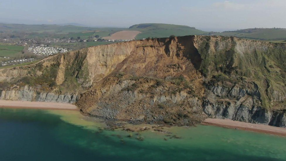
Much of the Archaean Eon is represented by cratons, which occur at the core of continental parts of tectonic plates. Having low geothermal heat flow they are the most rigid parts of the continental crust.  The Superior Craton is an area that makes up much of the eastern part of the Canadian Shield, and formed during the Late Archaean from ~4.3 to 2.6 billion years (Ga) ago. Covering an area in excess of 1.5 million km2, it is the world’s largest craton. One of its most intensely studied components is the Abitibi Terrane, which hosts many mines. A granite-greenstone terrain, it consists of volcano-sedimentary supracrustal rocks in several typically linear greenstone belts separated by areas of mainly intrusive granitic bodies. Many Archaean terrains show much the same ‘stripey’ aspect on the grand scale. Greenstone belts are dominated by metamorphosed basaltic volcanic rock, together with lesser proportions of ultramafic lavas and intrusions, and overlying metasedimentary rocks, also of Archaean age. Various hypotheses have been suggested for the formation of granite-greenstone terrains, the latest turning to a process of ‘sagduction’. However the relative flat nature of cratonic areas tells geologists little about their deeper parts. They tend to have resisted large-scale later deformation by their very nature, so none have been tilted or wholly obducted onto other such stable crustal masses during later collisional tectonic processes. Geophysics does offer insights however, using seismic profiling, geomagnetic and gravity surveys.

The Geological Survey of Canada has produced masses of geophysical data as a means of coping with the vast size and logistical challenges of the Canadian Shield. Recently five Canadian geoscientists have used gravity data from the Canadian Geodetic Survey to model the deep crust beneath the huge Abitibi granite-greenstone terrain, specifically addressing variations in its density in three dimensions. They also used cross sections produced by seismic reflection and refraction data along 2-D survey lines (Galley, C. et al. 2025. Archean rifts and triple-junctions revealed by gravity modeling of the southern Superior Craton. Nature Communications, v. 16, article 8872; DOI: 10.1038/s41467-025-63931-z). The group found that entirely new insights emerge from the variation in crustal density down to its base at the Moho (Mohorovičić discontinuity). These data show large linear bulges in the Moho separated by broad zones of thicker crust.

Geology of the Abitibi Terrane (upper),; Depth to the Moho beneath the Abitibi Terrane with rifts and VMS deposits superimposed (lower). Credit: After Galley et al. Figs 1 and 5.

Galley et al. suggest that the zones are former sites of lithospheric extensional tectonics and crustal thinning: rifts from which ultramafic to mafic magmas emerged. They consider them to be akin to modern mid-ocean and continental rifts. Most of the rifts roughly parallel the trend of the greenstone belts and the large, long-lived faults that run west to east across the Abitibi Terrain. This suggests that rifts formed under the more ductile lithospheric condition of the Neoarchaean set the gross fabric of the granites and greenstones. Moreover, there are signs of two triple junctions where three rifts converge: fundamental features of modern plate tectonics. However, both rifts and junctions are on a smaller scale than those active at present. The rift patterns suggest plate tectonics in miniature, perhaps indicative of more vigorous mantle convection during the Archaean Eon.

There is an interesting spin-off. The Abitibi Terrane is rich in a variety of mineral resources, especially volcanic massive-sulfide deposits (VMS). Most of them are associated with the suggested rift zones. Such deposits form through sea-floor hydrothermal processes, which Archaean rifting and triple junctions would have focused to generate clusters of ‘black smokers’ precipitating large amounts of metal sulfides. Galley et al’s work is set to be applied to other large cratons, including those that formed earlier in the Archaean: the Pilbara and Kaapvaal cratons of Australia and South Africa. That could yield better insights into earlier tectonic processes and test some of the hypotheses proposed for them

See also: Archaean Rifts, Triple Junctions Mapped via Gravity Modeling. Scienmag, 6 October 2025

 Using lasers to map landslide risk

As radar stands for radio detection and ranging, so lidar signifies light detection and ranging. In one respect the two are related: they are both active means of remote sensing and illuminate the surface, rather than passively monitoring solar radiation reflected from the surface or thermal radiation emitted by it. The theory and practice of imaging radar that beams microwaves at a surface and analyses the returning radiation are fiendishly complex. For a start microwave beams are directed at an angle towards the surface. Lidar is far simpler being based on an aircraft -mounted laser that sends pulses vertically downwards and records the time taken for them to be reflected from the surface back to the aircraft. The method measures the distance from aircraft to the ground surface and thus its topographic elevation. Lidar transmits about 100 thousand pulses per, so the resulting digital elevation model has remarkably good spatial resolution (down to 25 cm) and can measure surface elevation to the nearest centimetre. The technique is becoming popular: the whole of England and much of the nations of Scotland, Wales and Northern Ireland now have lidar coverage with 1 metre resolution.

The first thing the laser pulses encounter is the vegetation canopy, from which some are reflected back to the instrument. Others penetrate gaps in the canopy, to be reflected by the ground surface, so they take slightly longer to return. If the penetrating pulses are digitally separated from those reflected by vegetation, they directly map the elevation of the solid ground surface or the terrain. These data produce a  digital terrain model (DTM) whereas the more quickly returning pulses map the height and structure of the ground cover, if there is any. Both products are useful, the first to map topographic and geological features, the details of which are hidden to conventional remote sensing, the second to assess vegetation. The great advantage of a DTM is that image processing software can simulate illumination and shading of the terrain from different directions and angles to improve interpretation. Aerial photography has but a single direction and angle of solar illumination, depending on the time of day, the season and the area’s latitude. Stereoscopic viewing of overlapping photographic images does yield topographic elevation, and photogrammetric analysis produces a digital elevation model, but its usefulness is often compromised  by ground cover in vegetated terrain and by shadows. Also its vertical resolution is rarely better than 1 m. Another factor that limits terrain analysis using aerial photographs and digital images from satellites is the ‘patchwork-quilt’ appearance of farmed land that results from sharp boundaries between fields that contain different crops, bare ploughed soil and grassland. Together with spatial variation of natural vegetation, both ‘camouflage’ physical features of the landscape.

A cliff collapse in July 2023 at Seatown, Dorset England

In the field, areas of what is known as ‘mass wasting’, such as landslides, landslips, rockfalls, debris flows and solifluction, show topographic features that are characteristic of the processes involved.  They can be mapped by careful geological surveys. But are overlooked, being masked by vegetation cover such as woodland or because slower downslope movement of soil has smoothed out their original landforms. Potentially devastating mass wasting is encouraged by increased moisture content of soils and rocks that lie beneath steep slopes. Moisture provides lubrication that gravitational forces can exploit to result in sudden disruption of slopes and the movement of huge masses of Earth materials. Large areas of upland Britain show evidence of having experienced such mass wasting in the past. Some continue to move, such as that in the Derbyshire Peak District on the slopes of Mam Tor, as do cases on rugged parts of Britain’s coast where underlying rocks are weak and coastal erosion is intense (see image above).

It is thought that many of the mass-wasting features in Britain were initiated at the start of the Holocene. Prior to that, during the Younger Dryas cooling event, near-surface Earth materials were gripped solid by permafrost. Sudden warming at about 11.7 ka ago melted deeply frozen ground to create ideal conditions for mass wasting. In the last eleven thousand years the surface has come to a more or less stable gravitational balance. Yet heavy, sustained rainfall may reactivate some of the structures or trigger new ones. The likelihood of increased annual rainfall as the climate warms will undoubtedly increase the risk of more and larger instances of mass wasting. Indeed such an acceleration is happening now.

The most risky places are those with a history of landslides etc. So detailed mapping of such risk-prone ground is clearly needed. The UK has a large number of sites where mass wasting has been recorded, and below are lidar images of three of the most spectacular. Undoubtedly, there are other areas where no recent movements have been recorded, but which may ‘go off’ under changed climatic conditions. One of the best documented risky areas is in the English West Midlands within the new city of Telford. It follows the flanks of the River Severn as it passes through the Ironbridge Gorge that was cut by subglacial meltwater after the last glacial maximum. This area is also recognised as having been the birthplace of the Industrial Revolution. In 1714 Abraham Darby pioneered the use of coke in iron smelting and mass production of cast iron at Coalbrookdale a few kilometres to the east. The Severn also powered numerous forges and other heavy industries in the 18th and 19th centuries.  Industrial activity and townships in the Gorge have been plagued by large-scale mass wasting throughout subsequent history and no doubt long before. An excellent illustrated guide to the area has been produced by the Shropshire Geological Society (Rayner, C. et al. 2007. A Geological Trail through the landslides of Ironbridge Gorge, Proceedings of the Shropshire Geological Society, v. 12, p. 39-52; ISSN 1750-8568)

Lidar DTM illuminated from the west for the Severn Gorge near Ironbridge, Telford, Shropshire, UK. Lips of four major landslides shown by ‘No Entry’ signs. Initiated at the beginning of the Holocene, they continue to be active to this day, the southernmost slide having obliterated a tile factory and workers’ dwellings at Jackfield in 1952
Lidar DTM illuminated from the NW for the Alport Valley in the Peak District of North Derbyshire, UK. This includes the largest landslide complex in England, known as Alport Castles from the huge displaced sandstone blocks in the area of mass wasting.
An active landslide near Castleton, Derbyshire, UK. Note the defences of an Iron Age hillfort on Mam Tor that have been cut as the head of the landslide retreated westwards, as have medieval field walls. The relics of a major road that has been repeatedly disrupted and then destroyed following decades of maintenance can also be seen in the debris flow: it was abandoned in the 1970s.

Water in unexpected places. 1: Atmosphere

As a liquid, solid or in gaseous form water is everywhere in the human environment: even in the driest deserts it rains at some time and they may become tangibly humid. Water vapour moves most quickly in the atmosphere because of continual circulation. But 99% of all the Earth’s gaseous water resides in the lowest part, the troposphere. In that layer temperature decreases upwards to around -70°C, reflected by the lapse rate, so that water vapour condenses out as liquid or ice at low altitudes in the tangible form of clouds. So as altitude increases the air becomes increasingly cold and dry until it reaches what is termed the tropopause, the boundary between the troposphere and the stratosphere. This lies at altitudes between 6 km at the poles and 18 km in the tropics. Higher still, counter intuitively, the stratospheric air temperature rises. This is due to the production of ozone (O3) as oxygen (O2) interacts with UV radiation. Ozone absorbs UV thereby heating the thin stratospheric air. The tropopause is therefore an efficient ‘cold trap’ for water vapour, thereby preventing Earth from losing its surface water. Any that does pass through rises to the outer stratosphere where solar radiation dissociates it into oxygen and hydrogen, the latter escaping to space. So for most of the time the stratosphere is effectively free of water.

57 km high eruption plume and surrounding shock wave of Hunga Tonga-Hunga Ha’apai volcano one hour after explosion began on 15 January 2022: from the Himawari-8 satellite. The image is about 350 km across. Islands in red, the main island of Tonga being slightly to the south of the centre.

On 14 to 15 January 2022 the formerly shallow submarine Hunga Tonga-Hunga Ha’apai volcano in the Tonga archipelago of the South Pacific underwent an enormous explosive eruption (see an animation of the event captured by the Japanese weather satellite Himawari-8). The explosion was the largest in the atmosphere ever recorded by modern instruments, dwarfing even nuclear bomb tests, and the most powerful witnessed since that of Krakatoa in 1883. But, as regards global media coverage, it was a one-trick pony, trending for only a few days. It did launch tsunami waves that spanned the whole of the Pacific Ocean, but resulted in only 6 fatalities and 19 people injured. However, Hunga Tonga-Hunga Ha’apai managed to punch through the tropopause and in doing so, it changed the chemistry and dynamics of the stratosphere during the following year. A group of researchers from Harvard University and the University of Maryland used data from NASA’s Aura satellite to investigate changes in stratigraphic chemistry after the eruption (Wilmouth, D.M. et al. 2023. Impact of the Hunga Tonga volcanic eruption on stratospheric composition. Proceedings of the National Academy of Sciences, v. 120, article e23019941; DOI: 10.1073/pnas.2301994120). The Microwave Limb Sounder (MLS) carried by Aura measures thermal radiation emitted in the microwave region from the edge of the atmosphere, as revealed by Earth’s limb – seen at the horizon from a satellite. Microwave spectra from 0.12 to 2.5 mm in wavelength enable the concentrations of a variety of gases present in the atmosphere to be estimated along with temperature and pressure over a range of altitudes.

The team used MLS data for the months of February, April, September and December following the eruption to investigate its effects on the stratosphere n from 30°N to the South Pole. These data were compared with the averages over the previous 17 years. What emerged was a highly anomalous increase in the amount of water vapour between 0 and 30°S (the latitude band that includes the volcano) beginning in February 2022 and persisting until December 2023, the last dates of measurements. By April the peak showed up and persisted north of the Equator and at mid latitudes of the Southern Hemisphere and by December over Antarctica. It may well be present still. The estimated mass of water vapour that the eruption jetted into the stratosphere was of the order of 145 million tons along with about 0.4 million tons of SO2, the excess water helping accelerate the formation of highly reflective sulfate aerosols. Associated chemical changes were decreases in ozone (~ -14%) and HCl (~ -22%) and increases in ClO (>100%) and HNO3 (43%). Hunga Tonga-Hunga Ha’apai therefore changed the stratosphere’s chemistry and a variety of chemical reactions. As regards the resulting physical changes, extra water vapour together with additional sulfate aerosols should have had a cooling effect, leading to changes in its circulation with associated decrease in ozone in the Southern Hemisphere and increased ozone in the tropics. Up to now, the research has not attempted to match the chemical changes with climatic variations. The smaller 15 June 1991 eruption of Mount Pinatubo on the Philippine island of Luzon predated the possibility of detailed analysis of its chemical effects on the stratosphere. Nevertheless the material that is injected above the tropopause resulted in a global ‘volcanic winter’, and a ‘summer that wasn’t’ in the following year. The amount of sunlight reaching the surface fell by up to 10%, giving a 0.4 decrease in global mean temperature. Yet there seem to have been no media stories about such climate disruption in the aftermath of Hunga Tonga-Hunga Ha’apai. That is possibly because the most likely effect is a pulse of global warming in the midst of general alarm about greenhouse emissions, the climatically disruptive effect of the 2023 El Niño and record Northern Hemisphere temperature highs in the summer of 2023. Volcanic effects may be hidden in the welter of worrying data about anthropogenic global climate change.   David Wilmouth and colleagues hope to follow through with data from 2023 and beyond to track the movement of the anomalies, which are expected to persist for several more years. Their research is the first of its kind, so quite what its significance will be is hard to judge.

Monitoring ground motions with satellite radar

By using artificially generated microwaves to illuminate the Earth’s surface it is possible to create images. The technology and the theory behind this radar imaging are formidable. After about 30 years of development using aircraft-mounted transmission and reception antennas, the first high resolution images from space were produced in the late 1970s. Successive experiments improved and expanded the techniques, and for the last decade radar surveillance has been routine from a number of orbiting platforms. Radar has two advantages over optical remote sensing: being an active system it can be done equally effectively day or night; it also penetrates cloud cover, which is almost completely transparent to microwaves with wavelengths between a centimetre and a metre. The images are very different from those produced by visible or infrared radiation, the energy returns from the surface being controlled by topography and the roughness of the surface. One of many complicating factors is that images can only be produced by oblique illumination.  That, together with deployment of widely separated transmission and reception antennas, opens up the possibility of extracting very-high precision (millimetre) measurements of topographic elevation.

In 1992 radar data from two overpasses of the European ERS-1 satellite over California were processed to capture interference due to changes in the ground elevation during the time between the two orbits: the first interferometric radar or InSAR. It revealed the regional ground motions that resulted from the magnitude 7.3 Landers earthquake at 4:57 am local time on June 28, 1992. For the last decade InSAR has become a routine tool to monitor globally both lateral and vertical ground movements, whether rapid, as in earthquakes, or slow in the case of continental plate motions, subsidence or the inflation of volcanoes prior to eruptions. Juliet Biggs and Tim Wright, respectively of the Universities of Bristol and Leeds, UK, have summarised InSAR’s potential (Biggs, J. & Wright, T.J. 2020. How satellite InSAR has grown from opportunistic science to routine monitoring over the last decade. Nature Communications, v. 11, p. 1-4; DOI: 10.1038/s41467-020-17587-6).

Ground motions associated with the 2016 Kaiköuea earthquake on the South Island of New Zealand. Each colour fringe represents 11.4 cm of displacement in the radar line-of-sight (LOS) direction. Known faults are shown as thick black lines (Credit: Hamling et al. 2017. Complex multifault rupture during the 2016 Mw 7.8 Kaikōura earthquake, New Zealand. Science, v. 356, article eaam7194; DOI: 10.1126/science.aam7194)

Since the ERS-1 satellite discovered the ground motions associated with the Landers earthquake, InSAR has covered more than 130 large seismic events. Although the data post-dated the damage, they have demonstrated the particular mechanics of each earthquake, allowing theoretical models to be tested and refined. In the image above it is clear that the motions were not associated with a single fault in New Zealand: the Kaikoura earthquake involved a whole network of them, at least at the surface. Probably, displacement jumped from one to another; a complexity that must be taken into account for future events on such notorious fault systems as those in densely populated parts of California and Turkey.

East to west speed of the Anatolian micro-plate south of the North Anatolian Fault derived from the first five years of the EU’s Sentinel-1 InSAR constellation. Major known faults shown by black lines (Credit: Emre, O. et al. 2018. Active fault database of Turkey. Bulletin of Earthquake Engineering, v. 16, p. 3229-3275; DOI: 10.1007/s10518-016-0041-2)

Since its inception, GPS has proved capable of monitoring tectonic motions over a number of years, but only for widely spaced, individual ground instruments. Using InSAR alongside years’ worth of GPS measurements helps to extend detected motions to much finer resolution, as the image above shows for Asiatic Turkey. An important parameter needed for prediction of earthquakes is the way in which crustal strain builds up in regions with dangerously active fault systems.

InSAR image of the Sierra Negra volcano on Isabela Island in the Galapagos Archipelago, at the time of a magma body intruding its flanks. Each colour fringe represents 2.8 cm of subsidence in the LOS direction (Credit: Anantrasirichai, N. et al. 2019. A deep learning approach to detecting volcano deformation from satellite imagery using synthetic datasets. Remote Sensing of Environment, v. 230, article 111179; DOI: 10.1016/j.rse.2019.04.032)

Volcanism obviously involves the movement of large masses of magma beneath the surface before eruptions. GPS and micro-gravity measurements show that charging of a magma chamber causes volcanoes to inflate so InSAR provides a welcome means of detecting the associated uplift, even if it only a few centimetres, as show by the example above from the Galapagos Islands. A volcano’s flanks may bulge, which could presage a lateral eruption or a pyroclastic flow such as that at Mount St Helens in 1980. Truly vast eruptions are associated with calderas whose ring faults may cause collapse in advance.

The presence of cavities beneath the surface, formed by natural solution of limestones, deliberately as in extraction of brines from salt deposits or after subsurface mining, present subsidence hazards. There have been several series of alarming TV programmes about sinkhole formation that demonstrate sudden collapse. Yet every case will have been preceded by years of gradual sagging. InSAR allows risky areas to be identified well in advance of major problems. Indeed estate agents (realtors) as well as planners, civil engineers and insurers form a ready market for such survey.

Active volcanic processes on Venus

Earth’s nearest neighbour, apart from the Moon, is the planet Venus. As regards size and estimated density it could be Earth’s twin. It is a rocky planet, probably with a crust and mantle made of magnesium- and iron-rich silicates, and its bulk density suggests a substantial metallic core. There the resemblance ends. The whole planet is shrouded in highly reflective cloud (possibly of CO2 ‘snow’) at the top of an atmosphere almost a hundred times more massive than ours. It consists of 96% CO2 with 3% nitrogen, the rest being mainly sulfuric acid: the ultimate greenhouse world, and a very corrosive one. Only the four Soviet Venera missions have landed on Venus to provide close-up images of its surface. They functioned only for a couple of hours, after having measured a surface temperature around 500°C – high enough to melt lead. One Venera instrument, an X-ray fluorescence spectrometer – did crudely analyse some surface rock, showing it to be of basaltic composition. The atmosphere is not completely opaque, being transparent to microwave radiation. So both its surface textures and elevation variation have been imaged several times using orbital radar. Unlike the Earth, whose dual-peaked distribution of elevation – high continents and low ocean floors thanks to plate tectonics – Venus has just one and is significantly flatter. No tectonics operate there. There are far fewer impact craters on Venus than on Mars and the Moon, and most are small. This suggests that the present surface of Venus is far younger than are theirs; no more than 500 Ma compared to 3 to 4 billion years.

Volcanic ‘pancake’ domes on the surface of Venus, about 65 km wide and 1 km high, imaged by orbital radar carried by NASA’s Magellan Mission.

Somehow, Venus has been ‘repaved’, most likely by vast volcanic outpourings akin to the Earth’s flood basalt events, but on a global scale. Radar reveals some 1600 circular features that are undoubtedly volcanic in origin and younger than most of the craters. They resemble huge pancakes and are thought to be shield volcanoes similar to those seen on the Ethiopian Plateau but up to 100 times larges. Despite the high surface temperature and a caustic atmosphere, chemical weathering on Venus is likely to be much slower than on Earth because of the dryness of its atmosphere. Also, unlike the hydration reactions that produce terrestrial weathering, on Venus oxidizing processes probably produce iron oxides, sulfides, some anhydrous sulfates and secondary silicates. These would change the reflective properties of originally fresh igneous rocks, a little like the desert varnish that pervades rocky surfaces in arid areas on Earth. A group of US scientists have devised experiments to reproduce the likely conditions at the surface of Venus to see how long it takes for one mineral in basalt to become ‘tarnished’ in this way (Filberto, J. et al. 2020. Present-day volcanism on Venus as evidenced from weathering rates of olivine. Science Advances, v. 6, article eaax7445; DOI: 10.1126/sciadv.aax7445). One might wonder why, seeing as the planet’s atmosphere hides the surface in the visible and short-wavelength infrared part of the spectrum, which underpins most geological remote sensing of other planetary bodies, such as Mars. In fact, that is not strictly true. Carbon dioxide lets radiation pass through in three narrow spectral ‘windows’ (centred on 1.01, 1.10, and 1.18 μm) in which fresh olivine emits more radiation when it is heated than does weathered olivine. So detecting and measuring radiation detected in these ‘windows’ should discriminate between fresh olivine and that which has been weathered Venus-style. Indeed it may help determine the degree of weathering and thus the duration of lava flow’s exposure.

Venus VNIR
Colour-coded image of night-time thermal emissivity over Venus’s southern hemisphere as sensed by VIRTIS on Venus Express (Credit: M. Gilmore 2017, Space Sci. Rev. DOI 10.1007/s11214-017-0370-8; Fig. 3)

The European Space Agency’s Venus Express Mission in 2006 carried a remote sensing instrument (VIRTIS) mainly aimed at the structure of Venus’s clouds and their circulation. But it also covered the three CO2 ‘windows’, so it could detect and image the surface too. The image above shows significant areas of the surface of Venus that strongly emit short-wave infrared at night (yellow to dark red) and may be slightly weathered to fresh. Most of the surface in green to dark blue is probably heavily weathered. So the data may provide a crude map of the age of the surface. However, Filberto et al’s experiments show that olivine weathers extremely quickly under the surface conditions of Venus. In a matter of months signs of the fresh mineral disappeared. So the red areas on the image may well be lavas that have been erupted in the last few years before VIRTIS was collecting data, and perhaps active eruptions. Previous suggestions have been that some lava flows on large volcanoes are younger than 2.5 Ma and possible even younger than 0.25 Ma. Earth’s ‘evil twin’ now seems to be vastly more active, as befits a planet in which mantle-melting temperatures (~1200°C) are far closer to the surface as a result of the blanketing effect of its super-dense atmosphere.

Ediacaran glaciated surface in China

It is easy to think that firm evidence for past glaciations lies in sedimentary strata that contain an unusually wide range of grain size, a jumble of different rock types – including some from far-off outcrops – and a dominance of angular fragments: similar to the boulder clay or till on which modern glaciers sit. In fact such evidence, in the absence of other signs, could have formed by a variety of other means. To main a semblance of hesitancy, rocks of that kind are now generally referred to as diamictites in the absence of other evidence that ice masses were involved in their deposition. Among the best is the discovery that diamictites rest on a surface that has been scored by the passage of rock-armoured ice – a striated pavement and, best of all, that the diamictites contain fragments that bear flat surfaces that are also scratched. The Carboniferous to Permian glaciation of the southern continents and India that helped Alfred Wegener to reconstruct the Pangaea supercontinent was proved by the abundant presence of striated pavements. Indeed, it was the striations themselves that helped clinch his revolutionising concept. On the reconstruction they formed a clear radiating pattern away from what was later to be shown by palaeomagnetic data to be the South Pole of those times.

striae
29 Ma old striated pavement beneath the Dwyka Tillite in South Africa (credit: M.J Hambrey)

The multiple glacial epochs of the Precambrian that extended to the Equator during Snowball Earth conditions were identified from diamictites that are globally, roughly coeval, along with other evidence for frigid climates. Some of them contain dropstones that puncture the bedding as a result of having fallen through water, which reinforces a glacial origin. However, Archaean and Neoproterozoic striated pavements are almost vanishingly rare. Most of those that have been found are on a scale of only a few square metres. Diamictites have been reported from the latest Neoproterozoic Ediacaran Period, but are thin and not found in all sequences of that age. They are thought to indicate sudden climate changes linked to the hesitant rise of animal life in the run-up to the Cambrian Explosion. One occurrence, for which palaeomagnetic date suggest tropical latitude, is near Pingdingshan in central China above a local unconformity that is exposed on a series of small plateaus (Le Heron, D.P. and 9 others 2019. Bird’s-eye view of an Ediacaran subglacial landscape. Geology, v. 47, p. 705-709; DOI: 10.1130/G46285.1). To get a synoptic view the authors deployed a camera-carrying drone. The images show an irregular surface rather than one that is flat. It is littered with striations and other sub-glacial structures, such as faceting and fluting, together with other features that indicate plastic deformation of the underling sandstone. The structures suggest basal ice abrasion in the presence of subglacial melt water, beneath a southward flowing ice sheet

Chang’E-4 and the Moon’s mantle

The spacecraft Chang’E-4 landed on the far side of the Moon in January; something of a triumph for the Peoples’ Republic of China as it was a first. It was more than a power gesture at a time of strained relations between the PRC and the US, for it carried a rover (Yutu2) that deploys a panoramic camera, ground penetrating radar, means of assessing interaction of the solar wind with the lunar surface, and a Visible and Near-infrared Imaging Spectrometer (VNIS). The lander module itself bristles with instrumentation, but Yutu2 (meaning Jade Rabbit) has relayed the first scientific breakthrough.

ChangE
Variation in topography (blue – low to red – high) over the Moon’s South Pole, showing the Aitken Basin and the Chang’E-4 landing site. (Credit: NASA/Goddard)

Continue reading “Chang’E-4 and the Moon’s mantle”