A major boost for the ‘Hydrogen Economy’?

The notion of large-scale use of hydrogen as an energy source has a surprisingly long history. It was first proposed by J.B.S. Haldane in 1923, who envisaged electrolysis of water – releasing hydrogen and oxygen – using power from wind turbines to address this renewable source’s highly variable output effectively by storing it in the form of hydrogen. Since the only other output is oxygen, a hydrogen economy might seem to avoid global warming from the current release of greenhouse gases. However, as a 2023 post on Earth-logs concluded, of all the means for mass production and use of hydrogen only one source is a truly ‘green’ energy source: that emitted from rock by natural processes: so-called ‘white’ hydrogen.  It is known to be generated by the breakdown of the mineral olivine [(Fe,Mg)2SiO4] by water in the absence of oxygen:

3Fe2SiO4 + 2H2O → 2 Fe3O4 + 3SiO­2 +3H2

A more complex reaction is the hydration of olivine to the mineral serpentine [Mg3Si2O5(OH)4], which also yields hydrogen. Olivine is the most important mineral in the Earth’s mantle and abundant in crustal basalts and ultramafic rocks too. Oceanic lithosphere (ophiolites) added by tectonics to the continental crust form obvious targets for seeking natural hydrogen seepage. Yet such surface gas escapes have been documented only from a few sites, including an irrigation well in rural Mali that emitted gas containing 98% hydrogen, and a few natural springs from the Oman ophiolite.

The latest study may have taken the hydrogen economy to a literally deeper level  (Sherwood Lollar, B. &  Warr, O. 2026. Decadal record of continental H2 reservoirs reveals potential for subsurface microbial life and natural H2 exploration. Proceedings of the National Academy of Sciences, v. 123, article e2603895123; DOI: 10.1073/pnas.2603895123. PDF requests to owarr@uOttawa.ca and/or barbara.sherwoodlollar@utoronto.ca). Over fifteen years Barbara Sherwood Lollar and Oliver Warr of the Universities of Toronto and Ottawa, Canada monitored gas released by 35 boreholes originally drilled to assess and plan mining of an orebody in Precambrian basement rocks at Kidd Creek near Timmins, Ontario. On average, each of the boreholes released 8 kg of hydrogen per year. Scaled up to the mine’s 15 thousand exploratory boreholes, the mine itself  is estimated to be yielding 140 metric tons of the gas annually. That could provide 4.7 gigawatts of energy per annum, sufficient for the needs of more than 400 Canadian homes.

Schematic cross section through the Kidd Creek Mine, Ontario, Canada. Source American Museum of Natural History

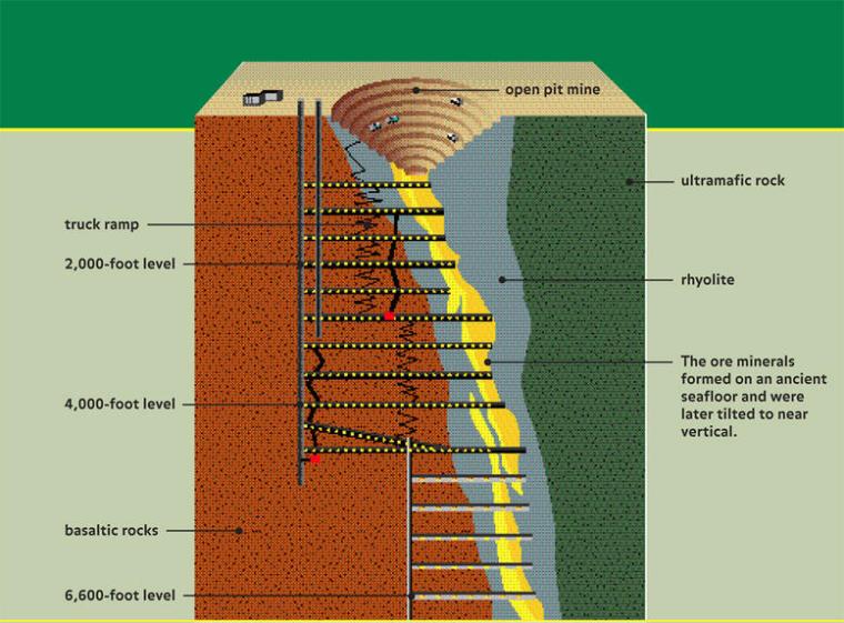
The Timmins mining district is typical of Archaean greenstone belts in the Canadian Shield and in cratons across the world: supracrustal rocks including ultramafic and mafic volcanics and a variety of metasedimentary rocks. The Timmins district is historically Canada’s largest gold producer, but also hosts ores of many other metals. The Kidd Creek Cu-Ag-Zn mine is one of the deepest in North America, which penetrates interlayered felsic, mafic, ultramafic, and metasedimentary rocks to a depth of 2.9 km below the surface. The ores formed by submarine hydrothermal processes around 2.7 Ga ago. The sampled boreholes were drilled horizontally at mine levels between 2.04 to 2.9 km below the surface to penetrate the ore zone and its mafic-ultramafic host rocks. Rather than yielding gas, the holes release briny fluids in which hydrogen, helium and various hydrocarbon gases are dissolved. They are similar to fluids issuing from other deep mines, but differ in showing their formation mainly to be through inorganic reactions with the bed rock rather than as a result of microbial metabolism that exploits a variety of chemical interactions in the ore, such as reduction of sulfate ions to sulfide. The authors have studied hydrogen yields from a number of other mines in mafic-ultramafic rocks, which are comparable with Kidd Creek. So it may be that hydrogen in vast volumes is being emitted by existing and abandoned metal mines in such igneous terrains.

Sherwood Lollar and Warr authoritatively outline the economic potential of hydrogen production for remote communities and mines in greenstone-belt terrains. They also assess active serpentinisation of ophiolites and kimberlites by near-surface groundwater and associated microbial ecosystems as hydrogen sources, the few that have been studied seeming to produce even larger amounts of hydrogen. But they also note that their closer proximity to the surface means that these geological features are generally ‘open-systems’ prone to rapid loss of gases. However, in the manner of hydrocarbon gas fields, some ophiolites may host large amounts of hydrogen if they are capped by younger clay-rich sedimentary strata. Whatever, the global warming of what might be called the ‘Hydrocarbon Age’ is set to become a disaster. Breaking its death grip should be the principal economic agenda, which requires the most rapid turn to long-term energy alternatives. Natural hydrogen could be a part of that, and hopefully the work of Sherwood Lollar and Warr, and others like them, should lead to determined exploration and assessment of this novel physical resource. In Scandinavia a Nordic Hydrogen Route is being proposed. This Swedish-Finnish initiative is based on the Scandinavian Shield and its greenstone terrains and numerous mines driven into them. One would hope that its entrepreneurs are considering naturally emitted hydrogen rather than or as well as sources given other coloured labels.

See also: Canada’s Billion-Year-Old Rocks Could Hold the Future of Clean Energy. Sci Tech Daily, 21 May 2026.

Gravity survey reveals signs of Archaean tectonics in Canadian Shield

Much of the Archaean Eon is represented by cratons, which occur at the core of continental parts of tectonic plates. Having low geothermal heat flow they are the most rigid parts of the continental crust.  The Superior Craton is an area that makes up much of the eastern part of the Canadian Shield, and formed during the Late Archaean from ~4.3 to 2.6 billion years (Ga) ago. Covering an area in excess of 1.5 million km2, it is the world’s largest craton. One of its most intensely studied components is the Abitibi Terrane, which hosts many mines. A granite-greenstone terrain, it consists of volcano-sedimentary supracrustal rocks in several typically linear greenstone belts separated by areas of mainly intrusive granitic bodies. Many Archaean terrains show much the same ‘stripey’ aspect on the grand scale. Greenstone belts are dominated by metamorphosed basaltic volcanic rock, together with lesser proportions of ultramafic lavas and intrusions, and overlying metasedimentary rocks, also of Archaean age. Various hypotheses have been suggested for the formation of granite-greenstone terrains, the latest turning to a process of ‘sagduction’. However the relative flat nature of cratonic areas tells geologists little about their deeper parts. They tend to have resisted large-scale later deformation by their very nature, so none have been tilted or wholly obducted onto other such stable crustal masses during later collisional tectonic processes. Geophysics does offer insights however, using seismic profiling, geomagnetic and gravity surveys.

The Geological Survey of Canada has produced masses of geophysical data as a means of coping with the vast size and logistical challenges of the Canadian Shield. Recently five Canadian geoscientists have used gravity data from the Canadian Geodetic Survey to model the deep crust beneath the huge Abitibi granite-greenstone terrain, specifically addressing variations in its density in three dimensions. They also used cross sections produced by seismic reflection and refraction data along 2-D survey lines (Galley, C. et al. 2025. Archean rifts and triple-junctions revealed by gravity modeling of the southern Superior Craton. Nature Communications, v. 16, article 8872; DOI: 10.1038/s41467-025-63931-z). The group found that entirely new insights emerge from the variation in crustal density down to its base at the Moho (Mohorovičić discontinuity). These data show large linear bulges in the Moho separated by broad zones of thicker crust.

Geology of the Abitibi Terrane (upper),; Depth to the Moho beneath the Abitibi Terrane with rifts and VMS deposits superimposed (lower). Credit: After Galley et al. Figs 1 and 5.

Galley et al. suggest that the zones are former sites of lithospheric extensional tectonics and crustal thinning: rifts from which ultramafic to mafic magmas emerged. They consider them to be akin to modern mid-ocean and continental rifts. Most of the rifts roughly parallel the trend of the greenstone belts and the large, long-lived faults that run west to east across the Abitibi Terrain. This suggests that rifts formed under the more ductile lithospheric condition of the Neoarchaean set the gross fabric of the granites and greenstones. Moreover, there are signs of two triple junctions where three rifts converge: fundamental features of modern plate tectonics. However, both rifts and junctions are on a smaller scale than those active at present. The rift patterns suggest plate tectonics in miniature, perhaps indicative of more vigorous mantle convection during the Archaean Eon.

There is an interesting spin-off. The Abitibi Terrane is rich in a variety of mineral resources, especially volcanic massive-sulfide deposits (VMS). Most of them are associated with the suggested rift zones. Such deposits form through sea-floor hydrothermal processes, which Archaean rifting and triple junctions would have focused to generate clusters of ‘black smokers’ precipitating large amounts of metal sulfides. Galley et al’s work is set to be applied to other large cratons, including those that formed earlier in the Archaean: the Pilbara and Kaapvaal cratons of Australia and South Africa. That could yield better insights into earlier tectonic processes and test some of the hypotheses proposed for them

See also: Archaean Rifts, Triple Junctions Mapped via Gravity Modeling. Scienmag, 6 October 2025

Coast-to-coast seismic section of Canada

Geological Map of Canada
Geological map of Canada. Image via Wikipedia

In the last few decades there have been several massive programmes aimed at imaging the lithospheric structure beneath continents, often linked with a re-assessment of the various tectonic provinces thought to be present. One of the first was a joint Indian-Soviet project managed by the National Geophysical research Institute in Hyderabad to investigate the crust of South India in the 1970s, which still graces my office wall as a memento of my own contribution to unravelling the underpinnings of this ravishing area. This was followed-up by one from the Himalaya southwards, and others have focused on Britain, the Baltic Shield and the USA by the Consortium for Continental Reflection Profiling (COCORP); the last revealing in detail large-scale, low-angle thrust faulting in the Appalachians and crustal-scale detachment faults in the eastern Basin and Range. These experiments must have been great fun, as they involved detonating large amounts of high explosive to produce sufficient energy to get returns from 100 r more km below, with all the planning needed to avoid fear and loathing among the populace, let alone frightening the horses. Nowadays, most seismic profiling onshore is done using Vibroseis, best imagined as large trucks jacked up on pads on which they bounce up and down, in manner of an LA ‘lowrider’. By comparison, marine surveys are far easier, although marine mammals have seemingly had major setbacks as a result of endless closely spaced seismic lines needed for 3-D subsurface analysis. Onshore, you only get one chance and need to pick your route with great care. Now a Canadian consortium has gone one better by using state-of-the-art seismic refraction and reflection techniques (Hammer, P.T.C. et al. 2011. The big picture: A lithospheric cross section of the North American continent. GSA Today, v. 21 (June 2011 issue), p. 4-9). Uniquely, the Canadian Lithoprobe project  coordinated a full spectrum of geological, geochemical, and geophysical research,  covering 20 years of deep-crustal research by hundreds of contributors.

A large-format profile in a supplement to the paper shows the deep relationships in the Mesozoic Cordilleran Orogen in the west, through the plexus of Precambrian Provinces of the Canadian Shield to the Palaeozoic Orogen in the east: a tract some 6000 km from west to east. The general picture is repeated stacking of orogens, with a remarkable repetition of very similar gross tectonic styles. Clearly, large-scale compressional processes have remained largely unchanged since the middle of the Archaean, and several upper parts of long-dead subduction zones and accretionary duplexes spring from the profile. The surface picture of much of the crust crossed by the stitched-together traverses gives the impression of both complex tectonics and many plutons of different ages, yet on the grand scale of the crust and lithosphere it is the tectonics that dominates: the passage of voluminous melts towards the surface has left the plethora of gently dipping deep shear zones and faults largely unmodified. Indeed, the seismic data reveal astonishingly well-preserved subducted or delaminated crust associated with collisions that occurred 2-3 billion years ago. Despite repeated accretionary tectonics spanning 3 Ga, and the Phanerozoic erosion of the Shield to reveal its innermost and deepest secrets, the crust-mantle boundary, the Moho, is astonishingly flat, ranging from 33-43 km deep. Nor is there much sign of ‘roots’ beneath orogens in the underlying lithospheric mantle; a long standing concept that appears not to be generally supportable over this stretch of the North American continent. The synthesis raises questions as to whether the Moho has always been that shallow or whether it can, in some situations, be a dynamic ‘boundary’. For that to be the case requires that the geologic crust-mantle boundary may not always correspond to the seismic discontinuity with which the Moho has previously been correlated.

PDFs of the profile can be downloaded from ftp://rock.geosociety.org/pub/GSAToday/1106insert-hammer/