Earthquakes in Nepal

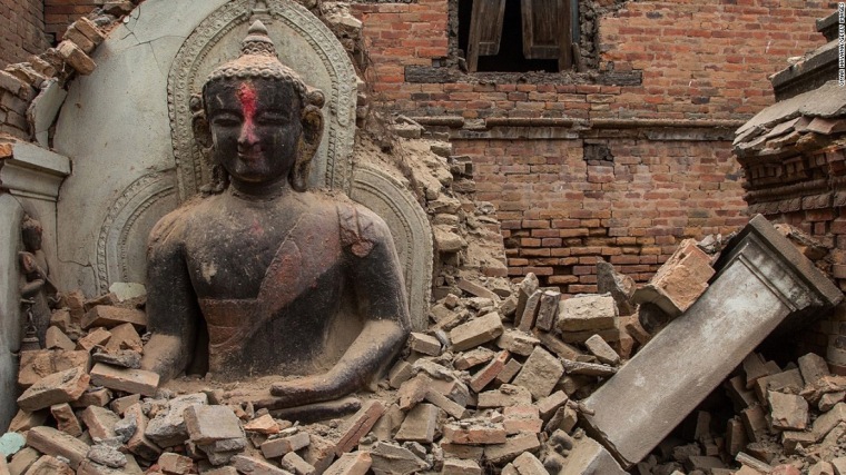
The magnitude 7.8 Gorkha earthquake hit much of the Himalayan state of Nepal on 25 April 2015, to be followed by one of magnitude 7.3 150 km to the east 18 days later. As would have happened in any high-relief area both events triggered a huge number of landslides as well as toppling buildings, killing almost 9000 people and leaving 22 000 injured in the capital Kathmandu and about 30 rural administrative districts. Relief and reconstruction remain hindered 9 months on in many of the smaller villages because they are accessible only by footpaths. Nepal had remained free of devastating earthquakes for almost 6 centuries, highlighting the perils of long quiescence in active plate-boundary areas.

Damage in Kathmandu, Nepal, after the Gorkha earthquake in May 2015 (Credit: CNN)

The International Charter: Space and Major Disasters consortium of many national space agencies was activated, resulting in one of the largest ever volumes of satellite images ranging from 30 to 1 m resolution to be captured and made freely available for relief direction, analysis and documentation. This allowed more than 7500 volunteers to engage in ‘crowd mapping’ coordinated by the Humanitarian OpenStreetMap Team (HOT) to provide logistic support to the Nepal government, UN Agencies and other international organizations who were swiftly responding with humanitarian relief. Most important was the location of damaged areas using ‘before-after’ analysis and assessing possible routes to remote areas. The US NASA and British Geological Survey with Durham University coordinated a multinational effort by geoscientists to document the geological, geophysical and geomorphological factors behind the mass movement of debris in landslides etc that was triggered by the earthquakes, results from which have just appeared (Kargel, J.S. and 63 others 2016. Geomorphic and geological controls of geohazards induced by Nepal’s 2015 Gorkha earthquake. Science, v. 351, p. 140 – full text purchase).

The large team mapped 4312 new landslides and inspected almost 500 glacial lakes for damage, only 9 had visible damage but none of them showing signs of outbursts. As any civil engineer might have predicted, landslides were concentrated in areas with slopes exceeding 30° coincided with high ground acceleration due to the shaking effect of earthquakes. Ground acceleration can only be assessed from the actual seismogram records of the earthquakes, though slope angle is easily mapped using existing digital elevation data (e.g. SRTM). It should be possible to model landslide susceptibility to some extent over large areas by simulation of ground shaking based on various combinations of seismic magnitude and epicenter depth modulated by maps of bedrock and colluvium on valley sides as well as from after-the-event surveys. The main control over distribution of landslides seems to have been the actual fault mechanism involved in the earthquake, assessed from satellite radar interferometry, with the greatest number and density being on the downthrow side (up to 0.82 m surface drop): the uplifted area (up to 1.13 m) had barely any debris movements. Damage lies above deep zones where brittle deformation probably takes place leading to sudden discrete faults, but is less widespread above deep zones of plastic deformation.

The geoscientific information gleaned from the Gorkha earthquake’s effects will no doubt help in assessing risky areas elsewhere in the Himalayan region. Yet so too will steady lithological and structural mapping of this still poorly understood and largely remote area. As regards the number of lives saved, one has to bear in mind that few people buried by landslides and collapsed buildings survive longer than a few days. It seems that rapid response by geospatial data analysts to the logistics of relief and escape has more chance of positive humanitarian outcomes.

In the same issue of Science appears another article on Nepalese seismicity, but events of the 12th to 14th centuries CE (Schwanghart, W. and 10 others 2016. Repeated catastrophic valley infill following medieval earthquakes in the Nepal Himalaya. Science, v. 351, p. 147-150). As the title suggests, this relates to recent geology beneath a valley floor in which Nepal’s second city Pokhara is located. It lies immediately to the south of the 8000 m Annapurna massif, about 50 km west of the Gorkha epicentre. Sections through the upper valley sediments reveal successive debris accumulations on scales that dwarf those moved in the 2015 landslides. Dating (14C) of interlayered organic materials match three recorded earthquakes in 1100, 1255 and 1344 CE, each estimated to have been of magnitude 8 or above. The debris is dominated by carbonate rocks that probably came from the Annapurna massif some 60 km distant. They contain evidence of extreme pulverisation and occur in a series of interbeds some fine others dominated by clasts. The likelihood is that these are evidence of mass movement of a more extreme category than landslides and rockfalls: catastrophic debris flows or rock-ice avalanches involving, in total, 4 to 5 km3 of material.

Seismic menace of the Sumatra plate boundary

More than a decade after the 26 December 2004 Great Aceh Earthquake and the Indian Ocean tsunamis that devastating experience and four more lesser seismic events (> 7.8 Magnitude) have show a stepwise shift in activity to the SE along the Sumatran plate boundary. It seems that stresses along the huge thrust system associated with subduction of the Indo-Australian Plate that had built up over 200 years of little seismicity are becoming unlocked from sector to sector along the Sumatran coast. Areas further to the SE are therefore at risk from both major earthquakes and tsunamis. A seismic warning system now operates in the Indian Ocean, but the effectiveness of communications to potential victims has been questioned since its installation. However, increasing sophistication of geophysical data and modelling allows likely zones at high risk to be assessed.

Recent Great Earthquakes in different segments of the Sumatra plate margin (credit: Tectonics Observatory, California Institute of Technology http://www.tectonics.caltech.edu/outreach/highlights/sumatra/why.html

One segment is known to have experienced giant earthquakes in 1797 and 1833 but none since then. What is known as the Mentawai seismic gap lies between two other segments in which large earthquakes have occurred in the 21st century: it is feared that gap will eventually be filled by another devastating event. Geophysicists from the Institut de Physique du Globe de Paris and Nanyang Technological University in Singapore have published a high-resolution seismic reflection survey showing the subduction zone beneath the Mentawai seismic gap (Kuncoro, A.K. et al. 2015. Tsunamigenic potential due to frontal rupturing in the Sumatra locked zone. Earth and Planetary Science Letters, v. 432, p. 311-322). It shows that that the upper part of the zone, the accretionary wedge, is laced with small thrust-bounded ‘pop-ups’. The base of the accretionary wedge shows a series of small seaward thrusts above the subduction surface itself forming ‘piggyback’ or duplex structures.

Seismic reflection profile across part of the Sumatra plate boundary, showing structures produced by past seismicity. (credit: Kuncoro et al. 2015, Figure 3b)

The authors model the mechanisms that probably produced these intricate structures. This shows that the inactive parts of the plate margin have probably locked in stresses equivalent to of the order of 10 m of horizontal displacement formed by the average 5 to 6 cm of annual subduction of the Indo-Australian Plate over the two centuries since the last major earthquakes. Reactivation of the local structures by release of this strain would distribute it by horizontal movements of between 5.5 to 9.2 m and related 2 to 6.6 m vertical displacement in the pop-ups. That may suddenly push up the seafloor substantially during a major earthquake, thereby producing tsunamis. Whether or not this is a special feature of the Sumatra plate boundary that makes it unusually prone to tsunami production is not certain: such highly resolving seismic profiles need to be conducted over all major subduction zones to resolve that issue. What does emerge from the study is that a repeat of the 2004 Indian Ocean tsunamis is a distinct possibility, sooner rather than later.

Earthquake hazard news

Assessments of seismic risk have relied until recently on records of destructive earthquakes going back centuries and their relationship to tectonic features, mainly active faults. They usually predict up to 50 years ahead. The US Geological Survey has now shifted focus to very recent records mainly of small to medium tremors, some of which have appeared in what are tectonically stable areas as well as the background seismicity in tectonically restless regions. This enables the short-term risk (around one year) to be examined. To the scientists’ surprise, the new modelling completely changes regional maps of seismic risk. The probabilities in the short-term of potentially dangerous ground movements in 17 oil- and gas-rich areas rival those in areas threatened by continual, tectonic jostling, such as California. The new ‘hot spots’ relate to industrial activity, primarily the disposal of wastewater from petroleum operations by pumping it into deep aquifers.

USGS map highlighting short-term earthquake risk zones. Blue boxes indicate areas with induced earthquakes (source: US Geological Survey)

Fluid injection increases hydrostatic pressure in aquifers and also in the spaces associated with once inactive fault and fracture systems. All parts of the crust are stressed to some extent but the presence of fluids and over-pressuring increases the tendency for rock failure. While anti-fracking campaigners have focussed partly on seismic risk – fracking has caused tremors around magnitudes 2 to 3 – the process is a rapid one-off injection involving small fluid volumes compared with petroleum waste-water disposal. All petroleum production carries water as well as oil and gas to wellheads. Coming from great depth it is formation water held in pores since sedimentary deposition, which is environmentally damaging because of its high content of dissolved salts and elevated temperature. Environmental protection demands that disposal must return it to depth.

The main worry is that waste water disposal might trigger movements with magnitudes up to 7.0: in 2011 a magnitude 5.6 earthquake hit a town in oil-producing Oklahoma and damaged many buildings. Currently, US building regulations rely on earthquake risk maps that consider a 50-year timescale, but they take little account of industrially induced seismicity. So the new data is likely to cause quite a stir. These are changing times, however, as the oil price fluctuates wildly. So production may well shift from field to field seeking sustainable rates of profit, and induced seismicity may well change as a result.

None of these areas are likely to experience the horrors of the 25 April 2015 magnitude 7.8 earthquake in Nepal. However, it also occurred in an area expected to be relatively stable compared with the rest of the Himalayan region. The only previous major tremor there was recorded in the 14th century. This supposedly ‘low-risk’ area overlies a zone in which small tremors or microearthquakes occur all the time. Such zones – and this one extends along much of the length of the Himalaya – seem to mark where fault depths are large enough for displacements to take place continually by plastic flow, thereby relieving stresses. Most of the large earthquakes have taken place south of the microseismic zone where the shallow parts of the Indian plate are brittle and have become locked. The recent event is raising concerns that it is a precursor of further large earthquakes in Nepal. Its capital Kathmandu is especially susceptible as it is partly founded on lake sediments that easily liquefy.

Note added: 13 May 2015. Nepal suffered another major shock (magnitude 7.3) on 12 May in the vicinity of Mount Everest. It too seems to have occurred in the zone of microearthquakes formerly thought to mark a zone where the crust fails continually bu plastic deformation thereby relieving stresses. Kathmandu was this time at the edge of the shake zone

How the great Tohoku-Sendai earthquake and tsunami happened

The great Tohoku earthquake (moment magnitude 9.0) of 11 March 2011 beneath the Pacific Ocean off the largest Japanese island of Honshu resulted in the devastating tsunami that tore many kilometres inland along its northern coast line and affected the entire Pacific Basin (see NOAA animation of the tsunami’s propagation) .

English: Sendai Rinkai Railway locomotive(SD55...
Railway locomotive thrown aside by the 11 March 2011 Tsunami in Japan. (credit: Wikipedia)

This article can now be read in full at Earth-logs in the Geohazards archive for 2017

Assessing submarine great-earthquake statistics fails

Geologists who study turbidites assume that the distinctive graded beds from which they are constructed and a range of other textures represent flows of slurry down unstable steep slopes when submarine sediment deposits are displaced. Such turbidity currents were famously recorded by the severing of 12 transatlantic telecommunication cables off Newfoundland in 1929. This happened soon after an earthquake triggered 100 km hr-1 flows down the continental slope, which swept some 600 km eastwards.

Load structures on turbidite sandstones, Crook...
Typical structures in Upper Carboniferous turbidites near Bude, Cornwall, UK (credit: Flickr, Earthwatcher)

Sea beds at destructive margins provide the right conditions for repeated turbidity currents and it is reasonable to suppose that patterns should emerge from the resulting turbidite beds that in some way record the seismic history of the area. British and Indonesian geoscientists set out to test that hypothesis at the now infamous plate margin off Sumatra that hosted the great Acheh Earthquake and tsunamis of 26 December 2004 to kill 250 thousand people around the rim of the Indian Ocean (Sumner, E.J. et al. 2013. Can turbidites be used to reconstruct a paleoearthquake record for the central Sumatra margin? Geology, v. 41, p.763-766).

Animation of 2004 Indonesia tsunami
Animation of Indonesian tsunami of 26 December 2004 (credit: Wikipedia)

Cores through turbidite sequences along a 500 km stretch of the margin formed the basis for this important attempt to test the possibility of recording long-term seismic statistics. To avoid false signals from turbidity currents stirred up by storms, floods and slope failure from rapid sediment build-up 17 sites were cored in deep water away from major terrestrial sediment supplies, which only flows triggered by major earthquakes would be likely to reach. To calibrate core depth to time involved a variety of radiometric  and stratigraphic methods

Disappointingly, few of the sites on the submarine slopes recorded turbidites that match events during the 150-year period of seismic records in the area, none being correlatable with the 2004 and 2005 great earthquakes. Indeed very little correlation of distinctive textures from site to site emerged from the study. Some sites on slopes revealed no turbidites at all from the last 150 years, whereas turbidites in others that could be accurately dated occurred when there were no large earthquakes. Only cores from the deep submarine trench consistently preserved near-surface turbidites that might record the 2004 and 2005 great earthquakes.

These are surprising as well as depressing results, but perhaps further coring will discover what kind of bathymetric features might yield useful and consistent seismic records from sediments.

Una parodia della giustizia?

Damage caused by the L’ Aquila earthquake of 6 April 2009. (credit: Reuters)

Lying above a destructive plate margin, albeit a small one, Italy is prone to earthquakes. Seismometers detect a great many of low magnitude that no one notices and that do no obvious damage to buildings. From 2006 to autumn 2008 the Abruzzo region on the eastern flank of the Appenine mountains of central Italy experienced a background of one low-magnitude tremor every day (Papadopoulos, G.A. et al. 2010. Strong foreshock signal preceding the L’Aquila (Italy) earthquake (Mw 6.3) of 6 April 2009. Natural Hazards and Earth System Sciences, v. 10, p. 19-24). In the following 6 months the rate more than doubled but the epicentres continued to be almost randomly situated. Things changed dramatically in the 10 days following 27 March 2009: the pace increased to twenty times the normal ‘background’ and epicentres clustered directly beneath the regional capital L’ Aquila (population 73 thousand) close to a known fault line. At 3.32 am on 6 April 2009 the Paganica fault failed less than 10 km below L’ Aquila, directing most of the Magnitude 6.3 energy at the town. This was the deadliest earthquake in Italy for three decades; 308 people died 1500 were injured and 40 thousand found themselves homeless. Silvio Berlusconi, not a man to flinch from controversy, commented on German TV about the homeless, ‘Of course, their current lodgings are a bit temporary. But they should see it like a weekend of camping’.

English: Silvio Berlusconi in a meeting with J...
Former Italian President Silvio Berlusconi (credit: Wikipedia)

L’ Aquila has a dismal history of seismic damage, having been devastated before: 7 times since the 14th century. Having grown on a foundation of lake-bed sediments, notorious for amplifying ground movements, the city was clearly in a high-risk status in much the same manner as Mexico City. Shaken several times before and built with no regard to seismicity, much of L’ Aquila’s centuries-old building stock was incapable of resisting the event of 6 April 2009: up to 11 thousand building were damaged, some collapsing completely.

Not only was the earthquake preceded by an increasing pace of foreshocks, but many local people reported strange ‘earth lights’ during the months beforehand (Fidani, C. The earthquake lights (EQL) of the 6 April 2009 Aquila earthquake, in Central Italy.Natural Hazards and Earth System Sciences, v. 10, p. 967-978). In fact, so many sightings were made that plans have been outlined for a CCTV monitoring network in rural areas.

So, this disaster was not short of signs that all was not well in Abruzzo, in a seismic sense: historical precedent; poor urban siting; foreshocks and oddities that have come to be associated with impending energy release. But was this litany sufficient to predict the place, date, and magnitude of what was coming? Plate tectonics, local structural geology and worldwide seismicity allow geophysicists to assess risk from earthquakes in the same way as hydrologists can outline flood-prone areas: literally on flood plains. Yet there are few if any records of a devastating earthquake having been predicted anywhere with sufficient accuracy to allow evacuation and mitigation of death and injury. That is despite the fact that teams of seismologists in the western US, Japan, Italy and several other well-off countries continually monitor seismic events even with a power many orders of magnitude less than those which kill or injure. Such bodies are faced with a dreadful choice in the face of evidence like that summarised above: warn tens of thousands to evacuate, organise such an exodus in a few days and prepare accommodation for them, or advise that similar seismic escalations rarely lead to massive damage with an estimate of the probability of risk. Both choices are guesswork for there are no rigorous equations that spell ‘doom’ or ‘all clear’ from such data. Earthquakes are not rainstorms or hurricanes, as 250 thousand dead people on the shores of the Indian Ocean bear grim witness.

Despite broad knowledge of the deep uncertainty associated with earthquakes and volcanic eruptions – no longer privy to specialist scientists these days, even in the least developed parts of the world – the Italian authorities saw fit to prosecute six earth scientists and a public official for multiple manslaughter.  Because they provided “inaccurate, incomplete and contradictory” information about what might have been the aftermath of tremors felt ahead of 6 April 2009 earthquake, a regional court sentenced all of them to six years in prison – two years more than even the prosecution demanded – and they are to pay the equivalent of £6.7 million in compensation. This was not a jury verdict, but the decision of a single judge, Marco Billi. No scientist, even one poring over data from the Large Hadron Collider in search of the Higgs boson, would every claim that what they report is perfectly accurate, complete and incontrovertible. The L’Aquila Seven never said they were certain that no earthquake would ensue, and the city’s people were well aware of what risk they faced in much the same way that Neapolitans living on the slopes of Vesuvius know that one day they may be incinerated.

This is a travesty of justice so bizarre that one must look to the famous adage of Roman Law: qui bono? Certainly not the victims and their mourners, and definitely not science because any sensible Italian geophysicist will in future simply play dumb. There is already a huge world wide outcry, not just from outraged scientists.

Added 25 October 2012: The 12 October issue of Science carried a lengthy summary of proceedings early in the trial (Cartlidge, E. 2012. Aftershocks in the courtroom. Science, v. 338, p. 185-188). Read Nature‘s editorial on the L’ Aquila verdict here and further comment.

Birth of a plate boundary rocks the planet

English: Historical seismicity across the Sund...
Historical seismicity across the Sunda trench(credit: Wikipedia)

Few people will fail to remember the Indian Ocean tsunamis of 26 December 2004 because of their quarter-million death toll. The earthquake responsible for them resulted from thrusting movements on the subduction zone where part of the India-Australia plate descends beneath Sumatra. There have been some equally large but far less devastating events and many lesser earthquakes in the same region since. Some have been on the massive Wadati-Benioff zone but many, including two with magnitudes >8 in April 2012, have occurred well off the known plate boundary. Oddly, those two had strike-slip motions and were the largest such events since seismic records have been kept. Such motions where masses of lithosphere move past one another laterally can be devastating on land, yet offshore ones rarely cause tsunamis, for a simple reason: they neither lift nor drop parts of the ocean floor. So, to the world at large, both events went unreported.

To geophysicists, however, they were revealing oddities, for there is no bathymetric sign of an active sea-floor strike-slip fault. But there is a series of linear gravity anomalies running roughly N-S thought to represent transform faults that were thought to have shut down about 45 Ma ago (Delescluse, M. et al. 2012. April 2012 intra-oceanic seismicity off Sumatra boosted by the Banda-Aceh megathrust. Nature (on-line 27 September issue) doi:10.1038/nature11520). Examining the post-December 2004 seismic record of the area the authors noted a flurry of lesser events, mostly in the vicinity of the long dead fracture zones. Their analysis leads them to suggest not only that the Banda-Aceh earthquake and others along the Sumatran subduction zone reactivated the old strike-slip faults but that differences in the motion of the India-Australia plate continually stress the lithosphere. Indian continental crust is resisting subduction beneath the Himalaya thereby slowing plate movement in its wake. Ocean lithosphere north of Australia slides more easily down the subduction zone, so its northward motion is substantially faster, creating a torque in the region affected by the strike-slip motions. Ultimately, it is thought, this will split the plate into separate Indian and Australian plates.

Another surprising outcome of this complex seismic linkage in the far-east of the Indian Ocean is that the April strike-slip earthquake set the Earth ringing. For six days afterwards there was a five-fold increase in events of magnitudes greater than 5.5 more than 1500 km away, including some of around magnitude 7.0 (Polliitz, F.F. et al. 2012. The 11 April 2012 east Indian Ocean earthquake triggered large aftershocks worldwide. Nature (on-line 27 September issue) doi:10.1038/nature11504). Although distant minor shocks often follow large earthquakes, this is the first time that a swarm of magnitude 5.5 and greater has been noticed.

Erosion by jostling

Inca wall of dry stone in Sacsayhuamán fortres...
Inca dry stone wall in Sacsayhuamán fortress, Cusco, Peru (credit: Håkan Svensson via Wikipedia)

These days it is a rare thing for an entirely novel surface process to be discovered; two centuries of geomorphological and sedimentological studies seem to have exhausted all the basic possibilities with only a few bits and pieces to be filled in.

Go to the foot of any steep slope topped by hard rock in an arid or semi-arid area and you are sure to find a boulder field formed by a variety of mass-wasting processes, such as rockfalls. As often as not such boulders are rounded, the usual explanation being that the rounding has resulted either from chemical weathering in the up-slope colluvium or exfoliation (‘onion-skin’ formation) through physical weathering in situ. Boulders are simply too big to have been moved other than by toppling or glacial transport at high latitudes, so rounding by abrasion seems unlikely. Aeolian sandblasting tends to favour just one side of boulders and ‘scallops’ their surface.

The driest place on Earth, Chile’s Atacama Desert, has plenty of boulder fields next to areas of high relief, and sure enough they are beautifully rounded, even though it has barely rained there for around 10 million years. Jay Quade of the University of Arizona, USA, with US, Australian and Israeli colleagues noticed that many of the boulders are surrounded by moat-like depressions and their sides, but not their tops, are nicely smoothed. These features suggested that some process had caused the boulders to move around and to rub one another, but whatever that was it had not caused even quite tall boulders to topple over (Quade, J. et al. 2012. Seismicity and the strange rubbing boulders of the Atacama Desert, northern Chile. Geology, 40, 851-854). An explanation was clearly something to puzzle over, until, that is, two of the authors returned to the area to make further observations. They were caught on the exposure by a magnitude 5.2 earthquake – a not uncommon experience in the foothills of the Andes – when the ton-sized boulders began to sway, rotate and jostle together with a great deal of noise. Here was the novel mechanism of erosion and ‘granulation’: seismic rubbing.

By dating the age of the exposed surfaces using cosmic-ray generated isotopes of beryllium and aluminium, the authors have been able to  estimate that over the past 1.3 Ma the boulders have experienced between 40 to 70 thousand hours of rubbing. Indeed, it is quite likely that the whole boulder field, the upslope mass wasting and the sediment in which the boulders are embedded are products of seismicity. Oddly, just such jostling and rubbing of boulders and cobbles is characteristic of Inca architecture in the Andes, whose stonework used no cement but has minimal  gaps between the blocks. Who is to deny that the Incas learned their unique building method from observing seismic rubbing.

Within-plate earthquakes


English: Earthquakes recorded in the New Madri...
Recent earthquakes in the US mid-west around New Madrid Missouri. Image via Wikipedia


Almost all devastating earthquakes within living memory and the tsunamis that ensued from some of them have occurred where tectonic plates meet and move past one another either horizontally through strike-slip motion or vertically as a result of subduction. This link between real events and the central theory of global dynamics gives an impression of inherent predictability about where damaging and deadly earthquakes might happen, if not the more useful matter of when the lithosphere might rupture. Such confidence is potentially highly dangerous: the most deadly earthquake in recorded history killed at least 800 thousand people in China’s Shanxi Province in 1556 when according to  a description written shortly afterwards, ‘… various misfortunes took place… In some places, the ground suddenly rose up and formed new hills, or it sank abruptly and became new valleys. In other areas, a stream burst out in an instant, or the ground broke and new gullies appeared…’. Shanxi is far from any plate boundary. A study of Chinese historic records covering the last two millennia (Liu, M. et al. 2011. 2000 years of migrating earthquakes in North China: How earthquakes in midcontinents differ from those at plate boundaries. Lithosphere, v. 3, p. 128-132) shows a pattern to the position of large intraplate events.  Rather than occurring along lines as do those at plate boundaries, earthquakes ‘hopped’ from place to place without affecting the same areas twice. Liu and colleagues consider this almost random pattern to result from reactivation of interlinked faults through broad-scale and gradual tectonic loading of the crust by far off plate movements. After a short period of reactivation one fault locks so that energy build-up is eventually released by another in the plexus of crustal weaknesses.

The best studied site of such intraplate seismicity lies midway along the Mississippi valley in the mid-US, between St Louis and Memphis. In 1811 and 1812 four Magnitude 7 to 8 earthquakes struck, the most affected place being the small township of New Madrid on the banks of the great river where mud and sand spouted from numerous sediment volcanoes. No-one died there but tremors were felt over a million square kilometers, bells ringing spontaneously as far away as Boston and Toronto. It is now known that this section of the Mississippi basin lies above a graben that affects the ancient basement beneath the alluvial sediments, one of whose faults was reactivated, perhaps in an analogous way to the hypothesis about Chinese seismicity. A coauthor in Liu et al. (2011), Seth Stein of Northwestern University, Illinois, believes stress redistribution through a Mid-western fault network was responsible and other events are likely at some uncertain time in the future on this and other areas underpinned by ancient fault complexes. Indeed sporadic ‘quakes up to Magnitude 7 have affected the eastern US and Canada and the Atlantic seaboard since European settlement. But since the largest of the New Madrid quartet of earthquakes, populations have grown across the likely areas of tenuous risk and future ones could have extremely serious consequences for which it is difficult to plan by virtue of unpredictability of both place and timing: in some respects a more worrying prospect than is the case where major events are inevitable – sometime – as along the San Andreas Fault. There are few, if any, major conurbations worldwide that could be considered seismically safe if the theory of networked stress redistribution through otherwise inert parts of continental crust is borne out.

In some respects the theory is a small-scale version of the suggested mechanical linkage through all major plate boundaries that has been suggested by some to account for the clustering in time of great earthquakes – around and above Magnitude 8 – around the globe. Since 2000 great earthquakes have occurred on subduction zones beneath Sumatra, the Himalaya, the Andes, Central America, Alaska, New Guinea, the mid-Pacific, Japan and the Kurile islands, on the strike-slip system that cuts New Zealand and in the intraplate setting of the 2008 Sichuan earthquake in China. Almost all plate boundaries link up globally, but although it seems likely that stress is redistributed along boundaries, especially between adjacent segments, as documented for the great Anatolian fault system of Turkey and the Indonesian subduction zone, a mechanism that transmits stress beyond individual plates seems unlikely.

Search on for past tsunamis

Wandoor is a small village and beach near the ...
Relics of the 2004 tsunami on the coast of South Andaman Island. Image via Wikipedia

Spurred by the horrific scenes and death toll wrought by tsunamis following  the 26 December 2004 Sumatran and 11 March 2011 Sendai giant earthquakes, environmental geologists are beginning to look for signs that can reveal past tsunamis in order to evaluate risk from region to region. Before the 11 March disaster Japanese scientists had in fact traced signs of a tsunami in 869 CE and showed that it had reached almost as far inland as that following the Sendai earthquake. There are a number of geological features that mark the wake of a tsunami: dislodgement of huge boulders on rocky shores; signs of powerful scouring of sallow marine sediments as water recedes from the land; chaotic sediments made up of a jumble of clasts; sediments associated with high-energy flow interleaved with those that mark long periods of low energy deposition; marine faunas unexpectedly found in otherwise terrestrial sediments.

Shortly after the 2004 Indian Ocean tsunamis Indian and Japanese scientists visited the Andaman Islands, which were at the northern end of the megathrust deformation, to seek onshore signs of previous catastrophes (Malik, J.N. et al. 2011. Geologic evidence for two pre-2004 earthquakes during recent centuries near Port Blair, South Andaman Island, India. Geology, v. 39, p. 559-562). They discovered a layer of ripped-up lumps of mud set in a sandy matrix dumped on a low-energy black mud, the sandy unit showing inclined stratification that dips inland. All the evidence pointed to deposition by a tsunami. An earlier event reveals swamping of older non-marine sediments by the black mud unit that contains brackish-marine diatoms; a probable result of sudden subsidence linked to an earthquake affecting the Andamans in much the same was as did that of December 2004. The mud had also been intruded by a body of structureless sand , probably resulting from liquefaction as a result of the seismicity. Dating the events using radiocarbon methods proved difficult. Although dating of the earlier event suggested an event around 1670 CE, carbon from the later one gave much older ages, suggesting that the tsunami had ripped up older sediments and redeposited them. However it may be correlated with the major Arakan earthquake of 2 April 1762 close to the coast of Myanmar.

Evidence of this kind can easily be overlooked, and rather less research centres on recent coastal-zone sediments than on sedimentary rocks of the distant past. Areas where such signs of neotectonics have been sought assiduously are those surrounding coastal nuclear installations, but largely to check for evidence of recent faulting that may indicate potential seismic threat but not tsunamis. Clearly it was that kind of threat that decisively put the Japanese Fukushima Daiichi nuclear power station out of action and almost resulted in complete melt-down in March 2011, and severely set back construction of an advanced fast-breeder reactor on the eastern coat of India at Kalpakkam, near Chennai in 2004.